


Tilicho Lake sits at 4,919m in a glacial amphitheater beneath the north face of Tilicho Peak (7,134m), and it is one of the most stunning natural sights in the entire Himalaya. Often cited as one of the highest lakes in the world, this turquoise jewel surrounded by snow-covered walls and rocky moraines has become one of the most popular side trips on the Annapurna Circuit, and for good reason.
Adding Tilicho Lake to your Annapurna Circuit trek requires 2-3 extra days from Manang, some serious altitude fitness, and comfort with exposed cliff trails. The reward is a high-altitude lake experience that many trekkers describe as the single most breathtaking moment of their entire circuit.
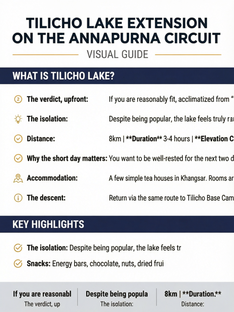
This guide covers everything you need to plan the Tilicho Lake extension: the day-by-day itinerary from Manang, trail conditions, difficulty assessment, what to expect at the lake, accommodation, and whether the detour is worth the extra effort and days.
The verdict, upfront: If you are reasonably fit, acclimatized from your Annapurna Circuit days, and have 2-3 extra days, Tilicho Lake is absolutely worth the detour. It is the highlight of the circuit for many trekkers.
Quick Facts: Tilicho Lake Extension
4,919m (16,138 ft)
2-3 days from Manang
4,919m (Tilicho Lake)
~35km round trip
Challenging (altitude + exposed trail)
October-November, March-May
None (covered by ACAP)
Tea houses to Tilicho Base Camp
Tilicho Peak (7,134m)
$50-100 (accommodation and meals)
What Is Tilicho Lake?
Tilicho Lake is a glacial lake located at 4,919m in the Manang District of Nepal, on the northern slopes of the Annapurna range. It was long cited as the highest lake in the world by the Guinness Book of World Records, though this claim is debated (several smaller, less accessible lakes in Tibet and the Andes may be higher). Regardless of the precise ranking, it is indisputably one of the highest large lakes on Earth.
The lake sits in a dramatic amphitheater formed by the north face of Tilicho Peak (7,134m), the Grande Barrier wall, and surrounding ridgelines. In autumn and spring, the water is a deep, almost unreal turquoise, reflecting the surrounding snow and rock walls. In winter, it freezes entirely.
Why It Captivates Trekkers
- The setting: A massive glacial lake surrounded by snow peaks exceeding 7,000m on three sides
- The color: Glacial mineral content gives the water an intense blue-green hue
- The isolation: Despite being popular, the lake feels truly remote and wild
- The achievement: Reaching 4,919m on foot is a significant altitude accomplishment
- The photography: Conditions for photography are often extraordinary, especially in early morning
How Tilicho Lake Fits into the Annapurna Circuit
The Tilicho Lake extension branches off from the main Annapurna Circuit at Manang (3,540m), the traditional rest and acclimatization stop before the climb to Thorong La Pass (5,416m).
Where It Sits in the Circuit Timeline
On a standard 15-day Annapurna Circuit itinerary:
- You arrive in Manang on approximately Day 7-8
- You typically spend a rest day in Manang for acclimatization (Day 8-9)
- The Tilicho extension adds 2-3 days after Manang
- You then return to the main circuit and continue to Yak Kharka and Thorong La
Impact on total itinerary: Adding Tilicho Lake extends the standard circuit by 2-3 days, making a 15-day circuit into a 17-18 day trek.
Acclimatization Advantage
Here is a significant bonus: the Tilicho Lake extension actually improves your acclimatization for Thorong La Pass. By trekking to 4,919m and returning before attempting the 5,416m pass, your body is better prepared for the highest point on the circuit. Many trekkers who add Tilicho Lake report easier Thorong La crossings.
Pro Tip
Use the Tilicho Lake extension as your final acclimatization push before Thorong La. After reaching 4,919m at Tilicho, the 5,416m Thorong La feels significantly more manageable. Your body will have already adjusted to oxygen levels close to what you will encounter at the pass.
The Tilicho Lake Extension Itinerary: Day by Day
Day 1: Manang to Khangsar (3,734m)
Distance: 8km | Duration: 3-4 hours | Elevation Change: +194m
An easy, short day that serves as a gentle warm-up for the more demanding days ahead. The trail heads northwest from Manang, passing through open terrain with views of the Annapurna range and the Gangapurna glacier.
Khangsar is a small, traditional village that feels far more authentic than the trekker-oriented town of Manang. Prayer flags flutter above flat-roofed stone houses, and the villagers grow barley and potatoes on terraced fields. The Khangsar Gompa (monastery) is worth visiting.
Why the short day matters: You want to be well-rested for the next two days, which are significantly more demanding. Use the afternoon to hydrate, eat well, and assess your physical condition.
Accommodation: A few simple tea houses in Khangsar. Rooms are basic ($5-8) with shared facilities. The food is simple but filling.
The Trail Split
At Khangsar, you leave the inhabited valley behind. From here to Tilicho Base Camp, the trail traverses increasingly wild, rocky terrain with no permanent settlements. Make sure you have snacks, water purification, and warm layers easily accessible in your daypack.
Day 2: Khangsar to Tilicho Base Camp (4,150m)
Distance: 10km | Duration: 4-5 hours | Elevation Change: +416m
This is the day where the Tilicho extension reveals its character. The trail from Khangsar to Tilicho Base Camp traverses steep, exposed hillsides above the Marsyangdi river valley, with sections that require careful footwork and a head for heights.
The trail conditions:
- First section (Khangsar to landslide zone): Well-trodden path through scrub and rocky terrain, gradually climbing
- Middle section (exposed cliff trail): The most challenging part. The trail narrows to a meter or less, traversing steep hillsides with significant drop-offs. After heavy rain or snow, sections may be muddy or icy. This is not technical mountaineering, but it demands concentration and steady feet.
- Final section (approach to base camp): The trail eases as you enter the broader valley leading to Tilicho Base Camp
Exposed Trail Warning
The trail between Khangsar and Tilicho Base Camp includes several sections that traverse steep, landslide-prone hillsides with significant exposure. In icy conditions (early morning or winter), these sections can be genuinely dangerous. Do not attempt this trail in heavy snow, fresh landslide conditions, or thick fog. If you are uncomfortable with heights or exposed trails, discuss this with your guide before committing.
Landslide risk: The hillsides between Khangsar and Tilicho BC are composed of loose sedimentary rock and are prone to landslides, especially after rain. The trail is rerouted after significant slides, but the terrain is inherently unstable. Trek with awareness, do not linger under cliff overhangs, and follow your guide's route exactly.
Tilicho Base Camp consists of a single lodge (Tilicho Base Camp Hotel) at 4,150m. It is basic but functional: dormitory-style rooms, shared toilets, a dining hall with a stove (when fuel is available), and simple meals. There is no heating in rooms, and temperatures drop well below freezing at night.
Accommodation at Tilicho BC: The single lodge fills up during peak season (October-November). Arrive by early afternoon to secure a bed. In extreme cases, trekkers have been turned away and forced to sleep in the dining hall. Carrying a tent as backup is wise during the busiest weeks.
Day 3: Tilicho Base Camp to Tilicho Lake (4,919m) and Return
Distance: 14km round trip | Duration: 6-8 hours round trip | Elevation Change: +769m / -769m
This is the summit day. The early morning hike from Tilicho Base Camp to Tilicho Lake and back is the crux of the extension and one of the most rewarding days on the entire Annapurna Circuit.
Start time: 4:30-5:30 AM. An early start is essential for three reasons:
- The trail is firmer and safer when frozen (loose scree sections)
- The weather is clearer in the morning; clouds build by late morning
- You want to be back at base camp before afternoon winds and cold
The ascent:
- First section (BC to moraine, 1.5-2 hours): Steep climb up rocky terrain and loose scree. The trail is marked with cairns but can be confusing in poor visibility. Follow your guide or the trekkers ahead.
- Middle section (moraine traverse, 1-1.5 hours): Crossing the lateral moraine of the Tilicho glacier. Uneven footing, rocky terrain, some snow patches.
- Final section (approach to lake, 30-60 minutes): The trail flattens as you approach the lake's eastern shore. And then, suddenly, the lake appears.
Arriving at Tilicho Lake:
The first sight of Tilicho Lake stops most trekkers in their tracks. The massive body of water, roughly 4km long and 1.2km wide, sits perfectly still in its glacial bowl. The turquoise water reflects Tilicho Peak and the Grande Barrier wall, creating a mirror image so perfect it seems artificial. At 4,919m, the air is thin and the silence is profound.
How long to spend at the lake: Allow 30-60 minutes at the lakeshore. Take your photographs, absorb the atmosphere, eat a snack, and hydrate. Do not linger too long; the altitude effects are significant (you are at roughly 55% sea-level oxygen), and you need energy for the return.
The descent: Return via the same route to Tilicho Base Camp. The descent takes 2.5-3.5 hours. The loose scree that was frozen on the morning ascent may now be thawed and more treacherous. Use trekking poles and take your time.
Option for Day 3: Strong, fast trekkers sometimes continue from Tilicho BC all the way back to Manang or even Yak Kharka on the same day after the lake visit. This makes the extension a 2-day affair instead of 3, but it makes for an extremely long and exhausting day (10-12 hours of trekking). Only consider this if you are very fit and want to minimize the extra days.
Pro Tip
Bring at least 2 liters of water from Tilicho Base Camp; there is no water source on the trail to the lake. Carry energy bars, chocolate, or dried fruit for the descent. Your appetite will be reduced at 4,919m, but your body needs fuel for the return. Also bring a warm hat, gloves, and a windproof layer; the lake is exposed and can be brutally cold even in sunshine.
Day 4 (if taking 3 days): Return to Manang or Continue to Yak Kharka
Option A: Return to Manang (3,540m) Distance: 18km | Duration: 5-6 hours | Elevation Change: -610m
Retrace the route from Tilicho BC through Khangsar to Manang. This option gives you a comfortable night in Manang's better lodges before continuing the circuit.
Option B: Continue to Yak Kharka (4,018m) via Manang Distance: 24km | Duration: 7-8 hours | Elevation Change: Variable
For those wanting to minimize the extra days, trek from Tilicho BC through Khangsar to Manang, and then continue up the main circuit to Yak Kharka. This is a long day but saves an overnight in Manang.
Option C: The Mesokanto La High Route (5,120m) - Expert Only
Mesokanto La: Not for Most Trekkers
The Mesokanto La (5,120m) is a high pass connecting Tilicho Lake directly to the western side of the Annapurna Circuit (near Jomsom), bypassing Thorong La entirely. This route is rarely used, extremely challenging, requires mountaineering equipment (crampons, ice axe, rope), and should only be attempted with an experienced guide who has crossed it recently. Route-finding is difficult, the pass is snow-covered, and rescue access is minimal. This is NOT a trekking route; it is a mountaineering route. It is mentioned here for completeness, but we strongly discourage attempting it without significant mountaineering experience.
Difficulty Assessment: How Hard Is the Tilicho Extension?
The Tilicho Lake extension is significantly harder than the standard Annapurna Circuit at the same elevation range. Here is an honest difficulty breakdown.
Physical Difficulty: 7/10
- Altitude: You reach 4,919m, which is roughly the same as Thorong La's midpoint. At this elevation, every movement requires more effort.
- Trail quality: The trail between Khangsar and Tilicho BC includes exposed, narrow sections on unstable terrain. The ascent from BC to the lake is steep, rocky, and involves loose scree.
- Duration: The lake day is 6-8 hours of strenuous high-altitude trekking.
- Cumulative fatigue: By this point in the circuit, you have been trekking for a week or more. Adding 2-3 demanding days tests your reserves.
Technical Difficulty: 4/10
- No ropes, crampons, or mountaineering equipment needed for the standard route
- No glacier crossings
- Trail is marked with cairns and generally followable
- Some basic scrambling over rocky sections near the lake
Mental Difficulty: 6/10
- Exposed cliff sections test those uncomfortable with heights
- The early morning start at 4,150m in darkness and cold requires motivation
- Trail conditions can change rapidly with weather
- The base camp lodge is cold and basic, affecting sleep quality
Compared to Thorong La Pass
| Factor | Tilicho Lake | Thorong La Pass |
|---|---|---|
| Maximum Altitude | 4,919m | 5,416m |
| Altitude Gain from Sleep | +769m (from BC) | +1,000m (from High Camp) |
| Trail Quality | Moderate-poor (scree, rock) | Good (well-trodden) |
| Exposure | Moderate (cliff sections) | Low |
| Duration | 6-8 hours round trip | 7-10 hours one way |
| Technical | None | None |
| Overall Difficulty | Challenging | Very Challenging |
What to Carry for the Tilicho Extension
You do not need specialized equipment for the Tilicho Lake extension, but you do need the right gear for high-altitude day hiking.
Essential for the Lake Day
- Daypack with at least 2 liters of water
- Warm layers: Down jacket, fleece, thermal base layers (morning temperatures at BC are well below freezing)
- Windproof shell (the lake is exposed to strong winds)
- Warm hat and gloves (non-negotiable at 4,900m in early morning)
- Sunglasses with UV protection (snow glare at the lake is intense)
- Sunscreen SPF 50+ and lip balm with UV protection
- Trekking poles (essential for the loose scree descent)
- Headlamp (you start in darkness)
- Snacks: Energy bars, chocolate, nuts, dried fruit
- Camera (with fully charged battery; cold drains batteries fast)
What to Leave at Base Camp
- Main trekking pack (leave with the lodge)
- Extra clothing not needed for the day
- Electronics you will not use (charging at BC is limited and expensive)
When to Visit Tilicho Lake
Best Months
| Month | Conditions | Recommendation |
|---|---|---|
| March | Snow possible, lake partially frozen, cold | Fair |
| April | Clearing, lake thawing, still cold mornings | Good |
| May | Warm, clear, lake fully thawed | Very Good |
| October | Clear, cold, best visibility | Excellent |
| November | Clear, very cold, lake may begin freezing | Good |
| December-February | Lake frozen, trail snow-covered, extremely cold | Not Recommended |
Weather Window During the Day
The weather pattern at Tilicho Lake is predictable and must be respected:
- 5:00-8:00 AM: Clear skies, calm winds, cold (best for photography and the ascent)
- 8:00-10:00 AM: Still largely clear, winds beginning to build
- 10:00 AM-12:00 PM: Clouds forming, visibility decreasing, wind increasing
- After 12:00 PM: Often overcast, windy, potentially snowing at altitude
The message is clear: Start early, reach the lake by 8:00-9:00 AM, and begin descending by 9:30-10:00 AM for the best conditions and safety.
The Mesokanto La High Route: For Experts Only
The Mesokanto La (5,120m) is a high pass on the western rim of the Tilicho Lake basin that connects directly to the Kali Gandaki valley (Jomsom side) of the Annapurna Circuit. In theory, this allows you to visit Tilicho Lake and then cross the pass to the western circuit, bypassing Thorong La entirely.
In practice, this route is:
- Rarely used (perhaps 50-100 crossings per year)
- Not marked or maintained
- Snow-covered for much of the year
- Requires crampons, ice axe, and potentially rope
- Route-finding is difficult, especially in cloud
- No accommodation or shelter between Tilicho BC and the Kali Gandaki descent
- Rescue access is extremely limited
Who considers it: Experienced mountaineers looking for a different route, or trekkers with significant alpine experience who want to avoid backtracking to Manang. It must be done with a guide who has crossed it recently and in good weather.
Our recommendation: Unless you have mountaineering experience and a guide who specifically offers this route, stick to the standard out-and-back from Manang. The Mesokanto La is an adventure for a very small subset of trekkers.
Is Tilicho Lake Worth the Detour?
Absolutely yes, for most fit trekkers with time.
Here is the honest assessment:
Reasons to Add Tilicho Lake
- It may be the single most stunning sight on the Annapurna Circuit. The lake, the surrounding peaks, and the sense of altitude achievement combine into an unforgettable experience.
- It improves your Thorong La preparation. The acclimatization benefit of reaching 4,919m before attempting the 5,416m pass is real and measurable.
- The cost is minimal. No extra permits needed (covered by your existing ACAP). The only extra costs are 2-3 days of accommodation and meals ($50-100 total).
- The trail itself is dramatic. The cliff trail between Khangsar and Tilicho BC is a memorable experience in its own right.
- Relatively few circuit trekkers add it. Despite growing popularity, the Tilicho extension is still skipped by many circuit trekkers, meaning the trail and base camp feel less crowded than the main circuit.
Reasons to Skip Tilicho Lake
- Limited time. If your circuit schedule is tight and you cannot spare 2-3 extra days, do not rush it. A hurried Tilicho extension at the cost of proper Thorong La preparation is a bad trade.
- Altitude anxiety. If you have been struggling with altitude effects on the circuit, adding a 4,919m day before Thorong La may be unwise.
- Exposure aversion. If you are deeply uncomfortable with exposed cliff trails and heights, the Khangsar-to-BC section will be distressing rather than enjoyable.
- Physical exhaustion. If your body is telling you it needs rest by Manang, listen to it. Use the rest day in Manang for recovery rather than adding more strenuous trekking.
- Late season timing. In late November or early March, the trail may be snow-covered and the lake frozen, diminishing the visual payoff.
Pro Tip
If you are unsure, ask trekkers coming from Tilicho Lake about current conditions. In Manang, you will meet people returning from the lake daily during peak season. Their report on trail conditions, weather, and the lake itself will help you make a real-time decision.
Combining Tilicho Lake with the Full Annapurna Circuit
Here is how the Tilicho extension fits into a complete circuit itinerary:
Modified Annapurna Circuit with Tilicho Lake (17-18 days)
| Day | Route | Altitude |
|---|---|---|
| 1-7 | Standard circuit: Besisahar to Manang | 760m to 3,540m |
| 8 | Rest day in Manang (acclimatization) | 3,540m |
| 9 | Manang to Khangsar | 3,734m |
| 10 | Khangsar to Tilicho Base Camp | 4,150m |
| 11 | Tilicho BC to Lake (4,919m) and back to BC | 4,150m |
| 12 | Tilicho BC to Manang or Yak Kharka | 3,540m / 4,018m |
| 13 | Yak Kharka to Thorong Phedi / High Camp | 4,450m / 4,850m |
| 14 | Thorong La Pass (5,416m) to Muktinath | 3,800m |
| 15-17/18 | Descent: Muktinath to Jomsom to Pokhara | 2,720m to Pokhara |
Note: If you return to Manang on Day 12 (Option A), add one more day to reach Yak Kharka, making the total 18 days. If you push through to Yak Kharka directly (Option B), you save a day, totaling 17 days.
For the complete circuit itinerary, see our Annapurna Circuit 15-day itinerary guide.
Trail Safety and Risk Management
Landslide Awareness
The trail between Khangsar and Tilicho Base Camp crosses active landslide zones. The hillsides consist of loose moraine and sedimentary material that is inherently unstable. After rain or during spring thaw, landslide risk increases significantly.
Safety measures:
- Trek early in the day (frozen ground is more stable)
- Do not stop or rest under cliff overhangs
- If you hear rocks falling above, move quickly to a safe area
- Follow your guide's route exactly; they know the current stable sections
- If your guide advises against proceeding due to recent slides, listen
Weather-Related Risks
- Snow on the trail to the lake: In October-November and March-April, overnight snow can make the trail to the lake difficult. Wait for it to melt (usually by late morning) or use gaiters and trekking poles.
- Whiteout at the lake: If clouds descend while you are at the lake, navigation back to BC can be disorienting. Stay on the marked trail (cairns) and do not cut new routes.
- Hypothermia risk: The combination of altitude (4,919m), wind, and cold at the lake can rapidly cool your body, especially if you stop moving. Carry warm layers and put them on immediately upon stopping.
Altitude Sickness
At 4,919m, altitude sickness is a real risk, especially if you have not acclimatized adequately. Warning signs to watch for:
- Mild AMS: Headache, mild nausea, fatigue, mild shortness of breath. These are common and manageable. Descend if symptoms worsen.
- Moderate AMS: Persistent headache despite medication, vomiting, extreme fatigue. Descend to Khangsar immediately.
- HACE/HAPE indicators: Confusion, loss of coordination (ataxia), severe breathlessness at rest, gurgling sound when breathing. This is a medical emergency. Descend immediately and seek evacuation.
For comprehensive altitude sickness information, see our acclimatization guide.
Accommodation Options on the Tilicho Extension
| Stop | Options | Quality | Cost |
|---|---|---|---|
| Khangsar | 2-3 tea houses | Basic | $5-8/room |
| Tilicho Base Camp | 1 lodge (Tilicho BC Hotel) | Very Basic | $8-12/room |
| Manang (return) | Multiple lodges | Good | $8-20/room |
| Yak Kharka (if continuing) | 2-3 lodges | Basic | $5-10/room |
Tilicho Base Camp reality check: The single lodge at 4,150m is functional but not comfortable. Expect dormitory-style rooms (4-8 beds), no heating, shared squat toilets, and simple meals (dal bhat, noodle soup, tea). Bring a warm sleeping bag rated to at least -10C. Charging facilities are limited and expensive ($3-5 per device).
Frequently Asked Questions
How many extra days does the Tilicho Lake extension add?
Two to three days from Manang. A fast 2-day option (Manang to BC, BC to lake and back to Manang) is possible for very fit trekkers. The more common 3-day option (Manang to Khangsar, Khangsar to BC, BC to lake and back to BC, then return to Manang) is recommended.
Do I need additional permits for Tilicho Lake?
No. Tilicho Lake is within the Annapurna Conservation Area and covered by your existing ACAP permit. No additional permits or fees are required.
Is Tilicho Lake really the highest lake in the world?
It was long cited as such, but the claim is disputed. Several smaller lakes in Tibet and the Andes are higher. Tilicho is arguably the highest large lake (4km long) at 4,919m, but the "highest lake" title depends on how you define "lake" versus "pond" or seasonal water body. Regardless of the ranking, it is spectacularly high and beautiful.
Can I visit Tilicho Lake without doing the Annapurna Circuit?
Yes. You can trek directly from Manang to Tilicho Lake as a standalone trip (5-6 days round trip from Besisahar or a flight/drive to Manang). However, most trekkers combine it with the circuit since you are already in Manang.
Is the trail to Tilicho Lake dangerous?
The exposed cliff sections between Khangsar and Tilicho BC carry real risk in poor conditions (ice, recent landslide, heavy rain). In good conditions, the trail is challenging but manageable for fit, careful trekkers. The scree slope to the lake is tiring but not technically dangerous. Use trekking poles, trek early, and follow your guide.
What if Tilicho Base Camp lodge is full?
During peak season (October-November), the single lodge can fill up. Arrive early (by 1:00 PM) or carry a tent and sleeping mat as backup. Some trekking agencies carry camping equipment for this possibility.
Can I do the Tilicho extension in bad weather?
In rain: possible but the cliff trail becomes slippery and more dangerous. In snow: the trail to the lake may be obscured and dangerous. In fog: navigation between BC and the lake is difficult. In strong wind: possible but miserable. Best to wait for a clear morning if weather is marginal.
How cold is it at Tilicho Lake?
Extremely cold in the early morning. Temperatures at the lake (4,919m) at 6:00-7:00 AM can be -10 to -20C depending on the season. Wind makes it feel colder. Dress in multiple warm layers, cover all exposed skin, and keep moving.
Is a guide necessary for the Tilicho extension?
Not legally required (unlike Upper Mustang), but strongly recommended. The trail between Khangsar and Tilicho BC is not always well-marked, the landslide sections are confusing, and the altitude demands respect. A guide who has done this route recently knows the current trail conditions and safe sections.
Can beginners do the Tilicho Lake extension?
If you have successfully trekked from Besisahar to Manang on the Annapurna Circuit (7-8 days), your body is reasonably acclimatized and you have trekking experience. The Tilicho extension is harder than the standard circuit but does not require technical skills. Beginners who are fit and confident after reaching Manang can attempt it, but should have a guide and be willing to turn back if conditions or their body dictate.
What happens if I get altitude sickness on the way to Tilicho?
Descend immediately. From the trail between Khangsar and Tilicho BC, descend to Khangsar (3,734m). From the lake trail, descend to Tilicho BC (4,150m) and then to Khangsar if symptoms persist. The altitude relief from descending even 500m is usually dramatic and rapid.
Should I take Diamox for the Tilicho extension?
If you have been taking Diamox prophylactically during the circuit, continue it. If you have not, it is not strictly necessary for a day trip to 4,919m provided you are well-acclimatized from your circuit days. Consult your doctor before the trek.
Tilicho Lake vs Other Annapurna Circuit Side Trips
Tilicho Lake is not the only side trip available on the Annapurna Circuit. Here is how it compares:
| Side Trip | Extra Days | Max Altitude | Difficulty | Worth It? |
|---|---|---|---|---|
| Tilicho Lake | 2-3 | 4,919m | Challenging | Absolutely |
| Ice Lake (Kicho Tal) | 1 (day trip from Manang) | 4,620m | Moderate | Yes, if time is short |
| Gangapurna Lake | 0.5 (hour from Manang) | 3,540m | Easy | Yes, quick and beautiful |
| Pisang Peak Base Camp | 1 | 4,380m | Moderate | If interested in climbing |
| Milarepa Cave | 0.5 (from Manang) | 3,510m | Easy | Culturally interesting |
If you only have time for one side trip, choose Tilicho Lake. If you have time for two, add Ice Lake as a day trip from Manang before the Tilicho extension.
Final Verdict
The Tilicho Lake extension is one of the best additions you can make to the Annapurna Circuit. It adds one of the most stunning high-altitude lake experiences in the Himalayas, provides excellent acclimatization for Thorong La, costs minimal extra money, and creates a memory that many trekkers rank as the highlight of their entire Nepal experience.
The 2-3 extra days and the physical demands are real, and you should not underestimate the exposed cliff trail or the altitude. But for fit, motivated trekkers who have acclimatized well on the circuit, Tilicho Lake delivers a reward that far exceeds the effort.
Pack your warmest layers, start early, and prepare to be speechless.
Planning the full Annapurna Circuit? See our complete route guide and 15-day itinerary. For Thorong La preparation, read our Thorong La Pass guide. And check seasonal timing to ensure the best conditions for both the circuit and the Tilicho extension.