


The Annapurna Circuit is the trek that defines Nepal. A counter-clockwise journey through one of the most diverse landscapes on Earth, from subtropical rice paddies to barren Tibetan plateaus, from ancient Hindu villages to Buddhist monasteries perched on windswept passes, from the shadow of 8,000-meter giants to the deepest gorge in the world. At its heart is Thorong La (5,416m) -- the highest point on any major trekking circuit in the Himalayas, a pass that separates the green, monsoon-fed valleys of the east from the arid rain shadow of Mustang to the west.
This 15-day itinerary is the modern standard for the Annapurna Circuit. It accounts for the road construction that has changed the lower sections of the trail, starting from Chame rather than Besisahar to focus on the most spectacular and trail-only portions of the route. The result is a well-paced trek with proper acclimatization, time for the optional Tilicho Lake detour, and the flexibility to add rest days if needed.
Whether you are planning your first major trek or returning to Nepal for the circuit you have always wanted to complete, this day-by-day guide provides everything you need: exact elevations, trekking times, accommodation options, daily costs, acclimatization strategy, and detailed preparation for the Thorong La pass crossing.
15 trekking days + 2 travel days = 17 total
15 days on trail
5,416m (Thorong La Pass)
~160km (from Chame)
2 rest days (Manang + pre-Thorong La)
Moderate-Challenging
October-November, March-May
$25-45 per day on trail
ACAP ($30) + TIMS ($20)
85-90% with proper acclimatization
Why 15 Days? The Modern Annapurna Circuit
The Road Construction Reality
The traditional Annapurna Circuit was a 21-23 day trek starting from Besisahar and walking every step of the way. That circuit no longer exists in its original form. Road construction along the Marsyangdi River valley has extended vehicle access to Chame and sometimes beyond, replacing much of the lower trail with dusty roads shared with jeeps and motorcycles.
This is not a tragedy -- it is an evolution. The lower sections between Besisahar and Chame, while culturally interesting, were never the circuit's greatest scenery. The magnificent Manang Valley, the high-altitude villages, the Thorong La crossing, and the dramatic descent into Mustang remain entirely intact and trail-only.
The modern 15-day itinerary embraces this reality by starting from Chame (2,670m), where the road ends and the real mountain trail begins. You miss nothing essential and gain a more focused, more spectacular trekking experience.
Why Not Shorter? Why Not Longer?
Shorter (12-13 days): Possible but risky. Cutting days means sacrificing acclimatization, which significantly increases AMS risk at Thorong La. The pass at 5,416m demands respect -- insufficient acclimatization is the primary cause of failed crossings and medical evacuations.
Longer (18-20 days): Ideal for those with time. Additional days allow for the Tilicho Lake detour, extra acclimatization, the Poon Hill extension, or a leisurely pace through the Manang Valley. If you have the time, take it.
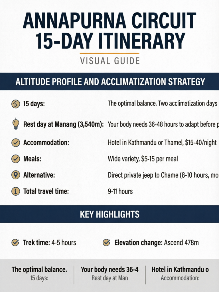
15 days: The optimal balance. Two acclimatization days (Manang and a strategic pre-pass day), the full upper circuit experience, time for the Thorong La crossing, and enough flexibility for weather delays. This is what most agencies recommend and most trekkers complete successfully.
Altitude Profile and Acclimatization Strategy
Elevation Overview
| Day | Destination | Altitude | Daily Gain/Loss |
|---|---|---|---|
| 1 | Chame | 2,670m | Start point |
| 2 | Upper Pisang | 3,300m | +630m |
| 3 | Manang | 3,540m | +240m |
| 4 | Manang (REST) | 3,540m | Hike to 4,600m |
| 5 | Yak Kharka | 4,018m | +478m |
| 6 | Thorong Phedi | 4,450m | +432m |
| 7 | Muktinath (via Thorong La 5,416m) | 3,760m | +966m / -1,656m |
| 8 | Jomsom | 2,720m | -1,040m |
| 9 | Marpha | 2,670m | -50m |
| 10 | Kalopani | 2,530m | -140m |
| 11 | Tatopani | 1,190m | -1,340m |
| 12 | Ghorepani | 2,860m | +1,670m |
| 13 | Poon Hill + Tikhedhunga | 1,540m | +350m / -1,670m |
| 14 | Nayapul + Pokhara | 820m | -720m |
| 15 | Pokhara to Kathmandu | 1,400m | Travel day |
Acclimatization Strategy
The circuit's natural counter-clockwise direction provides built-in acclimatization -- you gain altitude gradually up the Marsyangdi Valley before the steep push to Thorong La. The critical elements are:
- Gradual ascent: No more than 500m sleeping altitude gain per day above 3,000m
- Rest day at Manang (3,540m): Your body needs 36-48 hours to adapt before pushing higher
- Climb high, sleep low: On the Manang rest day, hike to Ice Lake (4,600m) or higher, then return to sleep at 3,540m
- Pre-pass staging: The nights at Yak Kharka (4,018m) and Thorong Phedi (4,450m) provide the final altitude steps before the big day
Do Not Skip the Manang Rest Day
The single most dangerous decision on the Annapurna Circuit is skipping the acclimatization day in Manang. Trekkers who go directly from Manang to Thorong La without a rest day have dramatically higher rates of AMS, HACE, and failed pass crossings. One day of rest at 3,540m is a small investment that could save your trek -- and potentially your life. See our acclimatization guide for the science behind this recommendation.
Day-by-Day Itinerary
Day 0: Kathmandu (1,400m) -- Preparation Day
- Collect ACAP permit and TIMS card
- Final equipment check, last-minute purchases in Thamel
- Agency briefing (if trekking with an agency)
- Arrange transportation to Chame for tomorrow
Accommodation: Hotel in Kathmandu or Thamel, $15-40/night Meals: Wide variety, $5-15 per meal
Day 1: Kathmandu to Chame (2,670m) -- Travel Day
- Transport: Tourist bus to Besisahar (6-7 hours), then local jeep to Chame (3-4 hours)
- Alternative: Direct private jeep to Chame (8-10 hours, more comfortable, $150-200)
- Total travel time: 9-11 hours
The journey to Chame is long but scenic. The bus follows the Prithvi Highway along the Trisuli River to the turnoff at Dumre, then continues up the Marsyangdi Valley to Besisahar. From Besisahar, the road becomes rougher and climbs through increasingly dramatic mountain scenery to Chame, the administrative center of the Manang District.
Chame is a small town with several comfortable tea houses, hot springs (across the river), and stunning views of Annapurna II and Lamjung Himal.
Accommodation: Tea house in Chame, NPR 300-500/night ($2-4) Meals: Dal bhat, noodles, momos -- NPR 400-700 ($3-5)
Pro Tip
Book a private jeep if your budget allows. The combination of tourist bus to Besisahar and local jeep to Chame is exhausting -- crowded vehicles on rough roads for 10+ hours. A private jeep is significantly more comfortable, faster, and allows stops for photos along the way. Split the cost with other trekkers to make it affordable.
Day 2: Chame to Upper Pisang (3,300m)
- Trek distance: 15km
- Trek time: 5-6 hours
- Elevation change: Ascend 630m
Morning: Leave Chame and trek through pine forest along the Marsyangdi River. The trail passes through Bratang, a small settlement famous for its apple orchards (try the apple brandy if it is the right season). The gorge narrows dramatically at points, with vertical rock walls on both sides.
Afternoon: The valley opens up spectacularly as you approach Pisang, revealing the first views of the Annapurna range to the south and the arid highlands of Manang ahead. Take the upper trail to Upper Pisang -- it is slightly longer but infinitely more rewarding than the lower route. Upper Pisang is a beautiful traditional Tibetan-style village with a gompa (monastery) on the hillside offering panoramic views.
Key sight: The view from Upper Pisang's monastery -- Annapurna II rises directly across the valley in a wall of ice that defies comprehension. This is one of the circuit's most iconic viewpoints.
Accommodation: Tea house in Upper Pisang, NPR 200-400/night Meals: NPR 400-700 per meal
Upper Pisang vs Lower Pisang
The trail splits at Pisang. The lower trail follows the valley floor and is faster. The upper trail climbs to Upper Pisang village and traverses high above the valley with vastly superior views. Always take the upper trail -- the extra hour of effort is repaid many times over by the scenery and the cultural experience of the traditional village.
Day 3: Upper Pisang to Manang (3,540m)
- Trek distance: 18km
- Trek time: 6-7 hours
- Elevation change: Ascend 240m
Morning: From Upper Pisang, the trail traverses high above the valley with constant mountain views before descending to rejoin the lower trail near Humde (which has a small airstrip for emergency evacuations). Continue through Braga, a stunning medieval village with a 500-year-old gompa built into the cliff face -- worth a 30-minute detour.
Afternoon: Arrive in Manang, the largest settlement in the upper valley and your home for the next two nights. Manang is a compact, bustling town with excellent tea houses, bakeries, equipment rental shops, and even a cinema (screening mountaineering films most evenings). The Himalayan Rescue Association (HRA) has a medical post here with daily altitude sickness lectures (highly recommended and free).
Key sight: Braga Gompa -- one of the oldest and most atmospheric monasteries in the Manang Valley, with murals and statues dating back centuries.
Accommodation: Tea house in Manang, NPR 300-500/night Meals: NPR 500-900 per meal (Manang has wider options including pizza, pasta, and baked goods)
Day 4: REST DAY -- Acclimatization in Manang (3,540m)
- Activities: Ice Lake hike, Gangapurna Lake visit, Praken Gompa, HRA altitude lecture
- Recommended hike duration: 4-6 hours
This is the most important day on the circuit. Your body needs time to adapt to the altitude before you push above 4,000 meters and toward Thorong La. Use the "climb high, sleep low" principle by hiking to a higher elevation, then returning to Manang to sleep.
Option A: Ice Lake (Kicho Tal) -- 4,600m (Recommended) The classic acclimatization hike. A steep trail climbs from Manang through pine forest to a series of stunning turquoise glacial lakes at 4,600m, directly beneath Annapurna III's ice-hung face. The round trip takes 4-5 hours and provides the altitude exposure your body needs. This is the most popular and most effective acclimatization option.
Option B: Gangapurna Lake -- 3,580m (Easy) A short, flat walk from Manang to the glacial lake at the base of Gangapurna (7,455m). Beautiful but does not provide significant altitude gain for acclimatization. Best as an afternoon addition to the Ice Lake hike.
Option C: Praken Gompa -- 3,900m (Moderate) A 30-minute climb above Manang to this small monastery with excellent panoramic views. A good option if you are feeling the altitude and cannot manage the Ice Lake hike.
Evening: Attend the free HRA altitude lecture at 3:00 PM. The doctors provide practical advice on AMS recognition, prevention, and when to descend. This information could save your life in the days ahead.
Pro Tip
The Ice Lake hike is strenuous but incredibly rewarding. Start early (7:00-8:00 AM) while the sky is clear -- afternoon clouds often obscure the views. Bring lunch, plenty of water, and warm layers for the lake (it is windy and cold at 4,600m even on sunny days). Pay attention to how you feel at 4,600m -- if you have a headache, nausea, or unusual fatigue, tell your guide and discuss whether your acclimatization is adequate for Thorong La.
Day 5: Manang to Yak Kharka (4,018m)
- Trek distance: 10km
- Trek time: 4-5 hours
- Elevation change: Ascend 478m
Morning: Leave Manang on a well-marked trail that climbs gradually through the upper valley. The landscape becomes increasingly stark -- vegetation thins, the air sharpens, and the mountains feel closer and more imposing. Pass through Tenki Manang (3,540m) and continue climbing.
Afternoon: Arrive at Yak Kharka ("yak pasture"), a small collection of tea houses and stone corrals at 4,018m. This is your first night above 4,000 meters. The settlement is basic but adequate -- expect simple rooms, warm dining rooms with stoves, and dal bhat.
Key observation: Notice the change in landscape. Below Manang, the valley was relatively lush with pine forests and fields. Above Manang, you enter the high-altitude desert zone -- sparse grass, rocky moraines, and windswept terrain. This is the transition to the Tibetan landscape that characterizes the other side of Thorong La.
Accommodation: Tea house at Yak Kharka, NPR 300-500/night Meals: NPR 500-800 per meal
Day 6: Yak Kharka to Thorong Phedi (4,450m)
- Trek distance: 8km
- Trek time: 3-4 hours
- Elevation change: Ascend 432m
Morning: A shorter day to conserve energy for tomorrow's big push. The trail continues up the valley, passing through Ledar (4,200m) and climbing gradually to Thorong Phedi ("foot of Thorong"), the last settlement before the pass.
Afternoon: Arrive at Thorong Phedi by early afternoon. This gives you maximum rest time before the pre-dawn start tomorrow. Thorong Phedi consists of a handful of tea houses clustered at the base of the steep ascent to Thorong La. The setting is dramatic -- you can see the switchbacks of the trail climbing up the mountainside above you.
Evening preparation:
- Pack your daypack for tomorrow (warm layers, rain gear, snacks, water, headlamp, camera)
- Arrange for your main bag to be carried by porter (if applicable)
- Eat a substantial early dinner (carbohydrates are your friend)
- Set your alarm for 3:30-4:00 AM
- Try to sleep by 7:00-8:00 PM
Alternative: Some trekkers push on to Thorong High Camp (4,850m), a tea house perched on the mountainside above Phedi. This shortens pass day by 1-2 hours but means sleeping 400 meters higher, which can disrupt sleep and worsen altitude symptoms. For most trekkers, Thorong Phedi is the better choice.
Pass Day Preparation Is Critical
Everything you do on Day 6 affects your performance on Day 7. Hydrate aggressively (3-4 liters of water), eat well (dal bhat is the best energy food), avoid alcohol completely, and rest as much as possible. Lay out your clothing and gear in the order you will put it on in the dark. Know exactly what is in your daypack and where. The smoother your morning preparation, the better your pass day will go.
Accommodation: Tea house at Thorong Phedi, NPR 400-600/night Meals: NPR 600-900 per meal (prices increase with altitude)
Day 7: THORONG LA PASS DAY -- Thorong Phedi (4,450m) to Muktinath (3,760m)
- Start time: 4:00-5:00 AM
- Pass reached: 8:00-10:00 AM (typical)
- Muktinath arrival: 12:00-2:00 PM
- Trek distance: 20km
- Trek time: 8-10 hours total
- Elevation change: Ascend 966m to pass, then descend 1,656m to Muktinath
This is the day that defines the Annapurna Circuit. It is the longest, highest, and most demanding day of the trek -- and also the most rewarding.
3:30-4:00 AM -- Wake Up: The alarm sounds in the cold darkness. Temperature at Thorong Phedi is typically minus 10 to minus 20 degrees Celsius in autumn. Dress in your warmest layers: thermal base layer, insulating mid-layer, down jacket, hardshell, warm hat, gloves, and buff. Eat whatever breakfast you can manage (many trekkers have little appetite) and fill your water bottles.
4:00-5:00 AM -- Departure: Begin the ascent by headlamp. The trail climbs steeply from Phedi through a series of switchbacks on a rocky, well-worn path. The gradient is relentless -- expect 700+ meters of ascent in 4-5 hours. Move at your own pace. This is not a race. Slow and steady breathing, one step at a time.
6:00-7:00 AM -- Sunrise on the Trail: Dawn breaks as you climb through the upper switchbacks. The sunrise is spectacular -- light flooding across the snow-covered peaks around you. This is often the moment that makes the early start worthwhile. Stop briefly for photos but keep moving -- you want to reach the pass before winds strengthen.
8:00-10:00 AM -- Thorong La (5,416m): Prayer flags strung across the pass announce your arrival at the highest point of the Annapurna Circuit. The sense of achievement is profound. On clear days, the panorama is extraordinary:
- Dhaulagiri (8,167m) dominates the western skyline
- Annapurna range stretches behind you to the east
- Mustang's barren plateaus open up to the north
- Thorong Peak rises directly above the pass
Take photos, enjoy the moment, but do not linger. The pass is exposed and cold, and altitude effects intensify the longer you stay above 5,000 meters. Most trekkers spend 15-30 minutes at the pass.
10:00 AM - 2:00 PM -- Descent to Muktinath (3,760m): The descent is long and punishing. The trail drops steeply through scree and rocky terrain for over 1,600 meters to Muktinath. Trekking poles are essential for protecting your knees. The landscape transforms dramatically as you descend -- from the barren, snow-dusted pass to the arid, brown slopes of the Mustang side.
Muktinath is a sacred site for both Hindus and Buddhists, with the Muktinath Temple drawing pilgrims from across South Asia. The temple complex features 108 water spouts shaped like bull heads and an eternal natural gas flame burning behind a waterfall.
Pro Tip
The key to a successful Thorong La crossing is pace management. Most trekkers who fail to cross do so not because of altitude sickness but because of exhaustion from starting too fast. Begin at a pace that feels almost too slow. You should be able to hold a brief conversation while walking. If you are gasping for breath, you are going too fast. Conserve energy for the long descent on the other side -- that is where injuries happen, when tired legs meet steep, rocky terrain.
Accommodation: Tea house or hotel in Muktinath, NPR 500-1,000/night Meals: NPR 500-800 per meal. Celebrate with your best meal of the trek -- you have earned it.
Day 8: Muktinath to Jomsom (2,720m)
- Trek distance: 20km
- Trek time: 5-6 hours
- Elevation change: Descend 1,040m
Morning: After the intensity of yesterday, today is a gentle descent through a completely different landscape. You have crossed from the green, monsoon-fed eastern Himalaya to the arid rain shadow of Mustang. The terrain is barren, brown, and windswept, resembling Tibet more than Nepal.
The trail passes through Kagbeni (2,800m), a medieval town at the confluence of the Jhong and Kali Gandaki rivers. Kagbeni is the gateway to Upper Mustang (the restricted former kingdom) and has a distinctive Tibetan character with narrow alleys, ancient chortens, and flat-roofed mud-brick buildings. It is worth a 30-minute exploration.
Afternoon: Continue to Jomsom, the district headquarters of Mustang, situated along the Kali Gandaki river. Jomsom has an airport with flights to Pokhara -- this is where many trekkers end their circuit if they choose not to continue on foot.
Key experience: The wind. The Kali Gandaki Valley is one of the windiest places in Nepal. Every afternoon, fierce winds blow up the valley from the south, making walking difficult and creating dust storms. Start early and aim to reach your destination by noon.
Accommodation: Tea house in Jomsom, NPR 500-800/night Meals: NPR 500-800 per meal
Ending the Circuit at Jomsom
If you are short on time, Jomsom is a natural endpoint. Flights to Pokhara operate most mornings (weather permitting, $100-130 one way) and take just 20 minutes. This skips the lower descent but allows you to be in Pokhara by afternoon. If you have the time, continuing on foot through the lower circuit to Tatopani and Ghorepani adds 3-4 days of excellent trekking and the chance to visit Poon Hill.
Day 9: Jomsom to Marpha (2,670m)
- Trek distance: 8km
- Trek time: 2-3 hours
- Elevation change: Descend 50m
A short, easy day. Marpha is the jewel of the Kali Gandaki -- a pristine whitewashed village with underground drainage systems, spotless stone-paved streets, and famous apple orchards. The local apple brandy (marpha raksi) and apple cider are legendary among trekkers.
Use the extra time to explore the village, visit the monastery, sample local apple products, and rest your legs. Marpha has some of the best accommodation and food on the entire circuit.
Accommodation: Tea house in Marpha, NPR 400-700/night (some of the nicest on the circuit) Meals: Apple pie, apple cider, and dal bhat. NPR 500-800 per meal.
Pro Tip
Marpha deserves a full afternoon. Walk through the narrow stone streets, visit the monastery perched above the village, and sit in one of the courtyard cafes with a cup of apple cider. This village represents the cultural synthesis of the Annapurna Circuit -- Tibetan Buddhism, Thakali culture, and the agricultural bounty of the Kali Gandaki Valley all in one impeccably maintained settlement.
Day 10: Marpha to Kalopani (2,530m)
- Trek distance: 15km
- Trek time: 4-5 hours
- Elevation change: Descend 140m
The trail continues down the Kali Gandaki, passing through Tukuche (another charming Thakali village) and gradually entering more vegetated terrain. The barren Mustang landscape begins to give way to pine forests and farmland.
Kalopani offers some of the best views on the entire circuit: Dhaulagiri (8,167m) and Annapurna I (8,091m) face each other across the valley, creating one of the most dramatic mountain panoramas accessible from any trail in Nepal. The Kali Gandaki Gorge at this point is the deepest gorge in the world -- measured from the summits of Dhaulagiri and Annapurna on either side.
Accommodation: Tea house in Kalopani, NPR 300-500/night Meals: NPR 400-700 per meal
Day 11: Kalopani to Tatopani (1,190m)
- Trek distance: 22km
- Trek time: 6-7 hours
- Elevation change: Descend 1,340m
A long descent day. The trail drops steeply from the high, dry terrain into subtropical vegetation -- a dramatic ecological transition. By the time you reach Tatopani, you are surrounded by banana trees, rice paddies, and thick forest. The transformation from the barren Mustang landscape to this tropical environment, accomplished in a single day, is one of the circuit's most remarkable features.
Tatopani means "hot water" in Nepali, and the village is famous for its natural hot springs beside the Kali Gandaki River. After days of cold nights and hard trekking, soaking in steaming mineral water beneath a canopy of stars is one of the trek's great pleasures.
Accommodation: Tea house in Tatopani, NPR 300-500/night Meals: NPR 400-700 per meal Hot springs entry: NPR 100 ($0.75)
Day 12: Tatopani to Ghorepani (2,860m)
- Trek distance: 12km
- Trek time: 6-7 hours
- Elevation change: Ascend 1,670m
The hardest day since Thorong La. After days of downhill, today is a relentless ascent from the tropical lowlands of Tatopani to the mountain village of Ghorepani. The trail climbs through terraced farmland, dense rhododendron forest (spectacular in spring bloom), and traditional Magar villages.
This is the transition from the Annapurna Circuit to the Poon Hill region -- a different character entirely, with dense forests replacing the open valleys you have walked for the past week. The climbing is steep and sustained, but the trail is well-maintained with stone steps for much of the ascent.
Evening: Ghorepani is a pleasant hilltop village with excellent tea houses. Tomorrow brings the Poon Hill sunrise, so prepare as you did for Thorong La: early dinner, clothes laid out, alarm set. But this time, the stakes are lower -- Poon Hill is a gentle walk, not an extreme altitude challenge.
Accommodation: Tea house in Ghorepani, NPR 300-500/night Meals: NPR 400-700 per meal
Day 13: Poon Hill Sunrise (3,210m), Trek to Tikhedhunga (1,540m)
- Poon Hill departure: 4:30-5:00 AM
- Poon Hill time: 30-45 minutes up from Ghorepani
- Onward trek time: 5-6 hours to Tikhedhunga
- Elevation change: Ascend 350m (Poon Hill), then descend 1,670m
Pre-Dawn: The pre-dawn climb to Poon Hill takes 30-45 minutes on a well-made stone staircase. Arrive before sunrise and find a spot among the other trekkers and local guides gathered at the summit viewpoint.
Sunrise at Poon Hill (3,210m): This is one of Nepal's most famous sunrise experiences. As the sun rises, light hits the snow-covered peaks in sequence:
- Dhaulagiri (8,167m) -- first to catch the light, turning from gray to pink to blazing gold
- Annapurna South (7,219m) -- the massive face looms to the north
- Annapurna I (8,091m) -- visible beyond the shoulder of Annapurna South
- Machhapuchhre (6,993m) -- the famous Fishtail peak to the east
- Annapurna III and IV -- completing the panorama
The sunrise over the Annapurna range from Poon Hill is the perfect closing act for the Annapurna Circuit -- a panoramic farewell to the mountains that have surrounded you for two weeks.
Descent: Return to Ghorepani for breakfast, then begin the long descent through rhododendron forest and stone-stepped trails to Tikhedhunga. The descent is steep and sustained -- trekking poles are essential for protecting knees.
Accommodation: Tea house in Tikhedhunga, NPR 200-400/night Meals: NPR 300-600 per meal
Day 14: Tikhedhunga to Nayapul (1,070m), Drive to Pokhara (820m)
- Trek distance: 10km to Nayapul
- Trek time: 3-4 hours
- Drive to Pokhara: 1.5-2 hours
Morning: The final trekking day. A gentle descent from Tikhedhunga through Birethanti (a pleasant riverside village) to Nayapul, where the trail meets the road. This is where the Annapurna Circuit officially ends.
Afternoon: Jeep or bus from Nayapul to Pokhara (1.5-2 hours). Arrive in Pokhara, Nepal's lakeside resort town, and check into a hotel with hot showers, proper beds, and restaurant menus that extend beyond dal bhat.
Pokhara is the perfect decompression zone after the circuit. The lakeside (Phewa Tal) area offers restaurants, bars, massage parlors, and the chance to simply sit and reflect on what you have accomplished. The Annapurna range rises above the northern horizon, a constant reminder of where you have been.
Accommodation: Hotel in Pokhara Lakeside, $10-50/night Meals: Wide variety, $3-15 per meal
Day 15: Pokhara to Kathmandu (1,400m)
- Options: Tourist bus (7 hours, $10), flight (25 minutes, $100-130), or private car (6 hours, $100-150)
The return to Kathmandu. The tourist bus is the budget option but is long and the road can be rough. The flight from Pokhara to Kathmandu is spectacular -- on clear days, the entire Himalayan chain is visible from the aircraft window, including Everest far to the east.
Optional Detour: Tilicho Lake (+2-3 Days)
The World's Highest Large Lake
Tilicho Lake (4,919m) is a stunning high-altitude lake nestled beneath Tilicho Peak (7,134m), accessible as a side trip from Manang. Adding this detour extends the itinerary by 2-3 days but provides one of the most dramatic high-altitude lake experiences in the Himalayas.
Tilicho Lake Itinerary Insert (Between Days 4 and 5)
Day 4A: Manang to Khangsar (3,734m)
- Trek time: 3-4 hours
- A short walk from Manang to the small village of Khangsar, the last settlement on the Tilicho trail
Day 4B: Khangsar to Tilicho Base Camp (4,150m)
- Trek time: 4-5 hours
- The trail traverses high above the Marsyangdi River on a narrow path cut into the cliffside. Some sections are exposed and require careful footing. Base camp is a single tea house in a dramatic glacial valley.
Day 4C: Tilicho Base Camp to Tilicho Lake (4,919m) and Return to Khangsar
- Trek time: 8-10 hours (long day)
- Early start for the steep ascent to the lake. The trail climbs through moraine and loose scree to emerge at the lake shore -- an enormous body of turquoise water surrounded by 6,000-7,000m peaks. The descent returns through base camp to Khangsar or Manang.
Tilicho Lake Safety
The trail to Tilicho Lake crosses several avalanche-prone slopes and includes sections of significant exposure. Rockfall is common on the trail between Khangsar and base camp. This side trip should only be attempted in settled weather, preferably with a knowledgeable guide. Several fatal accidents have occurred on this trail. Check conditions at the ACAP office in Manang before departing. If recent snowfall has occurred, the trail may be too dangerous.
The "Short Circuit" Option: Starting from Chame
For trekkers with 15-17 days, starting from Chame (as described in this itinerary) is now the standard approach. But here is what you miss -- and gain -- compared to the traditional full circuit from Besisahar:
What You Skip
| Section | Days Saved | What You Miss |
|---|---|---|
| Besisahar to Ngadi | 1 day | Lowland rice paddies, suspension bridges |
| Ngadi to Jagat | 1 day | Subtropical gorge, waterfalls |
| Jagat to Dharapani | 1 day | Tibetan villages, mani walls |
| Dharapani to Chame | 1 day | Apple orchards, first mountain views |
What You Gain
- 4 extra days that can be spent on:
- Tilicho Lake detour
- Extra acclimatization
- Poon Hill extension
- More time in Manang or Jomsom
- Simply a more relaxed pace
Should You Walk the Lower Section?
Walk from Besisahar if:
- You have 20+ days
- You value cultural immersion over mountain scenery
- You want the traditional "complete circuit" experience
- You enjoy walking on roads (much of the lower section follows the jeep road)
Start from Chame if:
- You have 15-17 days
- You prioritize the mountain scenery and high passes
- You want to avoid road-walking sections
- You prefer to spend extra days on side trips (Tilicho Lake, Poon Hill) rather than the lower valley
When to Add Extra Days
The 15-day itinerary has built-in acclimatization but minimal buffer. Consider adding extra days in these situations:
Add a day at Manang (+1 day) if:
- You have any AMS symptoms on arrival
- You have never been above 4,000 meters
- You are over 50 years old
- You want to do both Ice Lake and Tilicho Lake
Add a buffer day at Thorong Phedi (+1 day) if:
- Weather is threatening on your planned pass day
- You feel unwell at 4,450m
- You want to attempt the pass from High Camp (4,850m) to shorten the big day
Add the Poon Hill extension (+2-3 days) if:
- You are not flying from Jomsom
- You want one of Nepal's best sunrise experiences
- You have the time and energy after 12+ days of trekking
Accommodation Expectations
Tea Houses on the Annapurna Circuit
The Annapurna Circuit has some of the best tea house infrastructure in Nepal. Expect:
Lower circuit (Chame to Manang):
- Private rooms with twin beds
- Shared bathrooms (Western-style toilets in most lodges)
- Dining rooms with wood or gas stoves
- WiFi available (paid, $2-3)
- Hot showers (solar or gas heated, $2-4)
- Charging facilities ($1-2)
Upper circuit (Yak Kharka to Thorong Phedi):
- Simpler rooms, sometimes shared
- More basic bathrooms
- Dining rooms heated by stoves (essential)
- WiFi unreliable or absent
- Hot showers not always available
- Charging from solar batteries ($2-3)
Mustang side (Muktinath to Jomsom):
- Good quality tea houses, especially in Jomsom and Marpha
- Private rooms standard
- Hot showers generally available
- Better food variety than the upper circuit
Lower descent (Tatopani to Nayapul):
- Comfortable lodges in established trekking villages
- Hot springs at Tatopani
- Full services available
Pro Tip
Tea houses on the Annapurna Circuit operate on a system where room rates are kept very low (often free) in exchange for buying meals at the lodge. Eating dinner and breakfast at your lodge is not just expected -- it is the economic model that makes affordable trekking possible. Always eat at the lodge where you sleep. Ordering food from outside or cooking your own is considered rude and can result in being charged full room rate.
Food and Water
Eating on the Circuit
Dal bhat (lentil soup, rice, vegetables, pickles) remains the best trekking meal in Nepal -- unlimited refills, excellent nutrition, and predictable quality. It costs NPR 500-800 depending on altitude and location.
Other options: Most tea houses serve noodle soup, fried rice, momos (dumplings), pasta, pancakes, and basic Western dishes. Quality varies but is generally good, especially in Manang and Marpha.
Calorie needs: Expect to burn 3,000-4,500 calories per day while trekking at altitude. Eat more than you think you need, particularly carbohydrates. Loss of appetite at altitude is common but must be overcome -- undereating leads to fatigue and increased AMS risk.
Water
Never drink untreated water on the circuit. Options for safe water include:
- Purification tablets (Aquatabs/Micropur): Cheapest option, reliable, lightweight
- UV purifier (SteriPEN): Fast and effective, battery dependent
- Filtration (Sawyer/Katadyn): Excellent for turbid water, bulkier than other options
- Boiled water from tea houses: Available everywhere, NPR 100-200 per liter (expensive over 15 days)
- ACAP safe water stations: Available in some villages along the circuit, providing purified water for NPR 30-50 per liter
Budget Planning
Daily Cost Breakdown
| Expense | Budget | Mid-Range | Comfortable |
|---|---|---|---|
| Accommodation | NPR 200-300 ($1.50-2.50) | NPR 400-600 ($3-5) | NPR 700-1000 ($5-8) |
| Breakfast | NPR 300-400 ($2.50-3) | NPR 400-600 ($3-5) | NPR 500-700 ($4-5.50) |
| Lunch | NPR 400-500 ($3-4) | NPR 500-700 ($4-5.50) | NPR 600-900 ($5-7) |
| Dinner | NPR 500-700 ($4-5.50) | NPR 600-800 ($5-6.50) | NPR 700-1000 ($5.50-8) |
| Snacks/drinks | NPR 200 ($1.50) | NPR 400 ($3) | NPR 600 ($5) |
| Daily total | NPR 1,600-2,100 ($12-16) | NPR 2,300-3,100 ($18-24) | NPR 3,100-4,200 ($24-33) |
Total Trek Budget (15 Days)
| Category | Budget | Mid-Range | Comfortable |
|---|---|---|---|
| On-trail expenses (15 days) | $240 | $360 | $500 |
| Permits (ACAP + TIMS) | $50 | $50 | $50 |
| Transport (KTM-Chame-Pokhara-KTM) | $60 | $150 | $350 |
| Guide/porter | $0 (solo) | $300 | $500 |
| Travel insurance | $80 | $120 | $180 |
| Kathmandu/Pokhara hotels | $40 | $80 | $200 |
| Contingency | $50 | $80 | $150 |
| Total | $520 | $1,140 | $1,930 |
For detailed budget planning, see our Annapurna Circuit agency guide and seasonal timing guide.
Frequently Asked Questions
Is the Annapurna Circuit still worth doing with all the road construction?
Absolutely. The road affects primarily the lower sections between Besisahar and Chame. The magnificent upper circuit -- Pisang, Manang, Thorong La, Muktinath, Jomsom -- remains entirely on foot trails. By starting from Chame, you skip the road sections and experience only the best of the circuit. The Annapurna Circuit remains one of the world's great treks.
Can I do the Annapurna Circuit independently (with a mandatory licensed guide)?
Yes, as of 2026 the Annapurna Circuit does not require a guide by law (unlike some restricted regions). The trail is well-marked, tea houses provide meals and accommodation, and navigation is straightforward in good weather. However, a guide adds value through local knowledge, language skills, weather assessment, and safety support, particularly for the Thorong La crossing. See our guide on independent vs guided trekking for a full analysis.
How difficult is Thorong La?
Thorong La (5,416m) is challenging primarily because of altitude and duration, not technical difficulty. The trail is well-worn and does not require any climbing equipment in normal conditions. The difficulty is the 966m of ascent from Thorong Phedi, combined with the extreme altitude and cold. With proper acclimatization (following this itinerary), most fit trekkers cross successfully. See our detailed Thorong La pass guide.
What if the weather prevents a Thorong La crossing?
It happens, particularly in spring when snowfall can make the pass dangerous. Options include:
- Wait a day (if your schedule allows)
- Return to Manang and fly from Humde (emergency airstrip) -- expensive and unreliable
- Return to Chame and drive to Kathmandu
- Cross Thorong La as soon as weather clears (your guide will advise)
Having 1-2 buffer days in your itinerary provides the best insurance against weather delays.
Is the circuit safe for solo female trekkers?
The Annapurna Circuit is one of the safest treks in Nepal for solo female trekkers. The trail is well-populated, tea houses provide secure accommodation, and the trekking community is welcoming. Standard precautions apply (inform your lodge of your next destination, carry a charged phone, register your trek). See our solo female trekking guide for comprehensive safety information.
When is the best time to trek the Annapurna Circuit?
October and November offer the best conditions: stable weather, clear skies, and comfortable temperatures. March through May is the secondary season, with warmer weather but more afternoon cloud and spring snow on Thorong La. See our best time for the Annapurna Circuit guide for month-by-month analysis.
Do I need trekking poles?
Strongly recommended. The descent from Thorong La Pass (5,416m)in one day) is extremely hard on knees without poles. They also help with balance on the rocky trails and reduce fatigue on long days. Bring them or buy them in Kathmandu.
How crowded is the Annapurna Circuit?
The circuit sees far fewer trekkers than the Everest Base Camp route. In peak season (October-November), you will encounter other trekkers daily but rarely feel crowded. The upper circuit beyond Manang can feel genuinely remote. Tea houses are rarely full except during the busiest weeks (late October). In spring or shoulder seasons, you may have trails and lodges largely to yourself.
Can I add Pisang Peak to this itinerary?
Yes -- Pisang Peak is the most natural climbing addition to the Annapurna Circuit. See our Pisang Peak climbing guide for a combined itinerary that adds 3-4 days to the circuit for a 6,091m summit attempt.
What about the clockwise direction?
Almost everyone treks counter-clockwise (as described in this itinerary). This direction provides better acclimatization for Thorong La, as you gain altitude gradually up the Marsyangdi Valley. Going clockwise means ascending the steep Muktinath side to the pass without adequate acclimatization, which significantly increases AMS risk. Unless you have a specific reason (and prior high-altitude experience), always go counter-clockwise.
How do I get phone/internet access?
NCell and Nepal Telecom have coverage in most villages along the circuit, though signal can be weak between settlements. WiFi is available in most tea houses (NPR 200-400, quality varies). Above Yak Kharka, connectivity becomes unreliable. Consider a Nepali SIM card for basic communication -- see our connectivity guide.
Should I carry cash?
Yes. There are no ATMs on the circuit between Chame and Jomsom. Carry sufficient Nepali Rupees for 15+ days of trekking expenses. Most tea houses do not accept credit cards. Budget NPR 2,000-4,000 per day depending on your spending level. Exchange money or withdraw from ATMs in Kathmandu or Pokhara before starting the trek.
Final Thoughts: Why the Annapurna Circuit Endures
The Annapurna Circuit has survived road construction, earthquake damage, and the rise of competing treks because it offers something no other route can match: a complete journey through the Himalayan experience. In 15 days, you walk from subtropical lowlands to the highest trekking pass in the world. You eat dal bhat in Tibetan monasteries and drink apple brandy in Thakali villages. You wake before dawn to cross a 5,416-meter pass and soak in hot springs at the bottom of the world's deepest gorge.
No other trek in Nepal -- perhaps no other trek in the world -- delivers this range of landscape, culture, and challenge in a single continuous route. The Annapurna Circuit is not just a trek. It is the trek.
Plan carefully, acclimatize properly, respect the altitude, and let the mountains do what they have done for countless trekkers before you: change your perspective on what is possible.
For more Annapurna Circuit planning, see our complete route guide, Thorong La pass guide, best agencies for the circuit, and seasonal timing guide. For permit details, visit our ACAP permit guide. For acclimatization science, see our acclimatization guide.