


The Gokyo Lakes trek is the Everest region's best-kept secret. While thousands of trekkers crowd the trail to Everest Base Camp, the parallel Gokyo Valley offers an equally spectacular -- and many would argue superior -- Himalayan experience with turquoise glacial lakes, the panoramic summit of Gokyo Ri (5,357m), and views of four 8,000m peaks from a single viewpoint.
This 12-day standalone itinerary focuses exclusively on the Gokyo Valley, without combining it with the EBC route. It provides ample time for acclimatization, lake exploration, and the unforgettable Gokyo Ri sunrise, all while encountering a fraction of the trekkers you would find on the EBC trail.
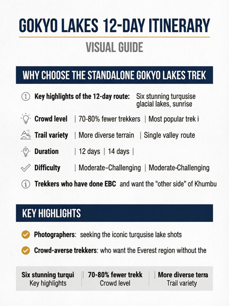
Key highlights of the 12-day route: Six stunning turquoise glacial lakes, sunrise from Gokyo Ri with views of Everest, Lhotse, Makalu, and Cho Oyu, the massive Ngozumpa Glacier (Nepal's longest), significantly fewer trekkers than EBC, proper acclimatization schedule, and the same Sherpa cultural experience as the Everest route.
Quick Facts: 12-Day Gokyo Lakes Trek
12 days (13 with departure day)
10 days on trail
5,357m (Gokyo Ri)
2 rest days (Namche, Gokyo)
110km round trip
Moderate-Challenging
March-May, September-November
$35-50 per day on trail
Why Choose the Standalone Gokyo Lakes Trek
Many itineraries combine Gokyo with EBC via Cho La Pass, creating a 17-20 day mega trek. But the standalone 12-day Gokyo route has distinct advantages for trekkers who want an exceptional experience without the extended time commitment.
Gokyo vs. EBC: Why Some Prefer Gokyo
| Factor | Gokyo Lakes 12-Day | EBC 14-Day |
|---|---|---|
| Views of Everest | Yes (from Gokyo Ri, 5,357m) | Yes (from Kala Patthar, 5,545m) |
| Number of 8,000m peaks visible | Four (Everest, Lhotse, Makalu, Cho Oyu) | Two (Everest, Lhotse) |
| Unique features | Six turquoise glacial lakes, Ngozumpa Glacier | Everest Base Camp itself |
| Crowd level | 70-80% fewer trekkers | Most popular trek in Nepal |
| Trail variety | More diverse terrain | Single valley route |
| Duration | 12 days | 14 days |
| Difficulty | Moderate-Challenging | Moderate-Challenging |
| Lodge availability | More available (fewer trekkers) | Can fill up in peak season |
For a detailed comparison, see our Gokyo Lakes vs EBC guide.
Who Is This Trek For?
- Trekkers who have done EBC and want the "other side" of Khumbu
- Photographers seeking the iconic turquoise lake shots
- Crowd-averse trekkers who want the Everest region without the traffic
- Nature lovers drawn to glacial geology and alpine lake ecosystems
- 12-day travelers who want a slightly shorter option than the 14-day EBC
- Repeat Khumbu visitors exploring a different valley
Pro Tip
The view from Gokyo Ri is considered by many mountaineers and photographers to be superior to Kala Patthar. From Gokyo Ri, you see four 8,000m peaks simultaneously -- Everest (8,849m), Lhotse (8,516m), Makalu (8,485m), and Cho Oyu (8,188m) -- plus the stunning turquoise lakes below and the Ngozumpa Glacier stretching toward the horizon. It is arguably the best panoramic viewpoint in the entire Khumbu region.
Complete Day-by-Day Itinerary
Day 0: Arrive in Kathmandu (1,400m)
Activities: Airport transfer, hotel check-in, trip preparation
Arrive in Kathmandu and transfer to your hotel in Thamel. If your agency is not handling permits, visit the Nepal Tourism Board office in Bhrikutimandap to obtain your Sagarmatha National Park Entry Permit and TIMS card. Spend the evening checking gear, confirming your Lukla flight time, and getting to bed early.
Accommodation: Hotel in Thamel ($15-50)
Day 1: Fly to Lukla (2,840m), Trek to Phakding (2,610m) -- 3-4 Hours
Starting Elevation: 2,840m (Lukla) Ending Elevation: 2,610m (Phakding) Elevation Change: -230m Distance: 8km Difficulty: Easy
The adventure begins with the exhilarating 35-minute flight from Kathmandu to Lukla, landing at Tenzing-Hillary Airport -- one of the world's most dramatic airstrips. After landing, register at the Sagarmatha National Park checkpoint and begin the gentle descent to Phakding along the Dudh Kosi river.
The trail is wide, well-maintained, and passes through small Sherpa settlements with prayer wheels and mani stones. This easy first day allows you to find your trekking rhythm.
For details on the Lukla flight experience, see our Kathmandu to Lukla flights guide.
Accommodation: Tea houses in Phakding ($8-15) Daily costs: $31-49
Lukla Flight Reliability
Lukla flights are weather-dependent and cancellations occur 30-40% of the time in peak season. Flights operate from approximately 6:00 AM to 10:00 AM when visibility is best. Some flights now operate from Ramechhap (4-5 hour drive from Kathmandu) to reduce congestion. Always confirm your departure airport and time with your agency the evening before.
Day 2: Phakding to Namche Bazaar (3,440m) -- 5-6 Hours
Starting Elevation: 2,610m (Phakding) Ending Elevation: 3,440m (Namche Bazaar) Elevation Gain: +830m Distance: 11km Difficulty: Moderate-Challenging
Day 2 is one of the hardest days of the trek. The trail follows the Dudh Kosi river valley, crossing several suspension bridges, before the infamous steep climb to Namche Bazaar -- a relentless 600m ascent over 3-4 hours. On clear days, you get your first glimpse of Everest from a viewpoint on the climb up.
Namche Bazaar is the Sherpa capital of the Khumbu and a fascinating mountain town with shops, bakeries, restaurants, and cultural sites. It sits in a horseshoe-shaped bowl with dramatic views of Kongde Ri and Thamserku.
Key waypoints:
- Phakding to Monjo (2,835m): 1.5-2 hours, gentle ups and downs
- Monjo to Jorsalle (2,740m): 30-45 minutes, park entrance checkpoint
- Jorsalle to Namche (3,440m): 2.5-3.5 hours, steep continuous climb
Accommodation: Tea houses in Namche Bazaar ($10-25) Daily costs: $42-69
Day 3: Acclimatization Day in Namche Bazaar (3,440m) -- 3-4 Hours Hike
Base Elevation: 3,440m (Namche Bazaar) Day High Point: 3,880m (Everest View Hotel area) Difficulty: Easy-Moderate
This critical acclimatization day allows your body to adjust to the altitude before ascending further. Do NOT skip this day -- the jump from sea level to 3,440m (via flight and trek) is significant and your body needs 36-48 hours to begin adapting.
Morning hike options:
- Everest View Hotel (3,880m): 2-3 hour round trip with stunning Everest panorama
- Khumjung Village (3,790m): Visit the monastery said to house a yeti scalp
- Syangboche Airstrip (3,720m): Short walk with excellent views
Afternoon in Namche:
- Visit the Sherpa Culture Museum
- Browse trekking shops (good quality gear at fair prices)
- Explore the Saturday market (if timing aligns)
- Enjoy bakery treats at Hermann Helmers or Namche Bakery
Accommodation: Same lodge as Day 2 in Namche Daily costs: $42-69
Pro Tip
Use the acclimatization day to observe how your body responds to altitude. Good signs include mild headache that resolves with water and ibuprofen, good appetite, and clear urine. If you experience persistent headache, nausea, or extreme fatigue, inform your guide. These symptoms should improve with rest at the same altitude. If they worsen, you may need an extra night in Namche.
Day 4: Namche Bazaar to Dole (4,110m) -- 5-6 Hours
Starting Elevation: 3,440m (Namche Bazaar) Ending Elevation: 4,110m (Dole) Elevation Gain: +670m Distance: 12km Difficulty: Moderate
This is where the Gokyo route diverges from the EBC trail. Instead of heading east toward Tengboche, you trek northwest toward the Gokyo Valley. The trail climbs to the Mong La pass (3,973m) with spectacular views of Ama Dablam, Thamserku, and Kangtega, then descends through rhododendron forest to the Phortse Tenga valley before climbing to Dole.
Key waypoints:
- Namche to Kyangjuma (3,550m): 1 hour, gentle climb with great views
- Kyangjuma to Mong La (3,973m): 1.5-2 hours, moderate ascent to the pass
- Mong La to Phortse Tenga (3,680m): 1 hour, descent through forest
- Phortse Tenga to Dole (4,110m): 1.5-2 hours, steady climb
Dole is a small settlement with a few tea houses surrounded by yak pastures. It offers peaceful evening views and the first sense of the remote Gokyo Valley ahead.
Accommodation: Tea houses in Dole ($12-20) Daily costs: $40-60
Day 5: Dole to Machhermo (4,470m) -- 3-4 Hours
Starting Elevation: 4,110m (Dole) Ending Elevation: 4,470m (Machhermo) Elevation Gain: +360m Distance: 8km Difficulty: Moderate
Day 5 is intentionally short to continue gradual acclimatization. The trail passes through Luza (4,360m) and follows the west bank of the Dudh Kosi, gaining altitude slowly through alpine meadows. The landscape becomes increasingly stark and beautiful as you leave the treeline behind.
Machhermo is historically significant as the village where the first "yeti" attack was reportedly documented in the 1970s -- a local herder claimed a yeti killed several yaks. The village has a small museum dedicated to this story.
Key waypoints:
- Dole to Luza (4,360m): 1.5-2 hours, gradual climb
- Luza to Machhermo (4,470m): 1-1.5 hours, gentle ascent
Important: Machhermo is home to a Himalayan Rescue Association (HRA) aid post. Attend their free altitude sickness lecture (usually held at 3:00 PM) -- it provides vital information for the days ahead.
Accommodation: Tea houses in Machhermo ($12-20) Daily costs: $40-60
HRA Aid Post at Machhermo
The Himalayan Rescue Association operates a seasonal medical post at Machhermo staffed by volunteer doctors during the spring and autumn trekking seasons. They offer free daily lectures on altitude sickness recognition and prevention at 3:00 PM. Even experienced trekkers benefit from attending. They can also check your blood oxygen levels and provide medical advice if you are experiencing symptoms.
Day 6: Machhermo to Gokyo (4,790m) -- 4-5 Hours
Starting Elevation: 4,470m (Machhermo) Ending Elevation: 4,790m (Gokyo) Elevation Gain: +320m Distance: 10km Difficulty: Moderate
Day 6 brings you to the jewel of this trek -- Gokyo village and its stunning turquoise lakes. The trail follows the Dudh Kosi valley, passing the edge of the massive Ngozumpa Glacier (Nepal's longest glacier at 36km) before arriving at the shores of the third Gokyo Lake (Dudh Pokhari).
Key waypoints:
- Machhermo to Pangka (4,580m): 1.5-2 hours, passing lateral moraine
- Pangka to First Lake/Longponga (4,690m): 1 hour, first turquoise lake appears
- First Lake to Second Lake/Taboche Tsho (4,710m): 30 minutes
- Second Lake to Gokyo Village (4,790m): 30-45 minutes, arriving at the third lake
The moment you see the first lake -- its impossibly turquoise water set against grey glacial moraine and snow-capped peaks -- is one of the defining moments of any Nepal trek. The color comes from glacial flour (finely ground rock particles) suspended in the water, which scatters blue-green light.
Accommodation: Tea houses in Gokyo ($15-25) Daily costs: $50-75
Altitude Caution at Gokyo
At 4,790m, Gokyo is higher than Everest Base Camp's approach village of Gorak Shep. Altitude sickness symptoms can intensify here. Stay well hydrated (3-4 liters of water daily), avoid alcohol, monitor for persistent headache or nausea, and descend immediately if symptoms worsen. The HRA recommends sleeping with your head elevated and keeping warm to reduce AMS risk.
Day 7: Gokyo Ri Sunrise and Lake Exploration (4,790m base) -- 6-8 Hours
Base Elevation: 4,790m (Gokyo) High Point: 5,357m (Gokyo Ri summit) Elevation Gain: +567m (Gokyo Ri) + lake exploration Difficulty: Challenging
This is the crown jewel day of the entire trek. You will climb Gokyo Ri for sunrise and then explore the upper Gokyo Lakes system.
Gokyo Ri Sunrise (5,357m)
Pre-dawn start: Leave Gokyo by 4:30-5:00 AM with headlamp Ascent time: 2-3 hours Summit time: Arrive for sunrise around 6:00-6:30 AM Descent time: 1.5-2 hours back to Gokyo
The trail to Gokyo Ri is steep and direct, climbing the rocky hill directly behind Gokyo village. The path is well-worn but involves sustained steep hiking on loose rock and scree. In the dark with headlamp, follow the trail carefully.
Sunrise panorama from Gokyo Ri (5,357m):
- Everest (8,849m) -- the unmistakable pyramid to the east
- Lhotse (8,516m) -- the massive wall south of Everest
- Makalu (8,485m) -- the fifth highest peak, visible to the southeast
- Cho Oyu (8,188m) -- towering to the north, closest 8,000m peak
- Ngozumpa Glacier -- stretching below, Nepal's longest glacier
- Gokyo Lakes -- all six turquoise jewels visible from above
- Countless 6,000-7,000m peaks in every direction
The sunrise hitting Everest and Cho Oyu simultaneously, with the turquoise lakes glowing below, is widely considered one of the top ten mountain viewpoints on Earth.
Lake Exploration (Afternoon)
After descending from Gokyo Ri and resting, spend the afternoon exploring the lake system:
The Six Gokyo Lakes:
| Lake | Nepali Name | Altitude | Distance from Gokyo | Notes |
|---|---|---|---|---|
| First Lake | Longponga Tsho | 4,690m | 2km south | Smallest, on the approach trail |
| Second Lake | Taboche Tsho | 4,710m | 1km south | Sacred to locals |
| Third Lake | Dudh Pokhari | 4,750m | At Gokyo village | Largest and most famous |
| Fourth Lake | Thonak Tsho | 4,800m | 2km north | Requires 1.5-2 hour walk |
| Fifth Lake | Ngozumpa Tsho | 4,990m | 4km north | Remote, full day excursion |
| Sixth Lake | Unnamed | 5,020m | 5km north | Rarely visited |
Recommended afternoon: Walk to the Fourth Lake (Thonak Tsho, 1.5-2 hours round trip). It is the second largest lake and offers excellent views of Cho Oyu's south face. The walk along the glacier edge is fascinating.
Accommodation: Same lodge in Gokyo as Day 6 Daily costs: $50-75
Pro Tip
For the Gokyo Ri sunrise, dress in your warmest layers -- temperatures at the summit can reach minus 15 to minus 20 degrees Celsius before dawn. Bring your headlamp with fresh batteries, a thermos of hot water (ask your lodge to prepare it the night before), snacks, and your camera with a fully charged battery (cold drains batteries fast). The sunrise display typically lasts 30-45 minutes as light sweeps across the peaks.
Day 8: Gokyo to Dole (4,110m) -- 5-6 Hours
Starting Elevation: 4,790m (Gokyo) Ending Elevation: 4,110m (Dole) Elevation Loss: -680m Distance: 18km Difficulty: Moderate (descending)
The return journey begins. You retrace your steps from Gokyo past the first two lakes, through Machhermo, and down to Dole. This combines Days 5 and 6 into a single descent day. The walking is straightforward but long.
Key waypoints:
- Gokyo to Machhermo: 2-2.5 hours
- Machhermo to Dole: 2-2.5 hours
The descent gives you a different perspective on the landscape. Views that were ahead of you on the way up are now behind you, and afternoon light creates different photographic opportunities.
Accommodation: Tea houses in Dole ($12-20) Daily costs: $40-60
Day 9: Dole to Namche Bazaar (3,440m) -- 5-6 Hours
Starting Elevation: 4,110m (Dole) Ending Elevation: 3,440m (Namche Bazaar) Elevation Loss: -670m Distance: 12km Difficulty: Moderate
Retrace the Day 4 route in reverse, climbing back over Mong La pass (3,973m) before descending to Namche Bazaar. The climb to the pass from the Dole side is less steep than the original approach, but the descent into Namche is steep on tired legs.
Arriving in Namche feels like returning to civilization. Celebrate with a pizza, apple pie, or cold beer at one of the many bakeries and restaurants.
Accommodation: Tea houses in Namche ($10-25) Daily costs: $42-69
Pro Tip
The descent days are when most knee injuries occur. Use trekking poles, take small steps on steep sections, and keep boot laces tight to prevent toe-banging. If your knees are suffering, consider buying an elastic knee support from one of the Namche pharmacies. They cost NPR 200-500 and can make a significant difference on the final descent days.
Day 10: Namche Bazaar to Lukla (2,840m) -- 6-7 Hours
Starting Elevation: 3,440m (Namche Bazaar) Ending Elevation: 2,840m (Lukla) Elevation Loss: -600m (net, with ups and downs) Distance: 19km Difficulty: Moderate (long day)
This is a long day that combines what took two days on the ascent (Namche to Phakding, Phakding to Lukla) into a single descent. The trail descends steeply from Namche to the river valley, then undulates through Jorsalle, Monjo, and Phakding before the final climb to Lukla.
Key waypoints:
- Namche to Jorsalle: 1.5-2 hours, steep descent
- Jorsalle to Phakding: 1 hour, gentle trail
- Phakding to Lukla: 3-3.5 hours, gradual ascent
Many trekkers prefer to split this into two days, staying a night in Phakding. If your schedule allows, this is the more comfortable option.
Accommodation: Tea houses in Lukla ($10-20) Daily costs: $35-55
Day 11: Fly Lukla to Kathmandu -- 35 Minutes
Starting Elevation: 2,840m (Lukla) Ending Elevation: 1,400m (Kathmandu)
The 35-minute flight from Lukla to Kathmandu reverses the dramatic landing experience. Enjoy views of the Himalayan range from the air as you return to the capital.
Morning priorities:
- Early breakfast (5:00-5:30 AM)
- Airport check-in by 6:00 AM
- Flights typically depart 6:30-9:00 AM
Arrival in Kathmandu:
- Transfer to Thamel hotel
- Hot shower (finally!)
- Celebration meal
- Rest and recovery
Daily costs: Lukla meals $10-15, Flight included in trek budget or $175-200 one-way, Kathmandu hotel $15-50, Celebration dinner $15-40. Total: $55-105
Day 12: Buffer Day in Kathmandu
Purpose: This essential buffer day accounts for the 30-40% chance of Lukla flight cancellations. If your Day 11 flight operated smoothly, enjoy a free day in Kathmandu.
If in Kathmandu:
- Sleep in and recover
- Visit Boudhanath Stupa, Swayambhunath, or Patan Durbar Square
- Souvenir shopping in Thamel
- Recovery massage ($15-30)
- Organize photos and memories
If still in Lukla:
- Wait for next available flight
- Most delays resolve within 24-48 hours
- In extended delays (3+ days), helicopter rescue costs $1,800-$5,000 depending on location (EBC to Lukla $1,800-$2,500, EBC to Kathmandu $4,500-$5,000) per seat
Daily costs: $60-150
Altitude Profile: Visualizing the 12-Day Route
| Day | Location | Sleep Altitude | Day High Point | Elevation Change |
|---|---|---|---|---|
| 0 | Kathmandu | 1,400m | 1,400m | -- |
| 1 | Phakding | 2,610m | 2,840m (Lukla) | +1,210m (flight), -230m |
| 2 | Namche Bazaar | 3,440m | 3,440m | +830m |
| 3 | Namche (accl.) | 3,440m | 3,880m | +440m day hike |
| 4 | Dole | 4,110m | 4,110m | +670m |
| 5 | Machhermo | 4,470m | 4,470m | +360m |
| 6 | Gokyo | 4,790m | 4,790m | +320m |
| 7 | Gokyo (explore) | 4,790m | 5,357m (Gokyo Ri) | +567m day hike |
| 8 | Dole | 4,110m | 4,790m | -680m |
| 9 | Namche | 3,440m | 4,110m | -670m |
| 10 | Lukla | 2,840m | 3,440m | -600m |
| 11 | Kathmandu | 1,400m | 2,840m | -1,440m (flight) |
Key acclimatization notes:
- Day 3 in Namche is the first critical acclimatization day (36-48 hours after the altitude jump via flight)
- Days 4-6 gain only 360-670m per day, well within safe limits
- Day 7 at Gokyo serves as a second acclimatization day following the "climb high, sleep low" principle (summit Gokyo Ri at 5,357m, sleep at 4,790m)
- Average daily altitude gain on ascending days: 445m -- conservative and safe
Permits and Costs
Required Permits
| Permit | Cost (Foreigners) | Cost (SAARC) | Where to Obtain |
|---|---|---|---|
| Sagarmatha National Park Entry | NPR 3,000 ($23) | NPR 1,500 ($12) | Kathmandu NTB or Monjo checkpoint |
| TIMS Card | NPR 2,000 ($15) | NPR 1,000 ($8) | Kathmandu NTB or TAAN office |
Total Trek Budget
Budget Independent Trek:
- Trail costs (10 days at $35-40/day): $350-400
- Lukla flights (roundtrip): $215-400
- Permits: $38
- Kathmandu hotels (3 nights): $45-90
- Kathmandu meals (3 days): $45-75
- Grand total: $828-1,003
Standard Guided Trek:
- Trail costs (10 days at $50-60/day): $500-600
- Lukla flights: $215-400
- Permits: $38
- Guide ($30-40/day x 12): $360-480
- Kathmandu expenses: $90-165
- Tips and extras: $150-250
- Grand total: $1,488-1,933
All-Inclusive Agency Package: $1,200-2,200 depending on agency and service level
Best Seasons for the Gokyo Lakes Trek
Autumn (October-November) -- Best Overall
Why it is best for Gokyo: The turquoise lakes are at their most vivid in late autumn when water levels are highest from monsoon melt but the skies are crystal clear. The contrast between blue lakes, white peaks, and grey moraine is at its most dramatic.
Weather: Clear skies, minimal precipitation, cold nights (minus 10 to minus 15 degrees Celsius at Gokyo) Crowds: Moderate (but still far fewer than EBC) Lake color: Most vivid turquoise
Spring (March-May) -- Second Best
Why spring works: Warmer temperatures make the high camps more comfortable. Rhododendron blooms below Namche add color to the lower trail sections.
Weather: Generally clear mornings, possible afternoon clouds, warmer than autumn Crowds: Moderate Lake color: Good, though slightly less vivid than autumn due to lower water levels
Winter (December-February) -- For Experienced Trekkers Only
Considerations: Extremely cold at Gokyo (below minus 20 degrees Celsius at night), some lodges may close above Dole, shorter daylight hours, but incredibly clear views and virtually no other trekkers.
Monsoon (June-September) -- Not Recommended
Why to avoid: Daily rain, clouds obscure mountain views, trail conditions deteriorate, leeches on lower trails, and the lakes lose their vivid color due to sediment-laden runoff.
For detailed seasonal information, see our Gokyo Lakes best time guide.
The Gokyo Lakes: A Complete Guide
The six Gokyo Lakes (collectively called the Gokyo Cho) are among the highest freshwater lake systems in the world. They are fed by glacial meltwater from the Ngozumpa Glacier and surrounding snowfields.
Why Are the Lakes Turquoise?
The stunning color comes from glacial flour -- microscopic rock particles ground by the glacier. These particles are suspended in the water and scatter short-wavelength blue and green light, creating the distinctive turquoise hue. The color varies by:
- Season: Most vivid in October-November when water is clearest
- Time of day: Best color in morning sunlight
- Weather: Overcast skies mute the color; direct sun enhances it
- Water depth: Deeper areas appear more intensely colored
Sacred Significance
The Gokyo Lakes are sacred to both Hindu and Buddhist communities. Dudh Pokhari (Third Lake) is particularly revered, and a ritual bathing ceremony takes place during the Janai Purnima festival (July-August) each year, drawing thousands of Hindu pilgrims. The lakes are protected, and swimming or washing in them is strictly prohibited.
Photography Tips for the Lakes
- Best light: Early morning (7:00-9:00 AM) when sun hits the water but peaks are still lit
- Best viewpoint: Gokyo Ri summit for all six lakes in one frame
- Best close-up: Shore of the Third Lake with Cho Oyu reflected in still water
- Polarizing filter: Essential for reducing glare and enhancing turquoise color
- Drone: Banned in Sagarmatha National Park. Do not bring one.
Ngozumpa Glacier: Nepal's Longest
The trek parallels the Ngozumpa Glacier for several days. At 36km long and up to 2km wide, it is the longest glacier in Nepal and one of the largest in the Himalayas. The glacier is covered in rock debris (making it look like a vast rubble field rather than clean ice) but contains deep ice beneath.
You can walk onto the glacier surface from the Gokyo side, but exercise extreme caution -- crevasses are hidden beneath rock debris, and the ice can be unstable. A guide is essential for any glacier walking.
The glacier has been retreating steadily, and scientists estimate it may disappear entirely within 100-150 years due to climate change. The Gokyo Lakes themselves may shrink as their glacial water source diminishes.
Frequently Asked Questions: 12-Day Gokyo Lakes Itinerary
Related Planning Resources
- Gokyo Lakes Trek Complete Guide -- in-depth guide to the Gokyo region
- Gokyo Lakes Best Time to Trek -- detailed seasonal breakdown
- Gokyo Lakes vs EBC: Which Trek to Choose -- detailed comparison
- Kathmandu to Lukla Flights Guide -- everything about the Lukla flight
- Altitude Sickness Prevention -- vital safety information
Final Thoughts: Is the 12-Day Gokyo Itinerary Right for You?
The 12-day Gokyo Lakes trek delivers one of Nepal's most visually stunning experiences. The turquoise lakes, the Gokyo Ri panorama of four 8,000m peaks, and the proximity to the Ngozumpa Glacier create a trekking experience that rivals and in some ways surpasses the more famous EBC route.
Choose the 12-day Gokyo route if:
- You want the best panoramic mountain viewpoint in the Khumbu region
- You prefer fewer crowds and a more intimate trekking experience
- You are drawn to the unique beauty of glacial lakes
- You have 12-14 days of vacation time
- You have already done EBC and want a new Khumbu experience
- You are a photographer seeking the iconic turquoise lake shots
Consider alternatives if:
- Standing at the actual Everest Base Camp is your primary goal -- choose EBC 14-Day
- You want both Gokyo and EBC -- plan 17-20 days for the combined route via Cho La Pass
- You want a shorter Khumbu trek -- consider Namche-Tengboche (7-8 days)
The Gokyo Valley is where experienced Khumbu trekkers go when they want to show people what the Everest region is truly capable of. It is raw, beautiful, and unforgettable.
Namaste, and safe trekking!
Sources:
This guide was researched using data from:
- Nepal Tourism Board -- Sagarmatha Region Statistics 2026/2027
- Sagarmatha National Park Authority -- Trail and Lake Information
- Khumbu lodge networks and pricing surveys 2026/2027
- Himalayan Rescue Association -- Altitude Guidelines and Machhermo Aid Post
- Glaciological Society of Nepal -- Ngozumpa Glacier Data