


The conventional wisdom about Nepal trekking is unambiguous: avoid monsoon season (June-September). And for most routes, that advice remains sound—trails become mud rivers, leeches emerge in biblical numbers, mountain views disappear behind walls of cloud, and landslides create genuine danger on exposed slopes. Yet reducing monsoon season to a simple "don't go" misses something extraordinary: this challenging season offers unique opportunities that have drawn savvy trekkers to the Himalaya for decades.
The secret lies in Nepal's remarkable geography. While the southern flanks of the Himalaya drown under relentless rain, certain trans-Himalayan valleys—protected by the very peaks that create Nepal's famous skyline—remain dry, clear, and remarkably trekker-friendly. These rain-shadow regions transform monsoon from a season to avoid into a season of opportunity: empty trails, dramatically reduced costs, lush green landscapes, powerful waterfalls, and authentic cultural experiences untouched by tourist crowds.
This comprehensive guide provides everything you need to make informed decisions about monsoon trekking in Nepal. We'll examine the meteorological reality of the season, identify which routes thrive and which to avoid absolutely, detail essential gear modifications (including the critical topic of leech protection), explore trail conditions and safety considerations, and provide month-by-month breakdowns to help you target optimal windows within this challenging season.
Whether you're a budget-conscious traveler seeking significant savings, an experienced trekker drawn to solitude and challenge, a cultural enthusiast wanting authentic village experiences, or simply someone whose schedule dictates summer travel—this guide will help you determine whether monsoon trekking aligns with your priorities and how to maximize success if you proceed.
June 10 - October 2 (average)
July 15 - August 15
Upper Mustang, Dolpo, Nar Phu, Upper Manang
70-90% fewer trekkers than peak season
25-50% below October pricing
1,200m - 3,000m elevation
Lukla: Poor | Jomsom: Moderate | Simikot: Variable
Poor (standard routes) | Good-Excellent (rain-shadow)
Muddy/hazardous (most) | Dry/dusty (rain-shadow)
Limited (many close) | Full operation (rain-shadow)
Prior trekking experience essential
Quality rain gear, leech protection, quick-dry clothing
Part 1: Understanding Nepal's Monsoon - The Meteorological Reality
Before planning any monsoon trek, you must understand what the monsoon actually is and how it fundamentally transforms Nepal's trekking environment.
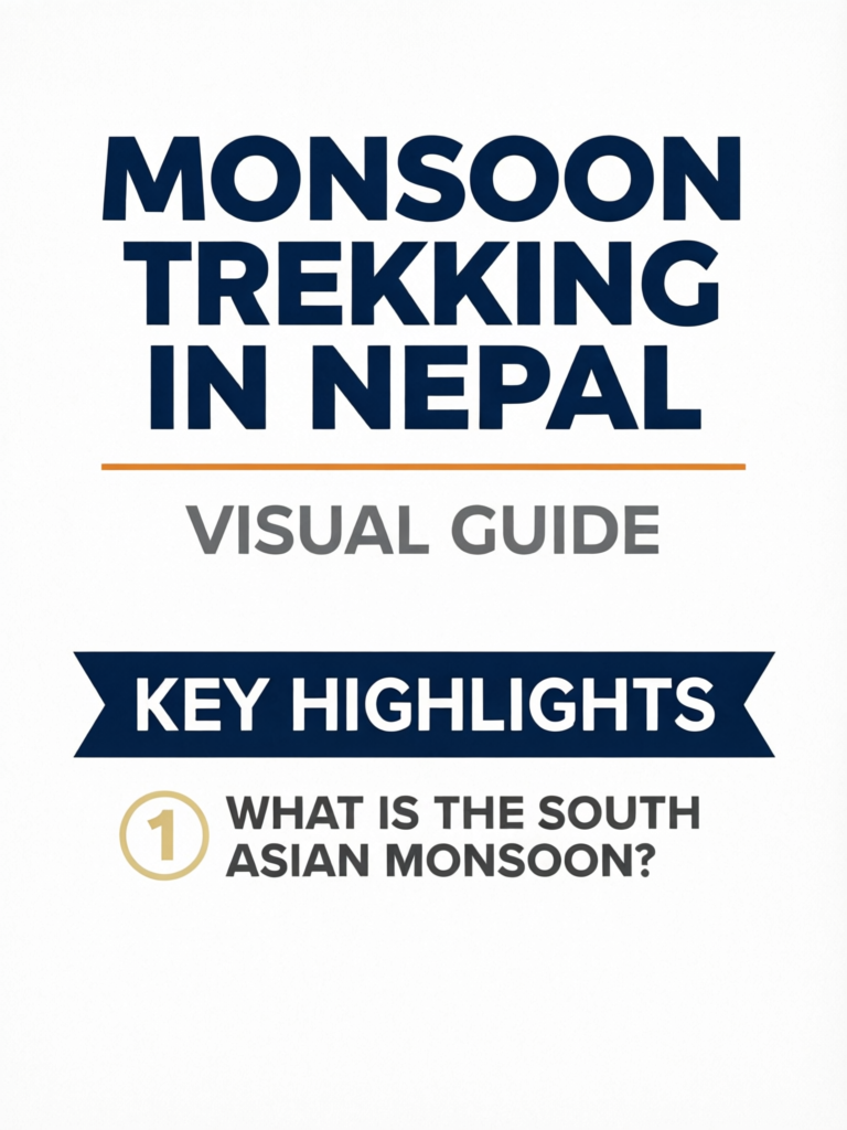
What Is the South Asian Monsoon?
The monsoon is not simply "rainy season"—it's a massive atmospheric circulation pattern driven by differential heating between the Asian landmass and the Indian Ocean. During summer, the Asian continent heats dramatically, creating a low-pressure zone that draws moisture-laden air from the ocean northward. When these saturated air masses encounter the Himalayan barrier, they're forced upward, cooling and releasing their moisture as precipitation.
The result is extraordinary: Nepal receives 70-85% of its annual rainfall during the four monsoon months (June-September). Kathmandu's average annual precipitation is approximately 1,400mm—and roughly 1,100mm of that falls during monsoon.
Key Monsoon Statistics for Nepal
Average Monsoon Timing:
- Onset: June 10 (±5 days)
- Withdrawal: October 2 (recent trend: delayed to early-mid October)
- Duration: 112-120 days
- Peak intensity: July 15 - August 15
Regional Rainfall Variation (June-September):
- Eastern Nepal (Khumbu foothills): 2,500-4,000mm
- Central Hills (Kathmandu): 1,100-1,500mm
- Pokhara Region: 3,000-5,000mm (one of world's wettest)
- Western Hills: 1,800-2,500mm
- Rain-Shadow Zones (Mustang, Dolpo): 150-400mm
How the Rain Shadow Creates Monsoon Trekking Opportunities
The monsoon's interaction with Nepal's topography creates one of the Himalaya's most fascinating phenomena: the rain shadow effect. Here's how it works:
-
Monsoon air masses approach from the south, heavy with moisture from the Bay of Bengal and Arabian Sea.
-
Forced ascent: The Himalayan range—including 8,000m+ peaks like Annapurna, Dhaulagiri, and Manaslu—forces these air masses upward.
-
Orographic precipitation: As air rises, it cools and can no longer hold its moisture. Rain dumps on the southern (windward) slopes.
-
Depleted air descends: By the time air masses cross the high peaks and descend into trans-Himalayan valleys, they've already released 80-95% of their moisture.
-
Rain shadow formation: Valleys north of the main Himalayan crest receive dramatically less rainfall—often resembling high-altitude deserts.
Practical Example:
| Location | Annual Rainfall | Monsoon (Jun-Sep) |
|---|---|---|
| Pokhara (south of range) | 4,000-5,000mm | 3,200-4,000mm |
| Upper Mustang (rain shadow) | 250-400mm | 80-150mm |
| Difference | 10-20x more rain | 20-40x more rain |
This isn't a subtle difference—it's the difference between trekking through daily downpours with zero mountain visibility and trekking under blue skies on dry trails. The rain shadow effect transforms the monsoon calculus entirely for certain destinations.
Regional Weather Patterns During Monsoon
Understanding how different regions experience monsoon helps you make informed route choices:
Everest Region (Khumbu):
- Heavy rainfall below Namche Bazaar (3,440m)
- Persistent clouds obscuring peaks 80-90% of time
- Lukla flights frequently cancelled (2-5 day delays common)
- Trails muddy, slippery, and leech-infested below 3,000m
- Higher elevations experience rain/snow mix
- Verdict: Not recommended for monsoon trekking
Annapurna Region (Southern Slopes):
- Among the wettest areas in Nepal during monsoon
- Pokhara receives up to 900mm in July alone
- ABC trek faces constant rain, obscured views, extreme leech activity
- Poon Hill route largely pointless without views
- Verdict: Avoid standard Annapurna routes entirely
Langtang Region:
- Heavy monsoon rainfall throughout
- Access trails prone to landslides (historically devastating)
- Leeches extremely active in lower forested sections
- Some improvement above Langtang village (3,500m+)
- Verdict: Not recommended; moderate risk
Upper Mustang:
- Protected behind Annapurna-Dhaulagiri barrier
- Receives only 250-400mm annually (most NOT during monsoon)
- July-August often has better conditions than rest of Nepal
- Clear skies 75-85% of monsoon days
- Dusty rather than muddy trails
- Verdict: Excellent monsoon destination
Dolpo Region:
- Deepest rain shadow in Nepal
- Upper Dolpo receives less than 200mm annually
- Virtually no monsoon impact in trans-Himalayan sections
- Lower Dolpo receives some moisture but still manageable
- Verdict: Excellent monsoon destination
Manang (Northern Annapurna Circuit):
- Partial rain shadow benefits
- Significantly drier than southern Annapurna
- July-August rainfall: 100-180mm (vs 600-900mm in Pokhara)
- Access from south (Besisahar-Manang) wet and difficult
- Access from north (Nar Phu) or west (Thorong La) better
- Verdict: Good option if accessed strategically
Part 2: Rain Shadow Treks - Where Monsoon Becomes an Advantage
These destinations don't just "survive" monsoon—they often provide better trekking experiences during June-September than during crowded peak season.
Upper Mustang: The Premier Monsoon Trek
Upper Mustang—Nepal's "Last Forbidden Kingdom"—is arguably the world's finest monsoon trekking destination. Protected by the Annapurna and Dhaulagiri massifs, this ancient Tibetan Buddhist enclave remains dry while the rest of Nepal floods.
Why Upper Mustang Excels During Monsoon:
- Minimal rainfall: 80-150mm during entire June-September period
- Clear skies: 75-85% of days have blue skies and mountain visibility
- Comfortable temperatures: 15-25°C daytime, 5-12°C nighttime
- Reduced crowds: 70-80% fewer trekkers than peak season
- Cultural authenticity: Visit villages during daily life, not tourist season
- Cost savings: 25-35% lower package prices
- Dramatic landscapes: Arid desert scenery, painted caves, medieval walled city
Monsoon-Specific Considerations:
- Strong afternoon winds kick up dust (bring buff/bandana)
- Jomsom flights more reliable than Lukla but still weather-dependent
- Some afternoon clouds may spill over from south (typically clearing by evening)
- All teahouses and services fully operational
Trek Specifications:
- Duration: 10-14 days
- Maximum elevation: 3,840m (Lo Manthang)
- Difficulty: Moderate
- Permits: Restricted Area Permit (USD 50/day) + ACAP ($30)
- Guide required: Yes (mandatory for restricted area)
- Minimum group: 2 trekkers
Upper Mustang Monsoon Strategy
Target the June 15-30 or August 20-September 10 windows for optimal conditions. Early monsoon (June) sees the freshest landscapes with minimal dust, while late August/early September captures the beginning of post-monsoon clarity. July-early August works perfectly well but experiences maximum dust and the occasional afternoon cloud spillover from the south.
Dolpo Region: Ultimate Remoteness in Monsoon
Dolpo—Nepal's largest and most remote district—sits in an even deeper rain shadow than Mustang. This is the destination for experienced trekkers seeking absolute solitude and authentic Tibetan culture.
Why Dolpo Excels During Monsoon:
- Driest major trekking region: Less than 200mm annual rainfall in Upper Dolpo
- Virtually zero monsoon impact in trans-Himalayan sections
- Extraordinary solitude: May see fewer than 10 other trekkers entire trip
- Peak wildlife activity: Blue sheep herds, potential snow leopard sightings
- Cultural immersion: Bon Buddhist communities largely untouched by tourism
- Shey Phoksundo Lake: Stunning turquoise waters at peak beauty
Monsoon-Specific Considerations:
- Access via Juphal requires Nepalgunj connection (monsoon flight delays possible)
- Lower Dolpo sections receive some moisture but remain manageable
- Very remote—medical evacuation difficult and expensive
- Camping required for Upper Dolpo circuit
- Expensive permits add significant cost
Trek Options:
Upper Dolpo Circuit:
- Duration: 18-24 days
- Maximum elevation: 5,200m (Kang La)
- Difficulty: Strenuous
- Permits: Restricted Area Permit (USD 50/day, then $50/day) + National Park ($30)
- Guide required: Yes (mandatory)
- Cost: $3,500-5,000+
Lower Dolpo (Phoksundo Lake):
- Duration: 12-16 days
- Maximum elevation: 3,611m
- Difficulty: Moderate-Strenuous
- Permits: National Park only (no restricted area permit needed)
- Cost: $2,200-3,500
Upper Manang and Nar Phu Valley
The northern sections of the Annapurna Circuit—specifically Upper Manang and the restricted Nar Phu Valley—benefit from partial rain shadow protection and offer viable monsoon trekking.
Key Advantages:
- 60-70% less rainfall than southern Annapurna
- Clear morning mountain views common
- Authentic Tibetan culture in Nar and Phu villages
- Fewer crowds than any other time of year
- Access via Thorong La from west avoids worst monsoon trail sections
Monsoon Challenges:
- Southern approach (Besisahar to Manang) remains wet and leech-prone
- Afternoon clouds more common than in Mustang/Dolpo
- Thorong La can receive snow even in summer
Strategic Approach:
Consider combining Nar Phu Valley (restricted area permit required) with Upper Manang, accessing via helicopter to Manang or Humde airstrip, thereby avoiding the problematic lower approach trails entirely.
Other Rain-Shadow Options
Tsum Valley:
- Trans-Himalayan valley near Manaslu
- Requires restricted area permit
- Significant rain shadow benefit
- Less developed than Mustang but increasingly popular
Upper Humla and Limi Valley:
- Far northwestern rain shadow
- Very remote, requires extensive logistics
- Cultural connection to Tibet
- Serious expedition-style trekking only
Part 3: Best Monsoon Trek Options - Ranked by Suitability
Tier 1: Excellent (Recommended for Monsoon)
| Trek | Duration | Max Elevation | Monsoon Rating |
|---|---|---|---|
| Upper Mustang | 10-14 days | 3,840m | 9/10 |
| Upper Dolpo | 18-24 days | 5,200m | 9/10 |
| Lower Dolpo | 12-16 days | 3,611m | 8/10 |
| Nar Phu Valley | 10-14 days | 5,320m | 7/10 |
Tier 2: Viable (Experienced Trekkers Only)
| Trek | Duration | Max Elevation | Monsoon Rating |
|---|---|---|---|
| Upper Manang (helicopter access) | 7-10 days | 4,500m | 6/10 |
| Tsum Valley | 12-16 days | 4,000m | 6/10 |
| Annapurna Circuit (Manang-Muktinath only) | 5-7 days | 5,416m | 5/10 |
Tier 3: Marginal (Proceed with Caution)
| Trek | Duration | Max Elevation | Monsoon Rating |
|---|---|---|---|
| Upper Langtang | 8-12 days | 4,984m | 4/10 |
| High-elevation Khumbu | 12-16 days | 5,550m | 3/10 |
Part 4: Treks to Absolutely Avoid During Monsoon
Do Not Trek These Routes June-September
The following routes face severe conditions during monsoon that make them genuinely dangerous or pointlessly unrewarding:
Everest Base Camp (Standard Route)
- Lukla flights cancelled 40-60% of days
- Trails below Namche muddy and leech-infested
- Mountain views obscured 80-90% of time
- No point reaching base camp if you can't see Everest
Annapurna Base Camp
- Pokhara receives up to 900mm rain in July alone
- Leeches in biblical numbers on forest trails
- Zero mountain views from sanctuary
- Genuine landslide danger
Ghorepani Poon Hill
- The entire point is sunrise mountain views—you won't get them
- Extreme leech activity in the forest sections
- Trails become treacherous mud slides
- Tea house operators often close
Mardi Himal
- Heavy rainfall throughout route
- Leech-infested forest sections
- Cloud-obscured ridge walking
- No high-elevation escape from moisture
Langtang Valley (Full Route)
- Access trails historically prone to devastating landslides
- Heavy rainfall throughout
- Leeches aggressive below Langtang village
- Some risk mitigation above 3,500m but not enough
Manaslu Circuit (Full)
- Southern approach extremely wet and difficult
- Larkya La can receive significant snow
- Trail damage common from monsoon erosion
- Not worth the risk when better options exist
Kanchenjunga Region
- Extreme rainfall in eastern Nepal
- Remote with difficult evacuation
- Trails severely affected by monsoon
- Absolutely not recommended
Part 5: Essential Monsoon Gear - What You Actually Need
Monsoon trekking requires significant gear modifications from standard autumn/spring setups. Your equipment choices can make the difference between a successful adventure and genuine misery.
Waterproof Outerwear
Rain Jacket Requirements:
- Minimum waterproof rating: 15,000mm (20,000mm+ preferred)
- Minimum breathability: 15,000g/m²/24hr
- Pit zips (absolutely non-negotiable for humid conditions)
- Helmet-compatible hood with stiffened brim
- Length extending below waist when arms raised
Recommended Jackets:
- Arc'teryx Beta AR (premium, 28,000mm)
- Patagonia Torrentshell 3L (excellent value, 15,000mm)
- Outdoor Research Foray (best value in premium tier, 20,000mm)
Rain Pants:
- Full side-zip design strongly recommended (allows venting and easy on/off)
- Waterproof rating: 10,000mm minimum
- Look for reinforced seat and knees
Pack Cover:
- Essential, not optional
- Sized correctly for your pack (too small = useless)
- Consider internal dry bags as backup
- Some trekkers use trash compactor bags inside pack as ultimate protection
Quick-Dry Clothing
Cotton is your enemy during monsoon. Every item should be synthetic or merino wool:
- Quick-dry trekking pants (zip-off legs useful for varying conditions)
- Moisture-wicking base layers (not cotton t-shirts)
- Synthetic hiking shirts with UPF protection
- At least 3-4 changes of socks (you will get feet wet)
- Light synthetic shorts for hot, humid lower elevations
Footwear Strategy
Primary Boots:
- Waterproof but breathable (Gore-Tex or equivalent membrane)
- Vibram or similar high-traction sole (trails will be slippery)
- Gusseted tongue to prevent water entry
- Break in thoroughly before departure
Secondary Footwear:
- Trail running shoes or sport sandals for tea house evenings
- Sandals with good grip for river crossings (Tevas, Chacos)
- Gaiters essential for leech protection (see next section)
Monsoon-Specific Essentials
| Item | Purpose | Notes |
|---|---|---|
| Gaiters | Leech protection, mud | Tall gaiters, tight ankle seal |
| Leech socks | Worn under boots | Treated with permethrin |
| Salt/DEET spray | Leech removal | Small bottle sufficient |
| Quick-dry towel | Everything gets wet | Pack 2 small microfiber towels |
| Dry bags | Protect electronics/documents | Various sizes, 2-3 minimum |
| Plastic bags | Extra waterproofing | Ziploc various sizes |
| Waterproof phone case | Photography in rain | Lanyard attachment helpful |
| Umbrella | Surprising utility | Lightweight trekking umbrella |
| Spare glasses/contacts | Visibility issues | Rain on glasses problematic |
The Umbrella Secret
Many experienced monsoon trekkers swear by lightweight trekking umbrellas. Unlike rain jackets, umbrellas provide complete protection for your upper body without trapping sweat, allow ventilation, protect your pack, and keep rain off your face. In sustained monsoon rain, the umbrella-plus-rain-pants combination often outperforms full rain suits. Choose a sturdy model designed for outdoor use (Euroschirm, Montbell Travel Umbrella) rather than flimsy city umbrellas that will fail in wind.
Part 6: Leech Protection Strategies - The Complete Guide
For many trekkers, leeches represent the most psychologically challenging aspect of monsoon trekking. These blood-feeding annelids emerge in massive numbers during wet months, particularly in forested zones between 1,200m and 3,000m elevation. While medically harmless (they don't transmit diseases), their presence can range from minor nuisance to trip-ruining torment depending on your preparation and mental approach.
Understanding Leech Behavior
Where Leeches Live:
- Damp leaf litter and undergrowth in forests
- Stream crossings and wet trail sections
- Bamboo groves (particularly heavy infestations)
- Active zone: 1,200m - 3,000m elevation
- Rare above 3,000m, almost absent above 3,500m
How They Find You:
- Sense heat, carbon dioxide, and vibration
- Wait on leaves and vegetation at ground level
- Attach when you brush past or step near
- Can squeeze through incredibly small openings
- Move surprisingly quickly once motivated
Peak Activity Times:
- Highest activity during and after rain
- Less active during midday heat
- Most aggressive in early morning and late afternoon
- Activity decreases significantly above 3,000m
The Multi-Layer Defense System
Effective leech protection requires multiple layers of defense:
Layer 1: Physical Barriers
- Tall gaiters: Must seal tightly at ankle, extend to below knee
- Leech socks: Specialized socks worn under regular socks, tucked into pants
- Pants tucked into socks: No gaps, no entry points
- Long sleeves when moving through vegetation: Leeches can drop from above
- Check yourself constantly: Quick detection prevents attachment
Layer 2: Chemical Deterrents
- DEET-based repellent: Apply to boots, gaiters, lower pants
- Permethrin treatment: Spray on socks, pants cuffs, gaiters (reapply every 2-3 days)
- Tobacco water: Traditional method still used by locals
- Salt solution: Spray on boots (less effective than DEET/permethrin)
Layer 3: Strategic Timing
- Start early when trails are drier and leeches less active
- Move quickly through worst sections rather than lingering
- Choose rest stops on rocks, not vegetation
- Consider timing lunch for midday when leech activity lowest
Layer 4: Mental Preparation
- Accept you will likely get at least one leech despite precautions
- Carry salt or DEET spray for removal
- Know they're medically harmless (just gross)
- Treat attachment as minor inconvenience, not emergency
Leech Removal Protocol
If (when) a leech attaches:
- Stay calm—panicking makes everything worse
- Do not pull directly—mouthparts may remain in wound
- Apply salt, DEET, or alcohol to the leech body
- Wait for it to release (usually within seconds)
- Let the wound bleed freely for a minute—this helps clean it
- Apply antibiotic ointment and bandage
- Bleeding may continue 15-30 minutes—this is normal (leeches inject anticoagulant)
The Psychological Battle
The most important leech protection is mental. Veterans of monsoon trekking report that the anticipation of leeches is far worse than the reality. Once you've dealt with your first attachment—removed it, treated the wound, and moved on—the psychological power diminishes significantly. Some trekkers even develop a dark appreciation for these remarkable creatures (an adult leech can consume 5-10 times its body weight in blood, then survive years without another meal). Frame your leech encounters as authentic monsoon experiences rather than calamities, and they lose their power to ruin your trek.
Part 7: Trail Conditions and Hazards
Monsoon transforms Nepal's trails in ways that create both challenges and genuine dangers. Understanding these conditions helps you prepare appropriately and make safe decisions.
Trail Surface Conditions
Mud:
- Ubiquitous below 3,500m on non-rain-shadow routes
- Can be ankle-deep on popular trails
- Creates extremely slippery conditions
- Dramatically slows hiking pace (plan 30-50% longer days)
- Proper footwear essential (aggressive tread, waterproof)
Stream Crossings:
- Rivers and streams swell dramatically during monsoon
- Crossings that are ankle-deep in October become waist-deep or uncrossable
- Flash floods can occur with little warning
- Never attempt crossing rivers that reach above mid-thigh
- Some bridges get damaged or washed out annually
Rock and Root Hazards:
- Wet rock becomes extremely slippery
- Tree roots on trails become ice-like hazards
- Stone steps (ubiquitous on Nepali trails) treacherous when wet
- Trekking poles essential for stability
Landslide Risk
Monsoon landslides kill dozens of people in Nepal annually. This is a genuine hazard requiring serious attention.
Landslide Safety
High-Risk Indicators:
- Steep hillsides above trail, especially recently deforested
- Areas with visible old slide debris
- Sections where trail crosses or traverses slopes
- Extended heavy rain (triggers most slides)
- Rumbling sounds or sudden silence in normally noisy areas
Risk Mitigation:
- Travel early morning when ground is relatively stable
- Don't linger in obvious slide zones
- If you hear rumbling, move quickly away from slope
- Never camp below unstable slopes
- Check locally for recent slide reports before departing
- Consider turning back if conditions seem dangerous
If Caught in a Slide:
- Move perpendicular to slide direction if possible
- Get behind large obstacles (boulders, trees)
- Protect your head
- Try to stay on top of debris
Flight Reliability
Getting to and from mountain trailheads becomes significantly more difficult during monsoon:
Lukla Flights (Everest Region):
- Cancellation rate: 40-60% during peak monsoon
- Delays of 2-5 days not uncommon
- Build minimum 3 buffer days into itinerary
- Consider helicopter alternatives (expensive but more reliable)
Jomsom Flights (Mustang Region):
- Better reliability than Lukla (30-40% cancellation rate)
- Morning flights more reliable than afternoon
- Driving alternative available (longer but reliable)
Simikot/Juphal Flights (Western Nepal):
- Variable reliability depending on conditions
- Connection through Nepalgunj adds complexity
- Budget extra days for delays
Mitigation Strategies:
- Never book international departure same day as mountain flight arrival
- Build minimum 2-3 buffer days into every itinerary
- Have backup plans (driving alternatives, helicopter options)
- Purchase comprehensive travel insurance covering delays
Part 8: Advantages of Monsoon Trekking
Despite the challenges, monsoon offers genuine advantages that draw experienced trekkers year after year:
Dramatically Reduced Crowds
The difference is staggering. Where popular routes like EBC and Annapurna Circuit see 300-500+ trekkers daily during October, monsoon numbers drop to 30-50. On rain-shadow routes like Upper Mustang, you might encounter fewer than a dozen other trekkers during your entire trip.
What This Means Practically:
- No competition for teahouse rooms
- More personal attention from guides and lodge owners
- Authentic village experiences (not overwhelmed by tourists)
- Photography without crowds in every shot
- Genuine solitude on the trail
Significant Cost Savings
Monsoon's low demand translates directly to your wallet:
| Cost Category | Peak Season | Monsoon | Savings |
|---|---|---|---|
| Organized trek packages | $2,500-4,000 | $1,800-3,000 | 25-35% |
| Guide/porter daily rate | $30-40 | $20-30 | 25-35% |
| Teahouse accommodation | $15-30/night | $10-20/night | 30-40% |
| Domestic flights | Premium pricing | Standard/discount | 15-25% |
| Kathmandu hotels | $80-150/night | $40-80/night | 40-50% |
Lush Green Landscapes
Monsoon transforms Nepal's landscapes from the browns and grays of dry season into vibrant greens. Waterfalls that are trickles in October become thundering cascades. Rice paddies gleam emerald against terraced hillsides. Alpine meadows explode with wildflowers. The visual difference is dramatic.
Even in rain-shadow regions like Mustang, the surrounding peaks wear fresh snow from monsoon precipitation, and the contrast between arid desert valleys and snow-capped peaks becomes even more striking.
Cultural Authenticity
With fewer tourists, village life proceeds normally. You'll see farmers working fields, children in school, daily religious rituals, and community activities that largely pause during crowded tourist season. Interactions feel more genuine, conversations less transactional.
Monsoon also coincides with important festivals:
- Janai Purnima/Raksha Bandhan (August): Sacred thread festival
- Teej (August/September): Women's festival with dancing and celebration
- Indra Jatra (September): Kathmandu's biggest festival
Unique Photography Opportunities
For photographers, monsoon offers conditions impossible to replicate in dry season:
- Dramatic cloud formations and lighting
- Lush green landscapes
- Powerful waterfalls
- Lightning over peaks
- Fresh snow on high mountains
- Reflections in rain-filled pools
- Rainbow frequency vastly higher
The challenges are real (protecting gear, limited visibility windows), but the potential rewards are extraordinary.
Part 9: Month-by-Month Monsoon Breakdown
Each monsoon month offers distinct conditions. Here's what to expect:
June: Early Monsoon Transition
Conditions:
- Monsoon typically arrives June 10-15
- Early June: Last pre-monsoon clarity, warming temperatures
- Mid-to-late June: Monsoon onset, increasing rainfall
- Rain shadow regions: Still excellent conditions
- Standard routes: Deteriorating rapidly
Rainfall Data:
- Kathmandu: 250-350mm
- Pokhara: 500-700mm
- Upper Mustang: 20-40mm
Best For:
- Upper Mustang (fresh landscapes before dust accumulates)
- Dolpo (excellent conditions throughout)
- Final pre-monsoon treks on standard routes (early June only)
Considerations:
- Leeches becoming active mid-month
- Flight reliability declining
- Many trekkers finishing up from spring season
Verdict: 7/10 for rain-shadow routes, 4/10 for standard routes
July: Peak Monsoon Intensity
Conditions:
- Heaviest rainfall of the year (especially July 15-August 15)
- Daily afternoon/evening downpours on southern slopes
- Rain shadow regions: Clear mornings, occasional afternoon clouds
- Standard routes: Very difficult, often inadvisable
- Highest leech activity
Rainfall Data:
- Kathmandu: 350-450mm
- Pokhara: 700-950mm
- Upper Mustang: 25-45mm
Best For:
- Upper Mustang (perfect conditions)
- Upper Dolpo (peak solitude)
- Absolutely nothing else
Considerations:
- Maximum landslide risk
- Lowest flight reliability
- Fewest trekkers = maximum solitude
- Warmest temperatures in rain-shadow regions
Verdict: 8/10 for rain-shadow routes, 2/10 for standard routes
August: Late Monsoon, Beginning of Transition
Conditions:
- Peak monsoon continues through August 15
- Gradual improvement August 20-31
- Rain shadow regions: Consistent excellence
- Standard routes: Slightly improving but still difficult
- Leech activity beginning to decline late month
Rainfall Data:
- Kathmandu: 320-400mm
- Pokhara: 650-850mm
- Upper Mustang: 25-50mm
Best For:
- Upper Mustang (conditions equal to July, less dust)
- Dolpo (excellent throughout)
- Late August: Beginning of transition window
Considerations:
- Janai Purnima and Teej festivals add cultural interest
- Late August offers improved reliability
- Some standard routes becoming marginally viable
Verdict: 8/10 for rain-shadow routes, 3/10 for standard routes (improving to 4/10 late month)
September: Post-Monsoon Transition
Conditions:
- Monsoon withdrawal begins (historically Sept 23, recently delayed)
- Early September: Still monsoon conditions in many areas
- Late September: Rapid improvement, approaching autumn quality
- Rain shadow regions: Excellent and improving
- Standard routes: Viable by late September
Rainfall Data:
- Kathmandu: 180-250mm
- Pokhara: 350-500mm
- Upper Mustang: 15-30mm
Best For:
- Upper Mustang (excellent, fewer afternoon clouds)
- Dolpo (outstanding conditions)
- Late September: Everest, Annapurna, Langtang becoming viable
- Shoulder-season value with improving conditions
Considerations:
- Flight reliability improving dramatically
- Leech activity declining significantly
- Crowds beginning to return late month
- Sweet spot: September 15-30 offers post-monsoon clarity at monsoon prices
Verdict: 9/10 for rain-shadow routes, 5/10 early September, 7/10 late September for standard routes
Part 10: Practical Planning Considerations
Booking and Permits
Advance Booking:
- Less critical than peak season (abundant availability)
- Still book rain-shadow restricted area permits 2-3 weeks ahead
- Upper Mustang and Dolpo require agency booking regardless
Permit Costs (2025):
- Upper Mustang RAP: USD 50/day (10 days) + $50/additional day
- Upper Dolpo RAP: $500 (10 days) + $50/additional day
- Lower Dolpo: $20/week + $5/additional day
- ACAP: $30 (Annapurna Conservation Area)
- National Park fees: $30 (Sagarmatha, Shey Phoksundo)
Insurance Requirements
Travel insurance is essential for monsoon trekking, with specific coverage requirements:
- Helicopter evacuation: $100,000+ coverage (non-negotiable)
- Trip cancellation: Cover flight delays and weather-related changes
- Medical treatment: Include altitude sickness specifically
- Coverage altitude: Confirm policy covers your maximum elevation (many exclude above 4,500m or 5,000m)
- Activity coverage: Confirm "trekking" is covered (some policies exclude)
Recommended Agencies
For rain-shadow monsoon treks, work with agencies experienced in these specific regions:
Upper Mustang Specialists:
- Look for agencies with multiple years of Mustang experience
- Confirm they handle restricted area permits directly
- Ask about monsoon-specific experience
Dolpo Specialists:
- Essential due to remote logistics
- Confirm camping and supply capabilities
- Expedition-style experience necessary for Upper Dolpo
Itinerary Buffer Days
Build more flexibility into monsoon itineraries than you would for autumn:
| Itinerary Element | Autumn Buffer | Monsoon Buffer |
|---|---|---|
| Mountain flight delays | 1-2 days | 3-4 days |
| Weather rest days | 0-1 days | 1-2 days |
| Trail condition delays | 0 days | 1-2 days |
| Total extra days | 1-3 days | 5-8 days |
Frequently Asked Questions
Conclusion: Is Monsoon Trekking Right for You?
Monsoon trekking in Nepal isn't for everyone—and it shouldn't be. The challenges are real: difficult trail conditions, limited route options, leech encounters, flight uncertainties, and weather unpredictability. For first-time trekkers or those prioritizing reliable mountain views and comfortable conditions, autumn (October-November) and spring (March-April) remain the clear choices.
But for the right trekker with the right destination, monsoon offers something genuinely special. The solitude of Upper Mustang with virtually empty trails. The cultural authenticity of villages continuing normal life without tourist crowds. The dramatic landscapes of lush green Nepal contrasting with snow-capped peaks. The significant cost savings that make extended trips feasible. The satisfaction of experiencing the Himalaya in its most dynamic, challenging, and authentic seasonal state.
Monsoon trekking is right for you if:
- You have prior trekking experience and can handle challenging conditions
- Your schedule restricts you to June-September travel
- You're targeting rain-shadow routes (Mustang, Dolpo, Nar Phu)
- You prioritize solitude and cultural authenticity over convenience
- You're comfortable with uncertainty and flexible itineraries
- Budget considerations make off-season pricing attractive
Monsoon trekking is not right for you if:
- This is your first Nepal trek
- Mountain views are your primary motivation
- You have limited flexibility with dates
- You're targeting standard routes (EBC, ABC, Langtang)
- You have strong leech aversion you can't overcome
- You need predictable, reliable conditions
The monsoon doesn't make Nepal untrekkable—it just transforms which parts of Nepal offer rewarding experiences. Choose wisely, prepare thoroughly, and you may discover that the "wrong" season offers some of the Himalaya's most memorable adventures.