


Larkya La Pass (5,160m/16,929ft) stands as the defining moment of the Manaslu Circuit Trek—a high-altitude crossing that separates two dramatically different worlds. To the east lies the Tibetan-influenced Nubri Valley with its Bön and Buddhist heritage; to the west awaits the verdant Budi Gandaki Valley descending toward familiar Hindu lowlands. For most trekkers, crossing Larkya La represents both the physical and emotional pinnacle of one of Nepal's finest trekking experiences.
Despite sitting lower than the Everest region's famous passes (Cho La at 5,420m, Kongma La at 5,535m), Larkya La presents unique challenges that many experienced trekkers consider more demanding than its higher-altitude counterparts. The remoteness, the commitment required, the longer crossing distance, and the dramatic weather patterns all contribute to Larkya La's reputation as a serious high-altitude undertaking.
This comprehensive guide prepares you for every aspect of the Larkya La crossing—from the strategic preparation days at Samdo and Dharamsala, through the demanding crossing day itself, to the technical descent to Bimthang. You'll understand why this pass deserves respect regardless of your experience level, and how to maximize your chances of a successful, memorable crossing.
5,160m (16,929ft)
22-26km (depending on route)
10-14 hours (full day)
Strenuous/Demanding
Non-technical but extremely long
Sep-Nov, Mar-May
Dharamsala (4,460m)
Bimthang (3,590m)
Manaslu Restricted Area + MCAP + TIMS
Mandatory (no minimum group size (solo trekkers allowed with licensed guide since 2023) with guide)
Why Larkya La Deserves Respect
The Distance Factor
Larkya La's primary challenge isn't its altitude—it's the extraordinary distance of the crossing day. While Everest region passes like Cho La cover 6-8km between accommodation, Larkya La demands a 22-26km trek from Dharamsala to Bimthang, with the pass roughly at the midpoint.
Distance breakdown:
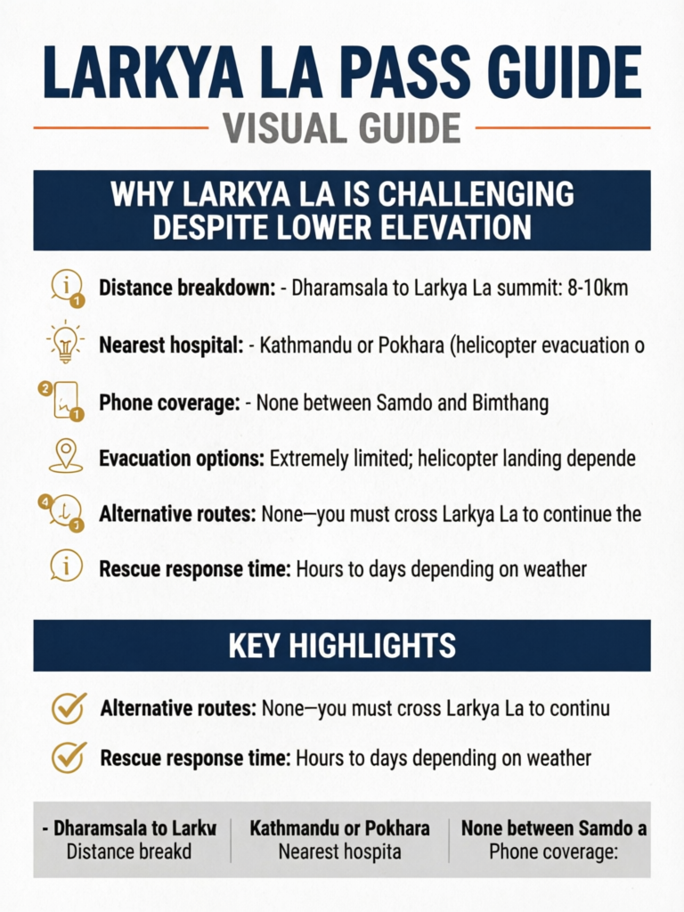
- Dharamsala to Larkya La summit: 8-10km
- Larkya La summit to Bimthang: 14-16km
- Total crossing: 22-26km (depending on exact route)
This distance, combined with 700m of ascent to the pass and 1,570m of descent to Bimthang, creates one of the longest and most demanding single days on any teahouse trek in Nepal.
The Remoteness Factor
Unlike the Everest region with its helicopter landing zones, satellite phones in every lodge, and relatively close medical facilities at Pheriche, the Manaslu Circuit exists in true isolation:
- Nearest hospital: Kathmandu or Pokhara (helicopter evacuation only)
- Phone coverage: None between Samdo and Bimthang
- Evacuation options: Extremely limited; helicopter landing dependent on weather
- Alternative routes: None—you must cross Larkya La to continue the circuit
- Rescue response time: Hours to days depending on weather
This isolation means that problems at Larkya La cannot be easily solved. A twisted ankle, sudden weather change, or altitude sickness doesn't just delay your trek—it can create a genuine emergency in one of Nepal's most remote accessible locations.
The Weather Factor
Larkya La sits in a meteorological transition zone between the dry Tibetan plateau climate to the east and the wet monsoon-influenced valleys to the west. This creates:
- Rapid weather changes with limited warning
- Stronger winds than comparable Everest passes
- More frequent afternoon storms
- Significant snowfall accumulation in shoulder seasons
- Reduced visibility windows
Weather that seems acceptable at Dharamsala can deteriorate dramatically at the pass. The long descent to Bimthang offers no escape if conditions worsen—you must push through or potentially face a dangerous retreat.
The Commitment Factor
Once you begin the Larkya La crossing, retreat becomes increasingly difficult. Unlike Everest passes where you can return to your starting point within a few hours, Larkya La's length means that turning back midway may be more dangerous than continuing forward. This one-way commitment raises the stakes significantly.
The Point of No Return
Approximately 4-5 hours into the Larkya La crossing, you reach a psychological and practical point of no return. Beyond this point, retreat to Dharamsala takes longer than continuing to Bimthang, and you'll be descending with deteriorating weather behind you. This commitment factor makes pre-departure weather assessment crucial—once you start, you're likely committed to finishing.
Preparation Days: Building Your Base
Day 1 Preparation: Samdo (3,860m)
Samdo is a traditional Tibetan village that serves as the final significant settlement before Larkya La. Most trekkers spend 1-2 nights here for acclimatization before pushing to Dharamsala.
What Samdo offers:
- Stone houses with basic teahouse accommodation
- Traditional Tibetan architecture and culture
- Views of Himalchuli (7,893m) and Manaslu North (7,157m)
- Opportunities for acclimatization hikes
- Last place with any phone signal before Bimthang
Acclimatization activities from Samdo:
Option 1: Samdo Viewpoint (4,200m)
- 2-3 hour round trip
- Excellent views of the surrounding peaks
- Gradual climb through alpine terrain
- Ideal morning activity
Option 2: Walk toward Dharamsala (partial)
- Hike 1-2 hours toward Dharamsala, then return
- Preview the trail conditions
- Better altitude preparation
- Gives sense of next day's terrain
Option 3: Explore Samdo's Buddhist heritage
- Visit the village monastery
- Observe traditional Tibetan lifestyle
- Learn about trade routes to Tibet (border crossing nearby)
- Cultural immersion without altitude exertion
Pro Tip
Samdo offers the last meaningful opportunity to stock up on simple supplies before the crossing. While the village store is basic, you can sometimes find chocolate bars, instant noodles, and batteries here. Dharamsala has nothing—it's a collection of stone shelters with no shops whatsoever.
Day 2 Preparation: Samdo to Dharamsala (4,460m)
Trail statistics:
- Distance: 4-5km
- Time: 2-3 hours
- Elevation gain: 600m
- Trail character: Gradual climb through high alpine terrain
Why this short day matters:
The brief walk to Dharamsala serves critical purposes:
-
Altitude adaptation: Gaining 600m and sleeping at 4,460m prepares your body for 5,160m the following day
-
Rest preservation: Arriving early afternoon allows maximum rest before the pre-dawn departure
-
Weather assessment: A full afternoon and evening at Dharamsala lets you observe weather patterns and make informed crossing decisions
-
Mental preparation: Time to organize gear, plan clothing layers, and psychologically prepare for the demanding day ahead
The trail to Dharamsala:
The path leaves Samdo and climbs gradually through stark, beautiful high-altitude terrain. Vegetation thins quickly, replaced by rock, scree, and occasional snow patches. You'll cross small streams and moraines, with the massive bulk of Larkya Peak (6,249m) appearing ahead.
The landscape becomes increasingly dramatic—barren yet beautiful, with prayer flags marking the approach to Dharamsala and enormous peaks towering on both sides.
Understanding Dharamsala
Dharamsala is not a village—it's a collection of basic stone shelters offering the most primitive accommodation on the Manaslu Circuit. Understanding what awaits helps manage expectations:
Physical infrastructure:
- 3-4 stone buildings with dormitory-style sleeping platforms
- Basic dining area with cooking stove
- No private rooms (except occasionally for organized groups)
- Pit toilets (cold, dark, basic)
- No showers, no washing facilities
- No electricity except generator/solar for minimal lighting
- No heating in sleeping areas
Food and drink:
- Simple dal bhat and noodle dishes
- Limited variety compared to lower villages
- Hot tea and coffee available
- No alcohol (wise given the altitude)
- Meals tend to be expensive ($15-20 for dal bhat)
Sleeping conditions:
- Dormitory platforms accommodating 8-15 people
- Bring your own sleeping bag (essential)
- Sleeping pad recommended (platforms hard)
- Temperatures drop to -10°C to -15°C inside at night
- Wear all your warm layers to bed
Dharamsala Realities
Dharamsala exists solely as a necessary staging point for the Larkya La crossing—no one would stay here for any other reason. Accept the basic conditions as part of the adventure. Focus on hydration, rest, and preparation. You'll only be here for one night, and the crossing day will make the discomfort worthwhile.
What to do at Dharamsala:
Afternoon arrival (2:00-4:00 PM):
- Secure sleeping spot (arrive early for best position)
- Unpack sleeping bag and organize gear for morning
- Eat substantial early dinner (5:00-6:00 PM)
- Drink 2-3 liters of water/tea
- Lay out all tomorrow's clothing in layers
- Pack daypack completely (don't leave anything for morning)
- Set multiple alarms (3:00-4:00 AM wake-up)
Evening:
- Be in bed by 7:00-8:00 PM
- Expect poor sleep (altitude, cold, shared space)
- Accept that rest, even without sleep, provides recovery
- Stay warm—coldest hours are 2:00-5:00 AM
The Night Before: Final Preparations
Gear organization:
Prepare two systems:
What porter carries (in duffel/backpack):
- Spare clothing
- Non-essential items
- Items needed only at Bimthang
What you carry (daypack):
- All warm layers (may need to add/remove during crossing)
- Down jacket (accessible for pass)
- Rain/wind jacket
- Gloves (liner + outer)
- Warm hat
- Sunhat and sunglasses
- Sunscreen
- 2-3 liters water capacity
- High-energy snacks (chocolate, nuts, energy bars, dried fruit)
- Camera with charged batteries (keep warm)
- Headlamp with fresh batteries
- Personal medications
- Toilet paper
- Small first aid items
Clothing strategy:
Start with multiple thin layers rather than few thick ones. You'll be active and generating heat during the steep ascent, then potentially waiting at the cold, windy pass, then descending for hours. Flexible layering is essential.
Recommended starting layers:
- Moisture-wicking base layer (merino or synthetic)
- Lightweight fleece or softshell
- Wind-resistant outer layer
- Trekking pants (not heavy insulation)
- Liner gloves
- Warm hat
- Buff/neck gaiter
Ready to add:
- Down jacket (in pack top)
- Insulated outer gloves
- Extra fleece layer
- Rain jacket if weather threatening
The Crossing Day: Hour by Hour
Pre-Dawn: Wake-Up and Departure (3:00-5:00 AM)
3:00-3:30 AM: Wake up, dress in prepared layers, eat quick breakfast if available (many lodges serve tea and biscuits, or simple porridge)
3:30-4:00 AM: Final gear check, bathroom visit (lines form quickly), fill water bottles
4:00-5:00 AM: Depart Dharamsala. Most groups leave between 4:30-5:00 AM. Earlier departure recommended during peak season to avoid congestion at the pass.
Why the early start:
- Cross the pass before afternoon weather deterioration
- Maximum daylight buffer for the long descent to Bimthang
- Frozen snow/ice easier to walk on than afternoon slush
- Best photography light at the pass (around sunrise)
- Psychological benefit of tackling hardest section first
Section 1: Dharamsala to the Glacier Approach (2-3 hours)
Terrain: Gradual ascent through rocky moraine, following cairns (stone markers) in pre-dawn darkness with headlamps
Elevation: 4,460m to approximately 4,900m
Physical demands: Moderate—steady climbing but not steep, warming up gradually
Challenges:
- Walking in darkness requires careful foot placement
- Cold temperatures (-5°C to -10°C typically)
- Route-finding dependent on cairns and guide knowledge
- Loose rock underfoot
Tips:
- Stay close to your guide—easy to lose the trail in darkness
- Don't rush—sustainable pace essential for the long day ahead
- Eat small amounts every 30-45 minutes (energy bars, chocolate)
- Drink regularly despite not feeling thirsty
As dawn breaks (around 5:30-6:30 AM depending on season), you'll see the dramatic peaks surrounding you: Larkya Peak (6,249m), Cho Danda (6,334m), and the glaciated slopes leading to the pass.
Section 2: The Final Ascent to Larkya La (2-3 hours)
Terrain: Steeper climb, potentially snow-covered, glacial moraine, sometimes fixed ropes in icy sections
Elevation: 4,900m to 5,160m (260m gain)
Physical demands: High—altitude effects pronounced, steep sections require sustained effort
Challenges:
- Altitude making every step difficult
- Potential snow/ice requiring careful footing
- Steep sections with exposure
- Wind increasing as you approach the pass
- Cold temperatures despite exertion
Navigation:
- Cairns mark the general route
- In heavy snow, route-finding becomes guide-dependent
- False summits (several!) test patience
- Prayer flags visible at actual pass from some distance
Technique tips:
- Use rest-step method (briefly lock knee with each step)
- Take smaller steps than you think necessary
- Breathe rhythmically (2-3 steps per breath)
- Don't stop too long (muscles stiffen, cold penetrates)
- Focus on the next cairn, not the distant pass
Pro Tip
The final 100 meters to Larkya La feel endless at altitude. When you see the prayer flags, you might have 30-45 minutes of climbing remaining. Don't let false hopes lead to disappointment—maintain steady effort and the pass will come.
Section 3: Larkya La Summit (5,160m)
Time spent: 15-30 minutes (conditions dependent)
What to expect:
The summit of Larkya La is marked by extensive prayer flags stretched between cairns, creating a colorful display against the stark mountain backdrop. On clear days, the views are extraordinary:
To the East (where you came from):
- Larkya Peak (6,249m) dominating the immediate skyline
- The moraine approach route stretching back toward Dharamsala
- Distant peaks of the Nubri Valley
To the West (where you're going):
- The massive bulk of Manaslu (8,163m), world's eighth-highest peak
- Himlung Himal (7,126m)
- The green valleys far below, seeming impossibly distant
- The descent route winding down glaciated slopes
Summit conditions:
- Wind almost always present (10-40 km/h typical)
- Temperature: -10°C to -20°C with wind chill
- Rapid cooling when you stop moving
- Limited shelter from wind
What to do at the summit:
- Photograph the moment (have camera accessible)
- Add your own prayer flag or khata (white scarf) if you brought one
- Don't linger too long—hypothermia risk if inactive
- Eat a quick snack if possible (may lack appetite)
- Celebrate briefly—you've earned it
- Begin descent before getting cold
The Emotional Moment
Standing at Larkya La represents the culmination of days of trekking through one of Nepal's most remote regions. Many trekkers experience strong emotions—joy, relief, accomplishment, sometimes tears. The prayer flags, the wind, the enormous peaks, and the knowledge of what you've achieved combine to create a powerful moment. Allow yourself to feel it, even as you prepare for the long descent ahead.
Section 4: Initial Descent from Larkya La (2-3 hours)
Terrain: Steep descent on loose rock, snow fields, and glacial moraine. This is often the most technically demanding section of the entire crossing.
Elevation: 5,160m to approximately 4,400m (760m loss)
Physical demands: High—sustained concentration required, technical footing, knee strain
Challenges:
- Very steep sections with loose scree
- Potential ice/snow requiring careful steps
- Knee and quad fatigue from steep descent
- Altitude still affecting judgment and coordination
- Increasing fatigue from hours of exertion
This section requires:
- Full concentration on foot placement
- Trekking poles (essential for stability and knee protection)
- Patience—rushing leads to falls
- Following guide's exact route
- Watching for loose rocks dislodged by those ahead
Injury prevention:
- Keep knees slightly bent
- Take smaller steps than on flat terrain
- Use poles to absorb impact
- Plant poles before stepping
- Rest every 20-30 minutes
The landscape on the western side of Larkya La differs dramatically from the eastern approach. You're descending into a different climate zone—more moisture, more vegetation visible in the distant valleys, and typically clearer skies (weather systems often hit the eastern side first).
Section 5: Valley Traverse to Bimthang (4-5 hours)
Terrain: Gradually descending valley floor, moraine fields, river crossings, eventual forest
Elevation: 4,400m to 3,590m (810m loss)
Physical demands: Moderate to high—relatively easy terrain but extreme fatigue by this point
Challenges:
- Sheer exhaustion after 8+ hours of trekking
- Seemingly endless distance
- Multiple river crossings (bridges usually present but may be challenging)
- Afternoon heat in lower sections (surprising after cold morning)
- Mental fatigue affecting motivation
The long valley:
After the initial steep descent, the terrain flattens into a long glacial valley. This section feels endless—you can see great distances but progress feels slow. Small settlements of summer herder huts (larke) appear occasionally, reminding you of human presence.
The trail quality improves significantly in this section, becoming well-defined and easier to follow. You'll cross several streams via basic bridges or stepping stones.
Vegetation returns:
As you descend below 4,000m, vegetation gradually returns—first hardy shrubs, then rhododendron and juniper, finally into forest as you approach Bimthang. This visual change signals the end approaching.
Arrival at Bimthang:
Most trekkers arrive at Bimthang between 2:00-5:00 PM, having been walking for 10-14 hours. The village offers:
- Multiple teahouses with private rooms
- Hot food and drinks
- Relative warmth (3,590m feels tropical after Larkya La)
- Views of Manaslu (8,163m) on clear evenings
- A sense of enormous accomplishment
Bimthang Celebration
You've completed one of Nepal's most demanding trek days. Bimthang teahouses are accustomed to exhausted, elated trekkers arriving from Larkya La. Don't be surprised if you feel emotional—the combination of physical exhaustion, altitude recovery, and achievement is powerful. Order a warm meal, share stories with fellow trekkers, and sleep deeply. You've earned it.
Weather Windows and Timing
Optimal Crossing Months
September-November (Autumn):
- Most stable weather patterns
- Clearest visibility, best views
- October is peak month
- Late November sees increasing cold but good conditions
- Highest number of trekkers
March-May (Spring):
- Good weather, especially late March through mid-May
- More snow on the pass (may require additional care)
- Warmer temperatures during crossing
- Rhododendron blooms on descent to Bimthang
- Fewer trekkers than autumn
Shoulder Season Considerations
Early September:
- Monsoon may still affect western slopes
- More cloud cover
- Trail can be wet/muddy on descent
- Fewer trekkers
- Lodges open but potentially less prepared
Late November-December:
- Very cold, especially at Dharamsala (-15°C to -25°C overnight)
- Clear days but shorter daylight
- Snow more likely on pass
- Very few trekkers
- Some lodges may close early
February-March:
- Cold but improving
- Possible significant snow on pass
- Clear visibility when weather holds
- Building toward spring season
Daily Weather Patterns
Typical high-altitude weather cycle:
5:00-8:00 AM: Clearest conditions, calm winds, best visibility
8:00-11:00 AM: Clouds begin forming in valleys, winds may pick up
11:00 AM-2:00 PM: Clouds rising, visibility decreasing, wind increasing
2:00-5:00 PM: Afternoon cloud cover often complete, precipitation possible
5:00-7:00 PM: Clouds may clear somewhat for sunset views
Crossing timing implication:
Aim to reach Larkya La summit by 8:00-9:00 AM for best conditions and begin descent before noon. This requires 4:00-5:00 AM departure from Dharamsala. Groups departing later risk worse conditions at the pass and potential afternoon precipitation during the long descent.
Weather Red Flags
Do not attempt Larkya La crossing if:
- Significant snow fell overnight (fresh snow obscures trail)
- Morning visibility less than 200 meters at Dharamsala
- Strong winds audible/visible from Dharamsala
- Your guide advises against crossing
- Weather forecast indicates storm system approaching
- You have any symptoms of altitude sickness
Weather Decision Authority
Your guide has authority to cancel or delay the Larkya La crossing based on weather conditions. This is not negotiable. Guides have seen what happens when parties attempt crossing in poor conditions. If your guide says wait, wait. The pass will still be there tomorrow. Your life may not be if you attempt a dangerous crossing.
Waiting Out Weather
If weather prevents crossing, you have limited options:
Wait at Dharamsala:
- Maximum 1-2 nights practical (supplies limited)
- Cold, uncomfortable, but safe
- Monitor conditions each morning
Return to Samdo:
- More comfortable waiting
- Better food and accommodation
- 2-3 hour return walk
- Can return to Dharamsala when weather improves
Extended delay (3+ days):
- Rare but possible
- May need to reassess entire itinerary
- Guide will communicate with agency about alternatives
- In extreme cases, may need to return to Jagat and fly out from Dharapani
Gear Requirements: What You Actually Need
Essential Items (Non-Negotiable)
Footwear:
- Sturdy trekking boots with ankle support (broken in before trek)
- Gaiters for snow crossing (optional but recommended)
- Extra socks in daypack
Layers:
- Moisture-wicking base layers (merino or synthetic)
- Insulating mid-layer (fleece or light down)
- Down jacket (must be accessible during crossing)
- Wind and water-resistant outer layer
- Waterproof jacket (even in dry season—weather changes quickly)
Extremities:
- Liner gloves (thin, for dexterity)
- Insulated outer gloves or mitts
- Warm hat (covering ears)
- Buff or balaclava (wind protection)
- Sunglasses (glacier-rated UV protection—essential)
- Sunscreen (SPF 50+, altitude intensifies UV)
Equipment:
- Trekking poles (essential for descent)
- Headlamp with fresh batteries (used for 2-3 hours pre-dawn)
- Water bottles or hydration system (2-3L capacity)
- Sleeping bag (rated to -15°C minimum)
Daypack contents:
- All warm layers (don't trust weather to stay good)
- High-energy snacks (minimum 1,000 calories)
- Water (full capacity before departure)
- Personal medications
- Camera with charged batteries
- Toilet paper
- Small first aid kit
- Sunscreen and lip balm
Recommended But Not Essential
Enhanced comfort:
- Sleeping pad (Dharamsala platforms are hard)
- Thermal underwear for Dharamsala night
- Hot water bottle (can fill at lodges)
- Hand warmers (chemical or rechargeable)
Photography:
- Camera with fully charged batteries (cold drains quickly)
- Extra batteries kept warm in pocket
- Lens cloth (condensation issues)
- Waterproof bag for camera
Communication:
- Satellite communicator (if personal safety device owned)
- Note: No phone coverage on crossing
What Not to Bring
Leave behind:
- Heavy books or entertainment (exhaustion eliminates interest)
- Multiple outfit changes (one set sufficient)
- Excess electronics (battery charging impossible)
- Heavy tripod (weight not justified)
- Anything non-essential in daypack (weight matters)
Gear Rental Options
Most gear can be rented in Kathmandu (Thamel area) if you don't want to purchase or bring from home:
| Item | Rental Cost (14 days) | Notes |
|---|---|---|
| Down jacket | $25-40 | Essential; rent quality |
| Sleeping bag (-15°C) | $30-50 | Essential; check rating |
| Trekking poles | $10-15 | Highly recommended |
| Gaiters | $5-10 | Useful for snow |
| Crampons | $10-15 | Rarely needed but available |
Pro Tip
Test all rented gear before leaving Kathmandu. Down jackets should be lofty with no cold spots; sleeping bags should be genuinely rated for claimed temperatures; trekking poles should lock securely. Poor gear fails at the worst moments—during the Larkya La crossing.
Emergency Options: Understanding the Risks
Medical Emergencies
Altitude sickness (AMS, HACE, HAPE):
The only treatment for serious altitude sickness is immediate descent. This creates a dilemma at Larkya La:
Before the pass: Return to Samdo (3,860m)—descent of 600m At the pass: Continue to Bimthang (3,590m)—descent of 1,570m, but longer distance After the pass: Continue to Bimthang—only viable option
Your guide will monitor for AMS symptoms throughout the crossing. Signs requiring immediate descent include:
- Severe headache unresponsive to medication
- Difficulty walking straight (ataxia)
- Confusion or disorientation
- Persistent vomiting
- Gurgling breath sounds (HAPE)
- Extreme fatigue beyond expected exertion
Physical injuries:
A twisted ankle or knee injury during the crossing creates serious logistical challenges:
- No evacuation vehicles can reach Larkya La or the upper descent
- Helicopter evacuation depends on weather (often impossible due to winds)
- Walking out may be the only option even with injury
- Your guide and porter may need to support your weight for hours
Prevention is the only reliable strategy. Move carefully, use poles, don't rush, and maintain concentration throughout the crossing.
Helicopter Evacuation
Reality check:
Helicopter evacuation from the Larkya La area is:
- Weather-dependent (often impossible)
- Extremely expensive ($8,000-15,000 USD)
- Not guaranteed even with insurance
- May require waiting 1-3 days for conditions
- Logistically complex in this remote area
Helicopter landing options:
- Dharamsala: Possible but limited landing zone
- Bimthang: Better landing zone, more accessible
- Neither is guaranteed in poor weather
Insurance requirements:
Travel insurance for the Manaslu Circuit must include:
- Coverage to 6,000m altitude
- Helicopter evacuation coverage ($100,000+ recommended)
- Adventure/trekking activity coverage
- Remote area medical evacuation
Verify exact coverage terms before departing your home country. Present insurance documents to your guide before the crossing.
Communication Options
No phone coverage exists between Samdo and Bimthang. This includes the entire crossing day.
Communication methods:
- Satellite phone (guide may carry)
- Satellite messenger/SOS device (personal device if you own one)
- No cellular or WiFi coverage
Emergency contacts:
- Nepal Police Tourist Division: 1144
- Your trekking agency emergency line (confirm before trek)
- Himalayan Rescue Association: +977-1-4440292
Nepal Police Tourist Division
24-hour tourist emergency line
Himalayan Rescue Association
Altitude sickness expertise
Manaslu Conservation Area Office
Regional park authority
CIWEC Clinic (Kathmandu)
Western-standard medical care
Helicopter evacuation cost: $8,000-15,000+ from Larkya La/Bimthang area
Travel insurance with helicopter evacuation coverage to 6,000m altitude is mandatory for the Manaslu Circuit. Verify coverage specifically includes the Manaslu region and trekking activities before departure. Insurance documents may be checked at permit checkpoints.
Why Larkya La is Challenging Despite Lower Elevation
Some trekkers, comparing Larkya La's 5,160m to Everest region passes at 5,400m+, assume it's easier. This is a dangerous misconception. Here's why Larkya La is arguably more demanding:
The Distance Disparity
| Pass | Altitude | Crossing Distance | Crossing Time |
|---|---|---|---|
| Cho La (Everest) | 5,420m | 6-8km | 6-8 hours |
| Kongma La (Everest) | 5,535m | 8-10km | 7-9 hours |
| Renjo La (Everest) | 5,360m | 8-10km | 7-9 hours |
| Larkya La (Manaslu) | 5,160m | 22-26km | 10-14 hours |
Larkya La's crossing distance is approximately three times that of Everest passes. This translates to:
- Significantly more total elevation change
- Much longer physical exertion
- Greater exposure to weather changes
- More accumulated fatigue affecting judgment
- Higher caloric expenditure
The Remoteness Factor
Everest region passes sit within a network of villages, lodges, and established evacuation routes:
- Cho La: Dzongla (before) and Gokyo (after) both have helicopter access
- Kongma La: Chhukhung (before) and Lobuche (after) are well-established
- Multiple escape routes exist if conditions deteriorate
Larkya La offers:
- Dharamsala: Basic shelters only, minimal services
- No intermediate shelter during 22-26km crossing
- Single route with no alternatives
- Helicopter evacuation extremely challenging
- Limited rescue resources in entire region
The Commitment Length
Everest passes can be "bailed" relatively easily—if weather turns at Cho La summit, you can retreat to Dzongla within 2-3 hours.
Larkya La's length means:
- Midway point is 5+ hours from both ends
- Weather deterioration after halfway = pushing through
- No shelter or escape along the crossing
- Retreat may be more dangerous than continuation
The Weather Exposure
Larkya La sits at the boundary between two distinct climate zones:
- East side: Dry Tibetan plateau influence
- West side: Wet monsoon-affected valleys
This creates:
- More volatile weather patterns
- Stronger average winds
- More frequent afternoon storms
- Less predictable conditions
The Physical Demands
Total elevation change on crossing day:
Larkya La:
- Ascent: 700m (Dharamsala to pass)
- Descent: 1,570m (pass to Bimthang)
- Total: 2,270m vertical
Cho La:
- Ascent: 500m
- Descent: 600m
- Total: 1,100m vertical
Larkya La demands approximately twice the vertical distance of comparable Everest passes.
Respect the Pass
Experienced mountaineers and guides consistently rate Larkya La among the most demanding high pass crossings in Nepal's trekking regions. The lower altitude creates a false sense of security that the distance, remoteness, and weather patterns quickly dispel. Treat Larkya La with the respect it deserves—proper preparation, conservative decisions, and realistic expectations.
Day After: Recovery at Bimthang
After the Larkya La crossing, most trekkers continue the circuit toward Tilije and eventually Dharapani/Besisahar. However, consider taking a rest day at Bimthang:
Why Consider a Rest Day
Physical recovery:
- Legs need recovery from 2,200m+ vertical
- Sleep debt from Dharamsala night needs repayment
- Energy reserves depleted need rebuilding
Altitude adjustment:
- Rapid descent (1,570m in one day) can cause its own issues
- Rest day allows body to stabilize
- Reduces risk of injury from fatigued muscles on continuing trail
Mental restoration:
- The crossing is emotionally as well as physically demanding
- Processing the experience adds to satisfaction
- Rushing onward diminishes achievement
What Bimthang Offers
Accommodation:
- Multiple lodges with private rooms
- Hot showers available (luxury after Dharamsala)
- Heated dining rooms
- Comfortable beds with blankets
Views:
- Spectacular Manaslu (8,163m) views from village
- Sunrise photography opportunities
- Alpine meadow setting
Activities:
- Short acclimatization walks (though you're descending)
- Photography of surrounding peaks
- Rest and reading
- Socializing with fellow trekkers
Permit Requirements for Manaslu Circuit
Required Permits
1. Manaslu Restricted Area Permit (RAP):
- Cost: $70/week (Sep-Nov, Mar-May) or $50/week (other months)
- Must be arranged through registered trekking agency
- Cannot be obtained independently
- no longer no longer requires a minimum group size (solo trekkers allowed with licensed guide) per permit application
2. Manaslu Conservation Area Permit (MCAP):
- Cost: $30 USD
- Obtained through trekking agency or TAAN office in Kathmandu
3. TIMS Card (Trekkers' Information Management System):
- Cost: Free through registered agency
- Required for all trekkers
Special Requirements
Minimum group size: 2 trekkers plus registered guide (mandatory)
Why this matters: You cannot trek the Manaslu Circuit solo, regardless of experience. If traveling alone, your agency will pair you with other trekkers or provide a companion for permit purposes.
Agency requirement: All permits must be arranged through a government-registered trekking agency. Independent permit acquisition is not possible for the Manaslu region.
Frequently Asked Questions
How hard is Larkya La compared to Everest Base Camp?
Larkya La is significantly more demanding than the standard EBC trek. While EBC reaches 5,364m at the base camp, the highest sleeping altitude is around 5,164m (Gorak Shep), and no single day requires more than 5-6 hours of trekking. Larkya La demands 10-14 hours of continuous effort with 2,200m+ of elevation change. Only the Three Passes Trek in the Everest region compares in difficulty.
Do I need crampons for Larkya La?
In normal conditions during peak season (October-November, March-April), crampons are not required. However, early season (September) or late season (December, February) crossings may encounter more snow/ice where crampons provide additional security. Your guide will advise based on current conditions. Crampons can be rented in Kathmandu if needed.
What if I can't complete the crossing?
If you cannot continue mid-crossing due to illness, injury, or exhaustion, your guide will make decisions based on your location and condition. Options include: supported continuation (guide/porter assistance), waiting for helicopter evacuation (if possible), or in extreme cases, being left with support while guide seeks help. Prevention through proper preparation is far preferable to any rescue scenario.
Can I cross Larkya La in monsoon?
Not recommended. June-August brings heavy precipitation, obscured trails, increased avalanche risk, and very poor visibility. The pass may be closed by authorities during peak monsoon. Wait for post-monsoon (late September onward) for safe crossing.
How do I train for Larkya La?
Focus on endurance over strength. Key training elements:
- Long hikes (6-10 hours) with elevation gain
- Stair climbing with weighted pack
- Cardiovascular fitness (running, cycling)
- Core strength for stability
- Downhill hiking for knee preparation
Start training 2-3 months before your trek. Prior high-altitude experience (above 4,000m) is highly beneficial.
Is the Manaslu Circuit harder than the Everest Base Camp trek?
Yes. The Manaslu Circuit is longer (14-18 days vs 12-14 days), includes a more demanding high pass, has more primitive accommodation in sections, and offers fewer escape options. It's better suited to trekkers with prior high-altitude experience or excellent fitness. First-time Nepal trekkers often start with EBC or Annapurna before attempting Manaslu.
What happens if I get altitude sickness at Larkya La?
Immediate descent is the treatment. If symptoms appear before the pass, return to Samdo. If symptoms appear at or after the pass, continue to Bimthang as quickly as safely possible. Your guide will monitor you continuously and make descent decisions. Carry altitude sickness medication (Diamox) as prescribed by your doctor, but know that medication is not a substitute for descent.
Can I hire a helicopter to fly over Larkya La?
No. Helicopter evacuation exists for emergencies only, not convenience. The pass must be crossed on foot—there is no alternative. If you're not prepared for the crossing, the Manaslu Circuit is not the right trek for you.
Final Preparation Checklist
Before departing Dharamsala for Larkya La crossing:
Physical readiness:
- No symptoms of altitude sickness
- Well-rested (even if sleep was limited)
- Well-hydrated (minimum 2L since arrival at Dharamsala)
- Substantial meal eaten the evening before
- Feeling strong enough for 10-14 hour day
Gear readiness:
- All warm layers accessible in daypack
- Headlamp tested with fresh batteries
- Water bottles filled (2-3L minimum)
- High-energy snacks packed (1,000+ calories)
- Trekking poles ready
- Sunglasses accessible
- Sunscreen applied
- Camera charged, batteries warm
Logistics:
- Porter has your main bag
- Know meeting arrangements with guide
- Understand basic route plan
- Weather assessment completed
- Guide confirms crossing is proceeding
- Manaslu Circuit Complete Guide
- Best Trekking Agencies for Manaslu Circuit
- Manaslu Circuit Cost Breakdown
- Altitude Sickness: Signs and Turnaround Rules
- Best Time to Trek Manaslu Region
- Hiring Guides and Porters in Nepal
- Travel Insurance for Nepal Trekking
- What to Wear Trekking in Nepal
- Fitness Requirements for Nepal Trekking
- Nepal Trekking Permits Explained
Plan Your Manaslu Circuit Adventure
Connect with verified trekking agencies experienced in the Manaslu Circuit and Larkya La crossing. Get expert guidance, proper permit arrangements, and safety support for this extraordinary trek.
Larkya La Pass stands as one of the great challenges of Nepal trekking—not because of extreme altitude or technical difficulty, but because of its unrelenting demand for sustained effort, its remoteness that amplifies every decision, and its position as the unavoidable crux of one of the world's finest trekking circuits.
Those who cross Larkya La join a fellowship of trekkers who understand what it means to push beyond comfort, to trust their preparation when fatigue argues for surrender, and to earn one of the Himalaya's most satisfying achievements. The view from 5,160m—prayer flags snapping in the wind, Manaslu's massive pyramid dominating the western sky, the knowledge of the long valley waiting below—represents everything that draws people to the mountains.
Prepare thoroughly. Respect the pass. And when you finally descend into Bimthang's welcoming lodges after 12 hours of walking, you'll understand why experienced trekkers speak of Larkya La with a mixture of reverence and hard-won affection. This is what you came to Nepal for.