Skip to content
+977-9861293812
WhatsApp
Trek and Tour Nepal
Makalu Region · Nepal

Makalu Base Camp Trek

4.9from 27 reviews
Days
18
Highest point
5,009 m
Level
Challenging
Best months
Mar to May and Sep to Nov

Overview

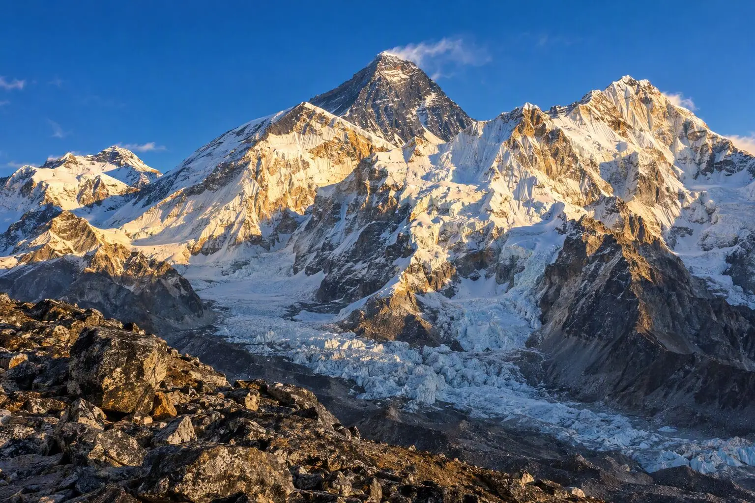
Makalu Base Camp stands apart from every other high-altitude base camp trek in Nepal by virtue of a single defining quality: genuine remoteness. While Everest Base Camp now hosts a functioning coffee shop and Annapurna Circuit teahouses offer WiFi, Makalu Base Camp is reached by 18 days of expedition-style camping through terrain that sees fewer than 150 trekkers per year. The approach follows two of Nepal's most beautiful valleys — the broad, subtropical Arun Valley and the narrower, more dramatic Barun Valley — traversing the full width of Makalu Barun National Park, one of the world's most biodiverse protected areas. The journey passes through five distinct ecological zones: from the warm lowland forest at Num (1,560m), through rhododendron-draped mid-hills, over the Shipton La and Keke La passes, and into the high alpine wilderness of the Barun Valley, terminating at the massive south face of Makalu (8,485m) at 5,009 metres. Makalu is often described by mountaineers as the most technically demanding of the 8,000-metre peaks, and its south face — first climbed in 1955 — is one of the great walls of Himalayan mountaineering. Standing at the base, looking directly up 3,500 metres of ice and rock to the distant summit, creates a sense of scale and awe that is simply unavailable anywhere else in the Himalaya. The trek includes two high-pass crossings — Shipton La (4,210m) and Keke La (4,170m) — which provide some of the finest viewpoints in eastern Nepal and require solid fitness and good weather to cross safely. A Restricted Area Permit and mandatory guide are required.

Want more detail on this route?

Read our full route guide with trail conditions, permits, and planning tips.

Route Guide

Highlights

Stand at the base of Makalu (8,485m), the world's fifth-highest peak
Cross two dramatic passes — Shipton La (4,210m) and Keke La (4,170m)
Trek through the Barun Valley, one of Nepal's last pristine wilderness areas
Experience Makalu Barun National Park's extraordinary biodiversity
Witness the massive south face of Makalu — one of mountaineering's greatest walls

Itinerary

18 days
Highest stop
5,009 m
Day 9
Biggest climb
+1,400 m
Day 4
Over 2,500 m
10 days
of 18

Day 1 of 18 · Fly to Tumlingtar, Drive to Num

1,560 m

2,500 m · altitude zone
  1. Day 1

    Fly to Tumlingtar, Drive to Num

    • 1,560 m
    • Teahouse
    • Breakfast, Lunch, Dinner

    The Makalu Base Camp expedition begins with a 45-minute domestic flight from Kathmandu to Tumlingtar, the small airstrip in the Arun Valley that serves as the gateway to the Makalu Barun region. The flight crosses the eastern Himalayan foothills and, on clear days, provides a distant view of the Makalu massif and the Everest group against the northern skyline.

    See Num on the map
  2. Day 2

    Trek to Seduwa

    • 1,500 m
    • Down60 m from day 1
    • Camping
    • Breakfast, Lunch, Dinner

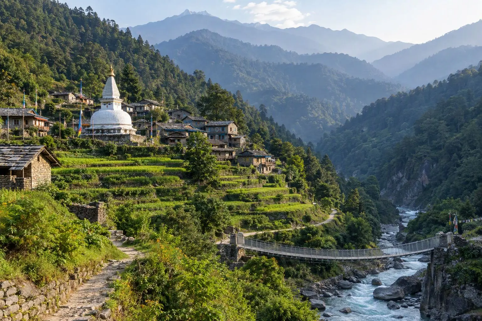
    The first trekking day descends steeply from Num to the Arun River on a rocky trail that plunges hundreds of metres in the space of two kilometres. The Arun is crossed on a long suspension bridge, and the trail then climbs the opposite bank through terraced farmland and mixed subtropical forest to Seduwa at 1,500 metres — a Rai village set on a hillside shelf above the Kasuwa Khola tributary.

    See Seduwa on the map
  3. Day 3

    Trek to Tashigaon

    • 2,100 m
    • Up600 m from day 2
    • Camping
    • Breakfast, Lunch, Dinner

    The ascent from Seduwa to Tashigaon at 2,100 metres follows the Kasuwa Khola upstream through an increasingly dramatic gorge. The trail crosses the river multiple times on wooden bridges, some of which require careful single-file crossing, and the forest on both sides of the valley grows progressively more temperate as altitude increases — the broad-leafed subtropical trees giving way to rhododendron, oak, and magnolia in the upper sections.

    See Tashigaon on the map
  4. Day 4

    Trek to Khongma Danda

    • 3,500 m
    • Up1,400 m from day 3
    • Camping
    • Breakfast, Lunch, Dinner
    • Biggest climb

    A long, sustained climb begins from Tashigaon as the trail ascends from 2,100 metres to Khongma Danda at 3,500 metres — a 1,400-metre gain that is the steepest single-day climb of the entire trek. The route switches back through dense rhododendron forest in the lower sections, the trees in spring covered in spectacular blooms of crimson and white. The trail is well-maintained by comparison to the approach sections — it has been used by mountaineering expeditions to Makalu for decades and shows the accumulated maintenance of many seasons of use.

    See Kongma on the map
  5. Day 5

    Cross Shipton La (4,210m), Camp at Manure

    • 3,500 m
    • Camping
    • Breakfast, Lunch, Dinner

    The Shipton La, named for the pioneering British mountaineer Eric Shipton who first explored the Barun Valley in the 1950s, sits at 4,210 metres and provides the gateway to the upper Barun wilderness. The ascent from Khongma Danda gains 710 metres over a rocky, cairned trail that climbs steadily through open alpine terrain above the treeline. The pass is reached in two to three hours of steady walking on a clear morning, with views that expand panoramically with every metre of altitude gained.

  6. Day 6

    Cross Keke La (4,170m), Trek to Mumbuk

    • 3,570 m
    • Up70 m from day 5
    • Camping
    • Breakfast, Lunch, Dinner

    The Keke La at 4,170 metres is the second of the two high passes that bracket the approach to Makalu Base Camp. The ascent from the Manure camp is shorter and less steep than the Shipton La — a two-hour climb gaining 670 metres on a rocky trail that switchbacks through increasingly sparse vegetation before cresting a rock-and-snow ridgeline with a dramatic drop into the Barun Valley on the northern side.

  7. Day 7

    Trek to Yangri Kharka

    • 3,600 m
    • Up30 m from day 6
    • Camping
    • Breakfast, Lunch, Dinner

    An easier day of moderate valley walking from Mumbuk to Yangri Kharka at 3,600 metres follows the Barun Khola upstream through the heart of the upper Barun Valley. This is one of the most biodiverse high-altitude environments in Nepal — a UNESCO-recognised zone where the transition from temperate to alpine to glacial ecosystems occurs within a remarkably compressed elevation range. The valley floor is carpeted with alpine herbs and mosses, and the surrounding hillsides support musk deer, Himalayan tahr, and the occasional Himalayan black bear emerging from the dwarf-juniper forest above.

  8. Day 8

    Trek to Langmale Kharka

    • 4,410 m
    • Up810 m from day 7
    • Camping
    • Breakfast, Lunch, Dinner

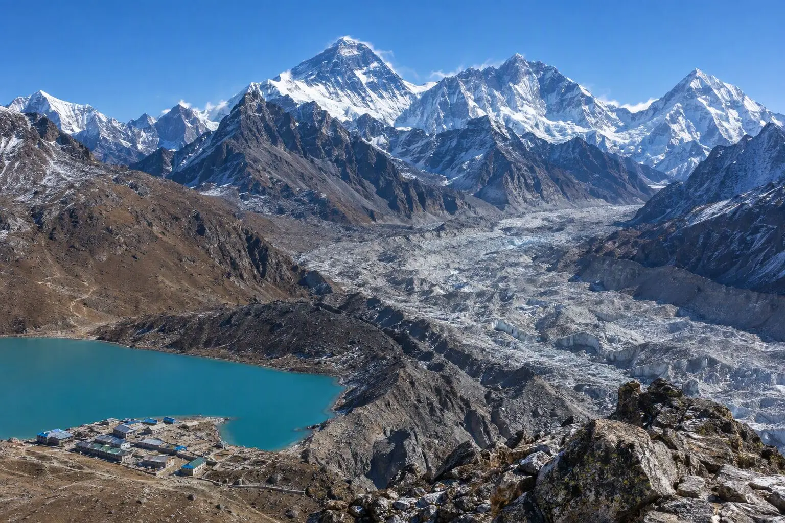
    The trail from Yangri Kharka to Langmale Kharka at 4,410 metres is the penultimate camp before Makalu Base Camp — an 810-metre climb through the upper Barun Valley's most dramatic terrain. The valley narrows as altitude increases, the surrounding peaks closing in on both sides and the Barun Glacier becoming visible ahead as a grey mass of crevassed ice filling the valley floor between the lateral moraines.

  9. Day 9

    Trek to Makalu Base Camp

    • 5,009 m
    • Up599 m from day 8
    • Camping
    • Breakfast, Lunch, Dinner
    • Highest stop

    The culminating day of the northward journey — the final approach to Makalu Base Camp at 5,009 metres. The trail from Langmale Kharka follows the Barun Glacier's lateral moraine for the first section before crossing to the glacier's edge and ascending a steep moraine ridge that leads directly to the base camp plateau. The gain of 599 metres from 4,410 metres takes three to four hours of slow, altitude-impacted walking.

  10. Day 10

    Exploration Day at Base Camp

    • 5,009 m
    • Camping
    • Breakfast, Lunch, Dinner

    A second day at 5,009 metres allows time for deeper exploration of the base camp environment and the surrounding glacial terrain. The most rewarding excursion from base camp is the climb to the Makalu La viewpoint — a high moraine crest at approximately 5,200 metres that offers a view around the western buttress of Makalu and toward the Hongu basin that separates Makalu from the Everest group. From this vantage point, Everest, Lhotse, and Cho Oyu are visible on the western horizon — a concentration of 8,000-metre peaks in a single field of view that is almost without parallel in the Himalaya.

  11. Day 11

    Trek to Langmale Kharka

    • 4,410 m
    • Down599 m from day 10
    • Camping
    • Breakfast, Lunch, Dinner

    The return journey from Makalu Base Camp begins with a descent that reverses the approach but feels entirely different in character. Moving downhill from 5,009 metres, the body responds with an immediate flood of oxygen and energy — the laboured breathing of the ascent gives way to easy, rhythmic walking that covers the distance to Langmale Kharka in considerably less time than the morning's climb up.

  12. Day 12

    Trek to Mumbuk

    • 3,570 m
    • Down840 m from day 11
    • Camping
    • Breakfast, Lunch, Dinner

    The long descent continues, dropping from Langmale Kharka at 4,410 metres back to Mumbuk at 3,570 metres over approximately fourteen kilometres of valley terrain. The body, no longer working against altitude, moves with a lightness and pace that contrasts sharply with the laboured ascent of the previous days. The Barun Valley on the southward journey is experienced differently — details of the landscape that were invisible on the way up now register: the colours of the moraine lichen, the precise shapes of the distant passes, the texture of the alpine meadows.

  13. Day 13

    Cross Keke La, Trek to Khongma Danda

    • 3,500 m
    • Down70 m from day 12
    • Camping
    • Breakfast, Lunch, Dinner

    The re-crossing of the Keke La from north to south is physically easier than the original crossing: the gradient that was a steep ascent on Day 6 is now a steep but rapid descent, and the approach from the Barun Valley side is shorter and more direct. An early morning departure from Mumbuk takes advantage of the calm, clear conditions before afternoon clouds develop on the pass ridgeline.

    See Kongma on the map
  14. Day 14

    Cross Shipton La, Trek to Tashigaon

    • 2,100 m
    • Down1,400 m from day 13
    • Camping
    • Breakfast, Lunch, Dinner

    The final pass crossing of the trek — the re-crossing of Shipton La at 4,210 metres from north to south — is completed in the morning hours before the valley weather develops. The ascent from Khongma Danda at 3,500 metres gains 710 metres on the same trail as Day 5, but with the benefit of full acclimatisation and the muscle memory of the original crossing. The group moves efficiently and the pass is reached in two hours of steady walking.

    See Tashigaon on the map
  15. Day 15

    Trek to Seduwa

    • 1,500 m
    • Down600 m from day 14
    • Camping
    • Breakfast, Lunch, Dinner

    The final descent through the Kasuwa valley from Tashigaon back to Seduwa covers the 600-metre drop through increasingly dense subtropical forest on a trail that, by this point in the trek, is entirely familiar. The descent takes three to four hours at a comfortable pace, passing through the series of small farmsteads and forest sections that defined the approach on Days 2-3. The birding on the descent is excellent — morning activity in the subtropical forest brings out the full diversity of species that the guide will have been pointing out throughout the trek.

    See Seduwa on the map
  16. Day 16

    Trek to Num

    • 1,560 m
    • Up60 m from day 15
    • Teahouse
    • Breakfast, Lunch, Dinner

    The final trekking day covers the short but dramatic descent from Seduwa back to Num at 1,560 metres — a route that reverses the first trekking day and provides a satisfying bookend to the wilderness journey. The trail descends from Seduwa to the Arun River, crosses on the suspension bridge, and climbs briefly to Num on the far bank. The total walking time is three to four hours.

    See Num on the map
  17. Day 17

    Drive to Tumlingtar, Fly to Kathmandu

    • 1,400 m
    • Down160 m from day 16
    • Hotel
    • Breakfast, Lunch

    An early morning departure from Num by vehicle retraces the Arun Valley road back to Tumlingtar for the domestic flight to Kathmandu. The drive of four to five hours passes through the same extraordinary landscapes of the approach — the deep gorge of the Arun River, the terraced hillsides of the lower valley, and the widening valley floor as the river approaches the Terai — but with the different perspective that comes from leaving rather than arriving.

    See Tumlingtar on the map
  18. Day 18

    Departure

    • 1,400 m
    • Breakfast

    The Makalu Base Camp expedition concludes with a final breakfast and transfer to Tribhuvan International Airport. The 18-day journey — from the subtropical warmth of the Arun Valley through the high passes and across the Barun wilderness to the base of the world's fifth-highest peak — is complete.

Want a different pace?

A local guide can add a rest day, shorten a stage, or swap where you sleep. We reply within 24 hours.

Ask a guide on WhatsApp

What's Included

Best Time to Trek Makalu Base Camp

Month by month

Main seasons: Mar to May and Sep to Nov

Tap a month to add it to your plan.

Spring

April-May is prime season. The Arun Valley approach is warm and lush. Both passes are clear. Rhododendron forests below the passes bloom spectacularly.

Autumn

October-November offers clear Makalu views and stable weather. The passes can have early snow in late November. Shorter days mean colder camping.

From
$2,199/ person

Before you book

Is the Makalu Base Camp Trek right for you?

Straight answers from this trek's own plan. Tap Ask about this on anything you are unsure of, and we send it all to a local guide in one message.

Who this trek suits

Nepal's premier wilderness trek for those seeking mountain grandeur in complete solitude. Makalu Base Camp receives fewer than 150 trekkers per year. The Barun Valley's pristine forests and the mountain's enormous south face create an experience that's more expedition than trek.

Can I walk it?

Level 3 of 4: Challenging.

6-8 hours walking per day

  • High passes, steep terrain, significant altitude
  • Prior multi-day trekking and good fitness required

Expedition fitness required. Two high passes, 5,009m base camp, and 18 days of camping demand sustained endurance. The daily altitude changes between passes are significant — 1,000m+ swings. Prior 5,000m experience and multi-week trekking experience essential.

How high does it go?

Highest point 5,009 meters. 10 of 18 days end above 2,500 meters.

Days above 2,500 m
10 of 18
Rest days to adjust
1

Above 2,500 m altitude sickness is possible for anyone, fit or not. Walk slowly, drink plenty and tell your guide how you feel. Our guides are trained Wilderness First Responders.

Where will I sleep?

  • 14tent nights
  • 2teahouse nights
  • 1hotel night

Most nights on this route are in tents, because there are few or no lodges on the way.

Who will I walk with?

Up to 12 trekkers per group

  • Guides trained as Wilderness First Responders
  • Guiding in 5 languages: English, German, French, Spanish, Nepali
  • Nepal Tourism Board Licensed, trekking since 2010
Meet the team

What if my plans change?

  1. You bookNo deposit
  2. 30 days beforeFree to cancel until here
  3. DepartureGuaranteed to run

You do not pay a deposit to hold your dates. Cancel for free up to 30 days before you start, and our departures are guaranteed, so a confirmed date runs.

What do other trekkers say?

4.9out of 5, from 1,200+ reviews
“The Barun Valley was unlike anything else in Nepal — raw, untouched, magnificent.”
Anna Bergström, Makalu Base Camp, 2024
Read more reviews

Still unsure? Ask a guide who has walked it.

Tap Ask about this on any answer above to add it to your message.

A real person in our Thamel office replies within 24 hours. Asking costs nothing.

The route

Where the route goes

Every stop on a satellite map, numbered in order, with the peaks around them. The line follows the trail as mapped on OpenStreetMap. Tap a stop on the map or in the list for its elevation and where you sleep, or switch to the topo map for contour lines. Pick 3D to see the valleys and passes in relief, and fly along the trail.

6 stopsWalk the route stop by stop

Height along the trail: 6 stops over 87.9 km of the route as drawn on the map, from Tumlingtar at 390 meters to Makalu Base Camp at 4,870 meters.

Ground height along the OpenStreetMap trail, from the Copernicus DEM GLO-90 (© DLR e.V. 2010-2014 and © Airbus Defence and Space GmbH 2014-2018, provided under COPERNICUS by the European Union and ESA). Stop heights are our own.

  • Trail, from OpenStreetMap
  • Start
  • Finish
  • Overnight stop
  • Mountain peak

6 stops, in order

Frequently asked questions

Similar treks

Other challenging treks in Nepal.

  • Everest Base Camp Trek

    14 daysChallenging

    Highest point 5,545 m

    Best: Spring, Autumn

    from$1,349

  • Gokyo Lakes Trek

    13 daysChallenging

    Highest point 5,357 m

    Best: Spring, Autumn

    from$949

  • Jiri to Everest Base Camp Trek

    20 daysChallenging

    Highest point 5,545 m

    Best: Spring, Autumn

    from$1,199

Compare0/3
Add a trek
Add a trek
Add a trek