

Regional Best Times
National "best time to trek" advice misses the point. Weather at 5400m on Cho La pass is a completely different world from 3000m in the Annapurna valley — even in the same week. These guides break down timing by specific region, altitude band, and route to give you accurate windows for your actual trek.
Why Regional Timing Matters More Than National Averages
Nepal spans an extraordinary 60 metres at the Terai lowlands to 8,849 metres at the Everest summit, crossing five distinct climate zones within a horizontal distance of less than 200 kilometres. This extreme vertical compression means that a "good month" at 3,000 metres in an Annapurna valley can simultaneously be a dangerous month at 5,400 metres on Cho La pass in the Everest region. Rain shadow effects create microclimates where the monsoon season is actually the best time to trek — Upper Mustang and Dolpo receive just 250mm of annual rainfall behind the Annapurna-Dhaulagiri barrier while Pokhara, only 100 kilometres south, receives 3,500mm. National "best time to trek Nepal" advice collapses this complexity into a single answer that oversimplifies a country where elevation changes of 3,000 metres within a single day's walk create radically different conditions. Understanding regional timing is not a luxury detail — it is the difference between a successful summit and a forced turnaround at the pass.
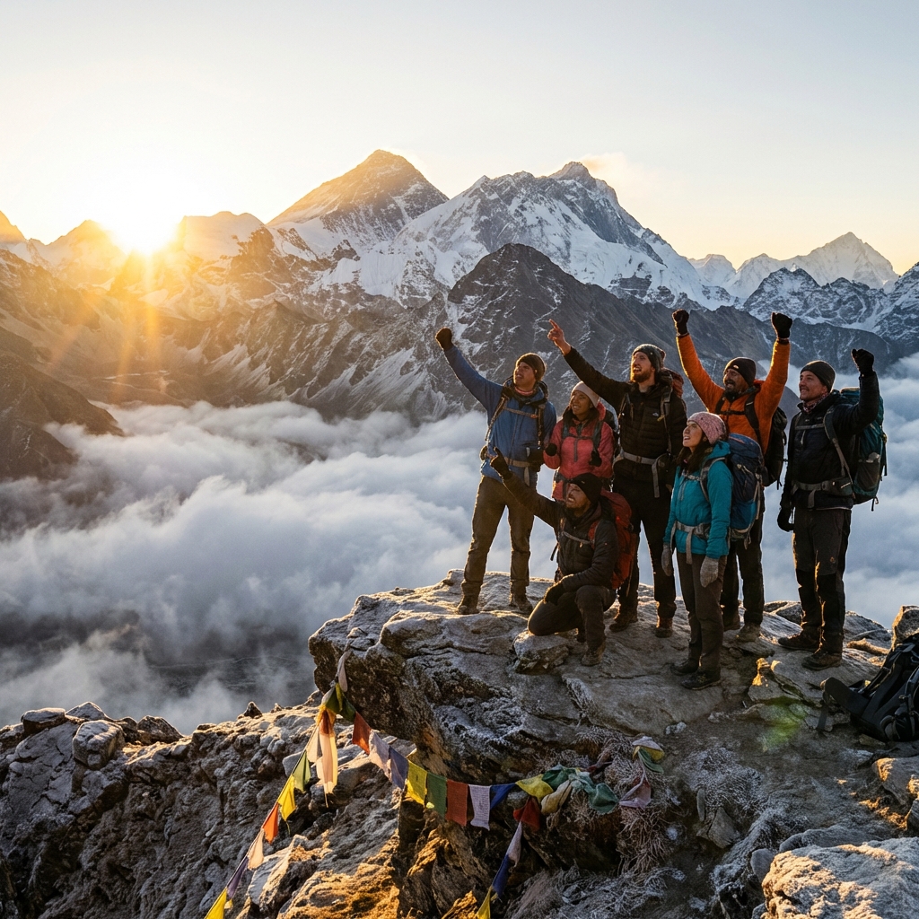
The Khumbu valley in the Everest region follows some of the most predictable and well-documented weather patterns in the Himalayas. October is the gold standard for EBC trekkers: statistical data shows 95% clear days above 4,000 metres, with post-monsoon atmosphere washing out the dust and haze that accumulates in spring. The jet stream descends below 8,000 metres by late November and December, bringing extreme wind conditions that make high passes genuinely dangerous and Lukla flight reliability drops sharply in winter fog. Spring (March–May) represents the second major season — the jet stream lifts by late April, creating the narrow window that expedition teams use for summit bids. For Everest Base Camp trekkers specifically, the optimal windows are October 1 to November 15 and March 15 to May 10. Outside these dates, conditions deteriorate enough to significantly impact the experience, with winter bringing extreme cold and summer bringing trail-obscuring cloud cover and precipitation on most afternoons.
Manaslu Circuit timing follows entirely different constraints centred on a single geographic choke point: Larkya La pass at 5,160 metres. This pass is reliably passable from September 20 through November 25 and from March 20 through May 15. Outside these windows, snow accumulation makes crossing genuinely dangerous — not just difficult. Unlike Thorong La on the Annapurna Circuit, which has the Thorong Phedi escape route back to the valley, Larkya La offers no alternative crossing. If conditions deteriorate mid-circuit, trekkers face turning back entirely or camping at altitude waiting for a weather window. The Budhi Gandaki valley below funnels monsoon moisture, making June through August extremely wet on lower trail sections with frequent landslides. The absolute sweet spot for Manaslu is October 10–25: stable pass conditions, post-monsoon clarity across the entire circuit, manageable cold at camp, and teahouses operating at full capacity. The restricted area permit system requires advance planning with a licensed agency, which eliminates the last-minute timing flexibility that solo trekkers on the Annapurna or Everest circuits can exploit.
Altitude is the single most important variable in understanding why regional timing matters so much in Nepal. The temperature lapse rate averages roughly 6.5°C per 1,000 metres of elevation gain — meaning a comfortable 15°C day in Lukla at 2,860 metres translates to approximately -5°C at Gorak Shep at 5,164 metres on the same afternoon. Wind chill at exposed passes can make that -5°C feel like -25°C on skin. The snow line varies significantly by season: it drops to around 4,500 metres in winter but sits above 5,500 metres in October, meaning the difference between a clear trail and a snow-covered one at Larkya La can be entirely a function of which month you cross. What constitutes a reasonable trekking day also scales sharply with altitude: 8+ hours of comfortable walking at 3,000 metres becomes 4–5 hours of difficult, exhausting progress at 5,000 metres in cold conditions, even for well-acclimatised trekkers. These physical realities mean the margin for error in timing shrinks dramatically as your route reaches higher elevations.
The rain shadow effect creates a category of regions that follow inverted seasonal logic compared to the rest of Nepal. Upper Mustang sits behind the combined Annapurna-Dhaulagiri barrier and receives only 250mm of annual rainfall — less than many desert regions — compared to 3,500mm in Pokhara just 100 kilometres to the south. Dolpo operates under similar conditions, protected by the same mountain wall. Upper Manaslu above Samagaon enters rain shadow territory, which is why late-monsoon Manaslu trekking is even possible. In these regions, the monsoon months of June through August actually bring warmth, clear skies at altitude, and fully functional trails — while December through February bring extreme cold that is the real limiting factor. Leeward valleys (north-facing, sheltered from southerly moisture) are drier year-round; windward valleys (south-facing, exposed to monsoon flow) are wetter. Recognising which side of a ridgeline your route travels unlocks 12-month trekking possibilities that standard seasonal advice ignores entirely.
Using regional timing data effectively requires integrating it with your specific itinerary rather than treating it as a single date recommendation. Match your acclimatisation schedule so that you arrive at pass-crossing altitudes during the most stable weather period, not at the edges of the window. Build 2–3 buffer days into your itinerary around any pass above 5,000 metres to allow for weather contingency — these are not wasted days but essential insurance. Monitor forecasts for your specific valley rather than Kathmandu, which often has completely different conditions. Stack acclimatisation hikes on forecast-stable days and use unsettled periods for rest days. For flight-dependent trailheads — Lukla for Everest, Jomsom for Mustang, Nepalgunj for western Nepal — add extra buffer days to account for weather delays, which can cascade into missed pass windows if your schedule is too tight. The trekkers who get into trouble are usually those who built no flex into a schedule that required perfect weather at every juncture.
Future regional timing guides planned for this section include Annapurna (ACAP timing across Thorong La, Annapurna Base Camp, and Poon Hill routes, which have meaningfully different windows despite being within the same permit area), Langtang Valley (including post-earthquake recovery and how seasonal access has changed since 2015), Kanchenjunga (remote eastern Nepal weather patterns that differ from both central and western Himalayan timing), and western Nepal (Rara Lake, Api Nampa, and Khaptad, which are among Nepal's least-documented regions in terms of seasonal conditions). Each region presents distinct microclimates that deserve dedicated analysis rather than a footnote in a general Nepal timing article. Community feedback from trekkers who have completed these routes shapes which regions get covered next — if you have first-hand timing data from a specific region, the guide pages include contact details for contributing field observations to future editions.
Regional Timing at a Glance
2 detailed
Regions Covered
Everest, Manaslu (more coming)
12 months
Data Points
full year analyzed per region
Altitude
Key Variable
weather varies by 3000m+ range
4–6 weeks
Sweet Spots
optimal window per region
Regional Timing Guides
Detailed month-by-month timing analysis for Nepal's major trekking regions — from Everest Base Camp and Manaslu Circuit to future guides covering Annapurna, Langtang, and western Nepal.
Frequently Asked Questions
When is the absolute best time to trek to Everest Base Camp?
The single best window is October 15 to November 5. This 3-week period combines post-monsoon clarity (100km+ visibility), comfortable daytime temperatures (5–15°C at 3500m), minimal precipitation, and fully operational infrastructure. Early October can still have residual monsoon moisture. Late November brings shorter days and colder nights. For spring, April 1–25 offers comparable conditions with rhododendron blooms at lower elevations but slightly more haze.
What makes Manaslu Circuit timing more critical than other treks?
The Larkya La pass at 5160m is the single choke point: snow closes it by late November and doesn't reliably clear until late March. Unlike Thorong La (Annapurna Circuit) which has escape routes, Larkya La has no alternative. The restricted permit system also means you can't easily extend dates. Missing your pass window means either turning back or waiting indefinitely. This combination of high pass, no alternatives, and fixed permits makes timing accuracy essential for Manaslu.
Does the Everest region get monsoon rain?
Yes, but less than southern regions. The Khumbu receives 400–500mm during June–August compared to 1500–2000mm in Annapurna foothills. Clouds typically build by midday even during monsoon, but mornings can be clear above 4000m. Trekking is possible but trails are slippery, views intermittent, and leeches present below 3500m. The region is substantially drier than Annapurna, Langtang, or Helambu during monsoon.
Can I combine regional timing data with monthly guides for better planning?
Absolutely, that's the recommended approach. Start with the monthly guide for your travel month to understand national-level conditions. Then read the regional guide for your specific route to understand local variations. For example: the October monthly guide tells you it's peak season nationally, but the Manaslu regional guide reveals the October 10–25 sweet spot for Larkya La specifically. Cross-referencing gives you the most accurate planning picture.
Which Nepal regions can be trekked year-round?
Lower-altitude routes in Annapurna (Poon Hill, Ghandruk loop) and Helambu near Kathmandu are accessible 12 months. Rain shadow regions (Upper Mustang, Dolpo) are technically year-round but extremely cold December–February. Everest to Namche (3440m) is feasible year-round for experienced trekkers. No route above 5000m is reliably year-round due to winter snow and monsoon conditions. The key is matching altitude ceiling to seasonal constraints.