Skip to content
+977-9861293812
WhatsApp
Trek and Tour Nepal
Annapurna Region · Nepal

Ghorepani Poon Hill Trek

Guaranteed departure4.8from 412 reviews
Days
5
Highest point
3,210 m
Level
Easy
Best months
Mar to May, Sep to Nov and Dec to Feb

Overview

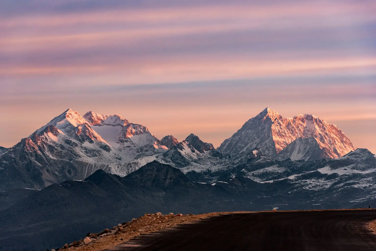
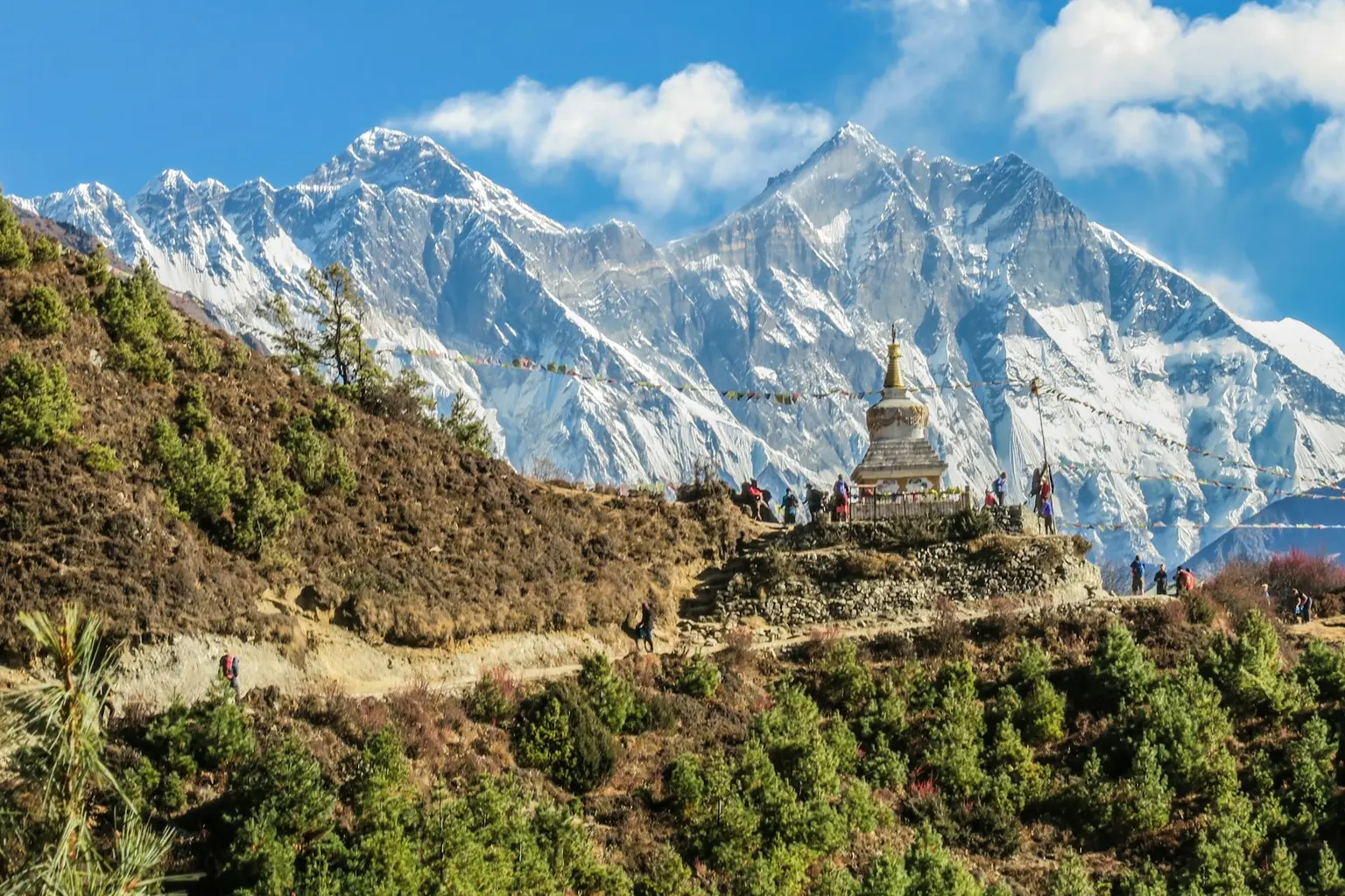
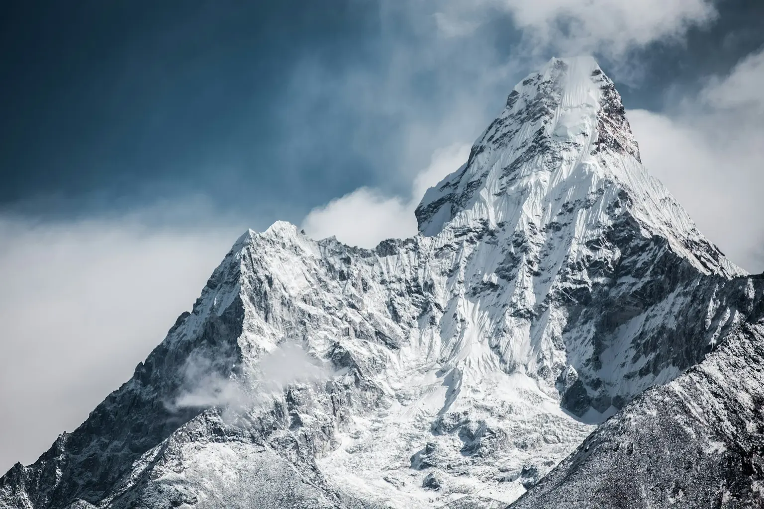
Watching the sun rise from Poon Hill is one of the best mornings you can spend in Nepal. In just five days, this beginner-friendly trek gives you views that rival routes three times its length. You climb before dawn to a hilltop viewpoint where over twenty Himalayan peaks turn amber and gold in the first light. The panorama runs from the massive bulk of Dhaulagiri to the pyramid of Machhapuchhre (Fishtail), with the entire Annapurna chain in between. The route from Pokhara climbs through varied terrain: terraced farmland tended by Gurung farmers, the famous 3,300-step stone staircase to Ulleri, and dense rhododendron forests that turn crimson every spring. The village of Ghandruk, with its flagstone paths and whitewashed Gurung houses, adds real Gurung culture to the mountain scenery. The trek suits first-time trekkers, families, and anyone short on time who still wants a proper Himalayan trek. The trail is well maintained, with excellent teahouses all the way. Autumn and spring offer the best conditions, but this is one of the few treks that also rewards winter trekkers with crisp visibility and snow-dusted trails. A luxury lodge option is available if you want more comfort on the trail.

Want more detail on this route?

Read our full route guide with trail conditions, permits, and planning tips.

Route Guide

Highlights

Watch sunrise over twenty Himalayan peaks from the Poon Hill viewpoint
Trek through rhododendron forests that flower red and pink in spring
Explore the traditional Gurung village of Ghandruk with its mountain backdrop
Climb the famous 3,300-step stone staircase to Ulleri
Complete a full Himalayan trek in just five days from Pokhara

Itinerary

5 days
Highest stop
2,860 m
Day 2
Biggest climb
+1,320 m
Day 2
Over 2,500 m
2 days
of 5

Day 1 of 5 · Drive to Nayapul, Trek to Tikhedhunga

1,540 m

2,500 m · altitude zone
  1. Day 1

    Drive to Nayapul, Trek to Tikhedhunga

    • 1,540 m
    • Teahouse
    • Lunch, Dinner

    Depart Pokhara early morning for the 1.5-hour drive to Nayapul (1,070m), the gateway trailhead for the Annapurna region. From Nayapul, trek approximately 7 km over 3-4 hours through the Modi Khola valley. You pass the riverside village of Birethanti (1,025m), with its ACAP checkpoint and stone-paved bazaar, before continuing to Tikhedhunga (1,540m). Total elevation gain: 470m.

  2. Day 2

    Trek to Ghorepani

    • 2,860 m
    • Up1,320 m from day 1
    • Teahouse
    • Breakfast, Lunch, Dinner
    • Highest stop
    • Biggest climb

    The most physically challenging day of the trek: approximately 10 km over 6-7 hours from Tikhedhunga (1,540m) to Ghorepani (2,860m), ascending 1,320m. The day begins with the famous stone staircase to Ulleri: over 3,300 hand-laid stone steps climbing steeply for approximately 2 hours through terraced hillside. From Ulleri (2,070m), the gradient eases as the trail enters dense rhododendron and oak forest, climbing steadily through Nangethanti to the ridge village of Ghorepani.

    See Ghorepani on the map
  3. Day 3

    Sunrise at Poon Hill, Trek to Tadapani

    • 2,630 m
    • Down230 m from day 2
    • Teahouse
    • Breakfast, Lunch, Dinner

    Rise at 4:30 AM for the 45-minute climb from Ghorepani (2,860m) to the summit of Poon Hill (3,210m), gaining 350m on a well-marked trail through forest to the stone observation tower at the top. After the sunrise, return to Ghorepani for breakfast, then trek approximately 8 km over 4-5 hours east through rhododendron forest to Tadapani (2,630m). Total descent on the day is approximately 230m net, though the trail undulates through several small valleys.

    See Tadapani on the map
  4. Day 4

    Trek to Ghandruk

    • 1,940 m
    • Down690 m from day 3
    • Teahouse
    • Breakfast, Lunch, Dinner

    Today's trek covers approximately 9 km over 4-5 hours, descending from Tadapani (2,630m) through dense forest and crossing a river valley to reach the historic Gurung village of Ghandruk (1,940m). The trail drops 690m through a mix of rhododendron forest and cultivated terraces, with several short climbs over ridges between the valleys. The descent is steady, and trekking poles help protect your knees on the stone steps.

    See Ghandruk on the map
  5. Day 5

    Trek to Nayapul, Drive to Pokhara

    • 1,070 m
    • Down870 m from day 4
    • Breakfast, Lunch

    The final trekking day descends from Ghandruk (1,940m) to Nayapul (1,070m), covering approximately 10 km over 3-4 hours with an elevation loss of 870m. The trail follows stone steps and farm paths through the lower Modi Khola valley, passing through Kimche and Syauli Bazaar before reaching the road at Nayapul. From Nayapul, a 1.5-hour drive returns you to Pokhara (820m) by early afternoon.

    See Nayapul on the map

Want a different pace?

A local guide can add a rest day, shorten a stage, or swap where you sleep. We reply within 24 hours.

Ask a guide on WhatsApp

What's Included

Best Time to Trek Ghorepani Poon Hill

Month by month

Main seasons: Mar to May, Sep to Nov and Dec to Feb

Tap a month to add it to your plan.

Spring

Late March through April fills the trail with blooming rhododendron, and entire hillsides turn red, pink, and white. The Poon Hill sunrise panorama over twenty Annapurna and Dhaulagiri peaks is reliably clear before 7am.

Autumn

October-November brings the sharpest visibility of the year. The sunrise over Dhaulagiri and Annapurna South is at its best, with crisp air and golden light.

Winter

December-February brings snow-dusted trails and far fewer trekkers. The lodges stay open, the sunrise views can be excellent on clear mornings, and you may have Poon Hill almost to yourself.

From
$450/ person

Before you book

Is the Ghorepani Poon Hill Trek right for you?

Straight answers from this trek's own plan. Tap Ask about this on anything you are unsure of, and we send it all to a local guide in one message.

Who this trek suits

The ideal first Himalayan trek for beginners, families, and travelers short on time. Autumn and spring bring the classic Poon Hill sunrise over twenty peaks, winter brings crisp snow-dusted trails and thinner crowds, and the five-day duration from Pokhara fits even the tightest travel schedule.

Can I walk it?

Level 1 of 4: Easy.

4-5 hours walking per day

  • Well-maintained trails, gradual elevation gain
  • No prior trekking experience needed

Nepal's most accessible multi-day trek. If you walk regularly and can manage stone staircases for a few hours, you'll enjoy this trek. The 3,210m Poon Hill summit is the highest point, well within reach for healthy beginners.

How high does it go?

Highest point 3,210 meters. 2 of 5 days end above 2,500 meters.

Days above 2,500 m
2 of 5
Highest night's sleep
2,860 m

Above 2,500 m altitude sickness is possible for anyone, fit or not. Walk slowly, drink plenty and tell your guide how you feel. Our guides are trained Wilderness First Responders.

Where will I sleep?

  • 4teahouse nights

Teahouses are simple family-run lodges: a twin room, a shared dining room and home-cooked meals. Rooms get more basic the higher you go. A more comfortable lodge option is available on this trek.

Teahouses by altitude

Who will I walk with?

Up to 12 trekkers per group

  • Guides trained as Wilderness First Responders
  • Guiding in 5 languages: English, German, French, Spanish, Nepali
  • Nepal Tourism Board Licensed, trekking since 2010
Meet the team

What if my plans change?

  1. You bookNo deposit
  2. 30 days beforeFree to cancel until here
  3. DepartureGuaranteed to run

You do not pay a deposit to hold your dates. Cancel for free up to 30 days before you start, and our departures are guaranteed, so a confirmed date runs.

What do other trekkers say?

4.9out of 5, from 1,200+ reviews
“As a solo female traveler, I felt completely safe the entire time.”
Emma Richardson, Annapurna Circuit, 2024
Read more reviews

Still unsure? Ask a guide who has walked it.

Tap Ask about this on any answer above to add it to your message.

A real person in our Thamel office replies within 24 hours. Asking costs nothing.

The route

Where the route goes

Every stop on a satellite map, numbered in order. The line follows the trail as mapped on OpenStreetMap. Tap a stop on the map or in the list for its elevation and where you sleep, or switch to the topo map for contour lines. Pick 3D to see the valleys and passes in relief, and fly along the trail.

6 stopsWalk the route stop by stop

Height along the trail: 6 stops over 33.5 km of the route as drawn on the map, from Nayapul at 1,070 meters to Ghandruk at 2,012 meters.

Ground height along the OpenStreetMap trail, from the Copernicus DEM GLO-90 (© DLR e.V. 2010-2014 and © Airbus Defence and Space GmbH 2014-2018, provided under COPERNICUS by the European Union and ESA). Stop heights are our own.

  • Trail, from OpenStreetMap
  • Start
  • Finish
  • Overnight stop
  • Stop on the way

6 stops, in order

Frequently asked questions

Similar treks nearby

Other routes in the Annapurna region.

  • Annapurna Circuit Trek

    16 daysChallenging

    Highest point 5,416 m

    Best: Spring, Autumn

    from$1,099

  • Annapurna Base Camp Trek

    11 daysModerate

    Highest point 4,130 m

    Best: Spring, Autumn

    from$949

  • Mardi Himal Trek

    7 daysModerate

    Highest point 4,500 m

    Best: Spring, Autumn

    from$749

Compare0/3
Add a trek
Add a trek
Add a trek