Skip to content
+977-9861293812
WhatsApp
Trek and Tour Nepal
Manaslu Region · Nepal

Manaslu Circuit Trek

4.9from 128 reviews
Days
14
Highest point
5,160 m
Level
Challenging
Best months
Mar to May and Sep to Nov

Overview

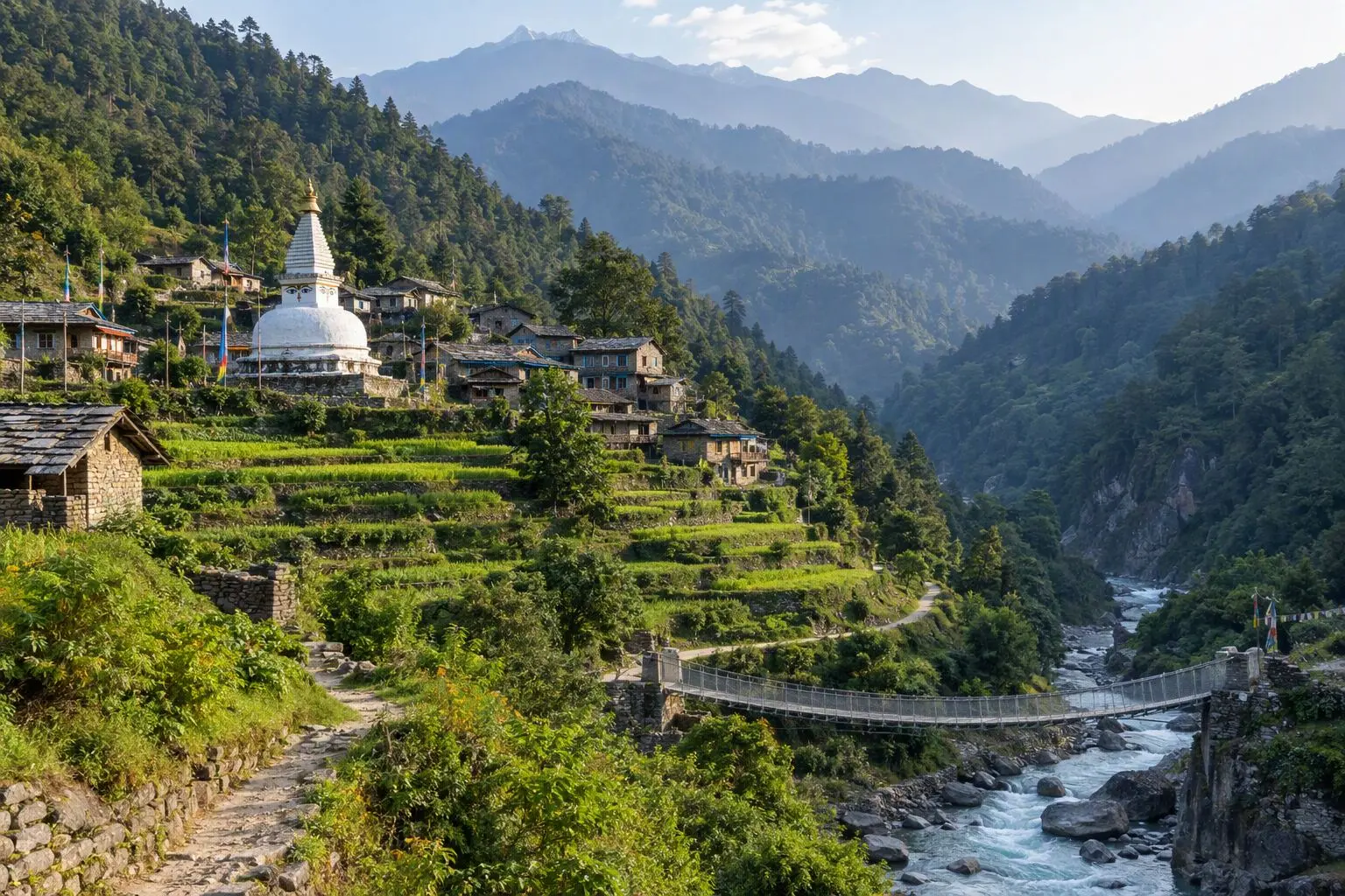
Remote, raw, and culturally rich — the Manaslu Circuit is Nepal's best-kept trekking secret. Circling the world's eighth highest mountain through a government-restricted area, this 14-day journey follows the thundering Budhi Gandaki River from subtropical gorges into the heart of the Tibetan-influenced Nubri Valley, where flat-roofed stone villages, centuries-old gompas, and prayer-flag-draped trails feel untouched by modern tourism. The route climbs steadily through lush rhododendron forest, past the turquoise waters of Birendra Tal glacial lake, and into the stark, windswept moonscape above 4,000 metres before culminating in the crossing of the 5,160-metre Larkya La — one of the great Himalayan pass experiences. Because a special permit and licensed guide are mandatory, you will encounter a fraction of the trekkers found on the Annapurna or Everest circuits, often walking an entire day without seeing another group. This trek suits experienced hikers who value solitude, cultural immersion, and dramatic high-altitude scenery over infrastructure and comfort. Spring (March to May) brings wildflower blooms on the lower slopes, while autumn (September to November) guarantees the clearest panoramas of Manaslu's 8,163-metre ice-clad summit. If you have already done the classic routes and want something deeper, the Manaslu Circuit delivers.

Want more detail on this route?

Read our full route guide with trail conditions, permits, and planning tips.

Route Guide

Highlights

Cross Larkya La Pass at 5,160m
Trek through Nepal's most restricted area
Experience authentic Tibetan Buddhist villages
Visit Birendra Tal glacial lake
Circle the world's 8th highest mountain
Encounter fewer trekkers than any major Nepal circuit

Itinerary

14 days
Highest stop
4,460 m
Day 10
Biggest climb
+870 m
Day 7
Over 2,500 m
6 days
of 14

Day 1 of 14 · Arrival in Kathmandu

1,400 m

2,500 m · altitude zone
  1. Day 1

    Arrival in Kathmandu

    • 1,400 m
    • Hotel
    • Dinner

    Your Manaslu Circuit adventure begins with arrival at Tribhuvan International Airport in Kathmandu, situated at 1,400 meters in the bowl-shaped Kathmandu Valley. Our airport representative meets you outside the terminal and transfers you to your hotel in the Thamel district, a 30-minute drive through the bustling capital city.

  2. Day 2

    Drive to Soti Khola

    • 730 m
    • Down670 m from day 1
    • Teahouse
    • Breakfast, Lunch, Dinner

    An early morning departure from Kathmandu takes you on a seven-to-eight-hour drive westward along the Prithvi Highway before turning north through the hill town of Arughat Bazaar and continuing to the roadhead at Soti Khola, situated at 730 meters along the banks of the Budhi Gandaki River. The first half of the drive follows the paved highway through Dhading district, while the second half narrows to a rough, unpaved road that winds through terraced hillsides, rice paddies, and scattered Gurung settlements.

    See Soti Khola on the map
  3. Day 3

    Trek to Machha Khola

    • 930 m
    • Up200 m from day 2
    • Teahouse
    • Breakfast, Lunch, Dinner

    The first full trekking day covers approximately 14 kilometers over six hours, following the Budhi Gandaki River upstream through a lush subtropical valley with a net elevation gain of only 200 meters from Soti Khola at 730 meters to Machha Khola at 930 meters. The trail undulates constantly, however, with short steep climbs and descents that make the day more demanding than the modest altitude difference suggests. You cross several suspension bridges, pass small waterfalls cascading down mossy cliff faces, and navigate rocky sections carved into the gorge walls above the river.

  4. Day 4

    Trek to Jagat

    • 1,410 m
    • Up480 m from day 3
    • Teahouse
    • Breakfast, Lunch, Dinner

    Today's trek covers roughly 13 kilometers over seven hours, climbing from 930 meters at Machha Khola to 1,410 meters at Jagat through the narrowing Budhi Gandaki gorge. The terrain grows more dramatic as the valley walls close in — the trail passes through tight rock corridors, crosses long suspension bridges swaying high above the churning river, and skirts waterfalls that spray mist across the path. Several sections involve steep stone staircases hewn into the cliff face, demanding careful footwork and a head for heights.

    See Jagat on the map
  5. Day 5

    Trek to Deng

    • 1,860 m
    • Up450 m from day 4
    • Teahouse
    • Breakfast, Lunch, Dinner

    The trail from Jagat to Deng covers approximately 12 kilometers in six hours, climbing steadily from 1,410 meters to 1,860 meters as the Budhi Gandaki gorge begins to open into a wider valley. The route passes through the villages of Salleri and Sirdibas, crossing the river on suspension bridges multiple times as the trail alternates between the east and west banks. The forest canopy shifts perceptibly — subtropical sal trees give way to temperate oak and pine, and the air carries a cooler, drier edge that hints at the high country ahead.

    See Deng on the map
  6. Day 6

    Trek to Namrung

    • 2,660 m
    • Up800 m from day 5
    • Teahouse
    • Breakfast, Lunch, Dinner

    A demanding but rewarding day of approximately 14 kilometers and seven hours of walking takes you from Deng at 1,860 meters to Namrung at 2,660 meters — an 800-meter elevation gain that marks the steepest climb so far. The trail ascends through dense rhododendron and pine forests that burst into vivid pink and crimson blooms during spring season, and the air grows noticeably thinner and cooler as you cross above the 2,000-meter mark. Several short, steep switchback sections test the legs, interspersed with level stretches through open meadows where the sound of cowbells drifts from grazing yak herds.

    See Namrung on the map
  7. Day 7

    Trek to Samagaon

    • 3,530 m
    • Up870 m from day 6
    • Teahouse
    • Breakfast, Lunch, Dinner
    • Biggest climb

    Today's trek from Namrung to Samagaon covers roughly 11 kilometers over six hours, gaining 870 meters as you climb from 2,660 meters to 3,530 meters through the cultural heart of the Nubri Valley. The trail passes through the villages of Lihi and Lho, each with its own gompa and clusters of prayer flags, before traversing a wide, windswept hillside where the full north face of Manaslu dominates the skyline in breathtaking proximity. Near Lho, the centuries-old Ribung Gompa perches on a hilltop with Manaslu as its backdrop — one of the most photographed monastery settings in the Nepal Himalaya.

    See Samagaun on the map
  8. Day 8

    Acclimatization Day

    • 3,530 m
    • Teahouse
    • Breakfast, Lunch, Dinner
    • Acclimatization

    This essential rest day at Samagaon, 3,530 meters, follows the 'climb high, sleep low' principle that is critical for safe passage over the Larkya La in the days ahead. The recommended acclimatization hike takes you up toward the Manaslu Base Camp viewpoint at approximately 4,200 meters — a three-to-four-hour round trip that gains 670 meters on a clear trail above the village before returning to sleep at the same elevation. The panoramic views from the viewpoint are extraordinary: Manaslu's north face fills the sky, flanked by the peaks of Peak 29 and Ngadi Chuli, while below you the glacial moraine stretches in grey ribbons toward the mountain's base.

  9. Day 9

    Trek to Samdo

    • 3,860 m
    • Up330 m from day 8
    • Teahouse
    • Breakfast, Lunch, Dinner

    A shorter day of approximately 8 kilometers and four hours of walking takes you from Samagaon at 3,530 meters to Samdo at 3,860 meters, gaining 330 meters at a gentle pace that continues your acclimatization. The trail follows the Budhi Gandaki upstream through a broad, windswept valley where the vegetation has thinned to low scrub, hardy grasses, and patches of grey-green lichen on the boulders. Yak herds dot the surrounding pastures, and their dung patties — stacked and dried along stone walls — serve as the primary fuel source at this altitude where trees no longer grow.

    See Samdo on the map
  10. Day 10

    Trek to Dharamsala (Larkya Phedi)

    • 4,460 m
    • Up600 m from day 9
    • Teahouse
    • Breakfast, Lunch, Dinner
    • Highest stop

    The trek from Samdo to Dharamsala — also called Larkya Phedi, meaning 'foot of the pass' — covers roughly 7 kilometers over four hours, ascending 600 meters from 3,860 to 4,460 meters through increasingly barren, high-altitude terrain. The trail climbs gradually along a glacial moraine above the treeline, passing scattered cairns and prayer flag strings that mark the route across a landscape of grey rock, ice-blue meltwater streams, and patches of thin, frost-resistant grass. The air is noticeably thinner here, and even experienced trekkers will feel the altitude in their breathing and pace.

  11. Day 11

    Cross Larkya La, Descend to Bimthang

    • 3,720 m
    • Down740 m from day 10
    • Teahouse
    • Breakfast, Lunch, Dinner

    This is the defining day of the Manaslu Circuit — the crossing of Larkya La at 5,160 meters, the highest point of the trek and one of the great Himalayan pass crossings. You wake at 3:00 AM to hot tea and a quick breakfast, strap on your headlamp, and begin the ascent in darkness by 4:00 AM. The first two hours climb steeply over glacial moraine and loose scree, following cairns and prayer flag fragments by torchlight as the stars blaze overhead in the thin, frigid air. The temperature at departure is typically minus 10 to minus 15 degrees Celsius, and every exposed inch of skin must be covered.

    See Bimthang on the map
  12. Day 12

    Trek to Dharapani

    • 1,860 m
    • Down1,860 m from day 11
    • Teahouse
    • Breakfast, Lunch, Dinner

    The descent continues dramatically as you trek from Bimthang at 3,720 meters to Dharapani at 1,860 meters — an enormous 1,860-meter drop over approximately 16 kilometers and six hours of walking. The trail plunges through rhododendron forest, past the village of Tilije, and along the Dudh Khola valley as the landscape transforms at a remarkable pace. Within hours you leave behind the barren, wind-scoured terrain of the high passes and re-enter a world of dense green forest, birdsong, warm air, and the smell of damp earth and wildflowers.

    See Dharapani on the map
  13. Day 13

    Drive to Kathmandu

    • 1,400 m
    • Down460 m from day 12
    • Hotel
    • Breakfast, Dinner

    A full day of driving — approximately eight to nine hours — takes you from Dharapani through the town of Besisahar and then along the Prithvi Highway back to Kathmandu at 1,400 meters. The first section follows the Marsyangdi River valley on a rough road shared with local buses and trucks, passing through the busy market town of Besisahar where you stop for lunch. From Besisahar, the paved highway follows the Trisuli River through Mugling and Malekhu, with roadside tea stalls, river views, and the gradually flattening terrain marking the transition from hill country to the Kathmandu Valley.

  14. Day 14

    Departure

    • 1,400 m
    • Breakfast

    Your Manaslu Circuit trek concludes with a final breakfast at your Kathmandu hotel followed by a transfer to Tribhuvan International Airport for your onward flight. Depending on your departure time, the morning may allow a last walk through the narrow streets of Thamel to pick up souvenirs — Tibetan singing bowls, prayer flags, pashmina shawls, or handcrafted lokta paper — as mementos of the journey.

Want a different pace?

A local guide can add a rest day, shorten a stage, or swap where you sleep. We reply within 24 hours.

Ask a guide on WhatsApp

What's Included

Best Time to Trek Manaslu Circuit

Month by month

Main seasons: Mar to May and Sep to Nov

Tap a month to add it to your plan.

Spring

March-May opens the Larkya La pass after winter snow, with wildflower blooms on the lower Budhi Gandaki gorge. The Tibetan Buddhist villages of Lho and Sama come alive with spring festivals.

Autumn

September-November is the most reliable weather window — clear skies over Manaslu's 8,163m summit and stable conditions for the 5,160m Larkya La crossing. The restricted permit keeps trekker numbers low even in peak season.

From
$1,249/ person

Before you book

Is the Manaslu Circuit Trek right for you?

Straight answers from this trek's own plan. Tap Ask about this on anything you are unsure of, and we send it all to a local guide in one message.

Who this trek suits

Suited for experienced trekkers who have done Annapurna or Everest and want Nepal's most remote major circuit. Autumn guarantees the clearest panoramas for the Larkya La crossing, spring brings wildflower blooms on the lower slopes, and the restricted area permit ensures solitude that the classic circuits can no longer offer.

Can I walk it?

Level 3 of 4: Challenging.

6-8 hours walking per day

  • High passes, steep terrain, significant altitude
  • Prior multi-day trekking and good fitness required

Comparable to the Annapurna Circuit in difficulty but more remote. The Larkya La (5,160m) requires solid acclimatization and sustained effort. Prior high-altitude trekking experience is strongly recommended — this isn't a first trek.

How high does it go?

Highest point 5,160 meters. 6 of 14 days end above 2,500 meters.

Days above 2,500 m
6 of 14
Rest days to adjust
1

Above 2,500 m altitude sickness is possible for anyone, fit or not. Walk slowly, drink plenty and tell your guide how you feel. Our guides are trained Wilderness First Responders.

Where will I sleep?

  • 11teahouse nights
  • 2hotel nights

Teahouses are simple family-run lodges: a twin room, a shared dining room and home-cooked meals. Rooms get more basic the higher you go.

Teahouses by altitude

Who will I walk with?

Up to 12 trekkers per group

  • Guides trained as Wilderness First Responders
  • Guiding in 5 languages: English, German, French, Spanish, Nepali
  • Nepal Tourism Board Licensed, trekking since 2010
Meet the team

What if my plans change?

  1. You bookNo deposit
  2. 30 days beforeFree to cancel until here
  3. DepartureGuaranteed to run

You do not pay a deposit to hold your dates. Cancel for free up to 30 days before you start, and our departures are guaranteed, so a confirmed date runs.

What do other trekkers say?

4.9out of 5, from 1,200+ reviews
“The extra acclimatization day they insisted on made all the difference.”
Carlos & Maria, Manaslu Circuit, 2024
Read more reviews

Still unsure? Ask a guide who has walked it.

Tap Ask about this on any answer above to add it to your message.

A real person in our Thamel office replies within 24 hours. Asking costs nothing.

The route

Where the route goes

Every stop on a satellite map, numbered in order, with the peaks around them. The line follows the trail as mapped on OpenStreetMap. Tap a stop on the map or in the list for its elevation and where you sleep, or switch to the topo map for contour lines. Pick 3D to see the valleys and passes in relief, and fly along the trail.

10 stopsWalk the route stop by stop

Height along the trail: 10 stops over 130 km of the route as drawn on the map, from Soti Khola at 700 meters to Dharapani at 1,860 meters.

Ground height along the OpenStreetMap trail, from the Copernicus DEM GLO-90 (© DLR e.V. 2010-2014 and © Airbus Defence and Space GmbH 2014-2018, provided under COPERNICUS by the European Union and ESA). Stop heights are our own.

  • Trail, from OpenStreetMap
  • Start
  • Finish
  • Overnight stop
  • Stop on the way
  • Mountain peak

10 stops, in order

Frequently asked questions

Similar treks

Other challenging treks in Nepal.

  • Everest Base Camp Trek

    14 daysChallenging

    Highest point 5,545 m

    Best: Spring, Autumn

    from$1,349

  • Gokyo Lakes Trek

    13 daysChallenging

    Highest point 5,357 m

    Best: Spring, Autumn

    from$949

  • Jiri to Everest Base Camp Trek

    20 daysChallenging

    Highest point 5,545 m

    Best: Spring, Autumn

    from$1,199

Compare0/3
Add a trek
Add a trek
Add a trek