Skip to content
+977-9861293812
WhatsApp
Trek and Tour Nepal
Langtang Region · Nepal

Tsum Valley Trek

4.8from 56 reviews
Days
12
Highest point
3,700 m
Level
Moderate
Best months
Mar to May and Sep to Nov

Overview

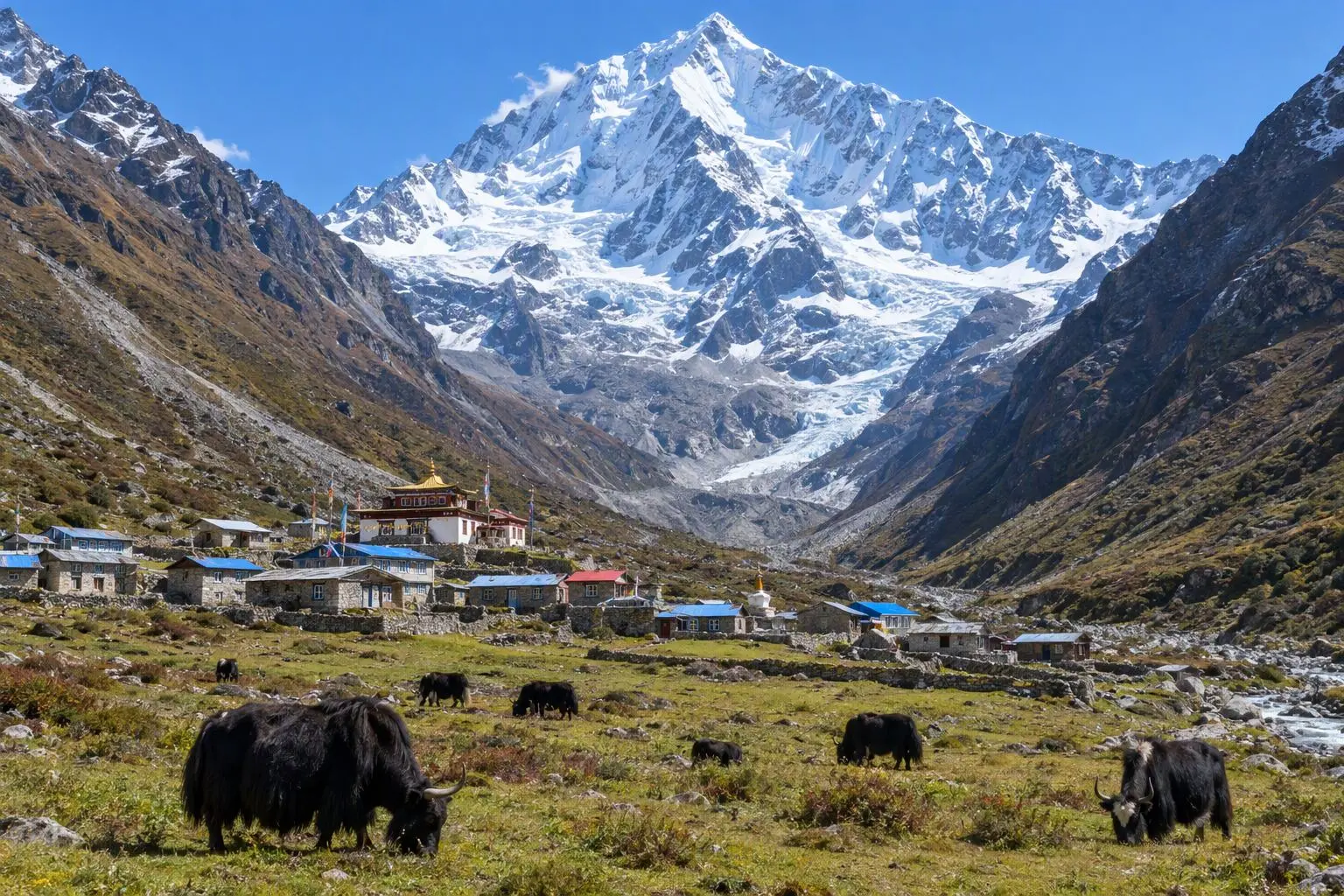
Closed to foreign visitors until 2008, the Tsum Valley is Nepal's most intact Tibetan Buddhist enclave — a beyul, or sacred hidden valley, whose isolation has preserved a way of life that has largely disappeared from the broader Himalayan world. The name translates to 'vivid' in Tibetan, but the valley is universally known by its epithet: the Valley of Happiness. Two thousand Tsum people live here, maintaining a polyandrous society, ancient monastery traditions, and a relationship with the surrounding landscape rooted in Buddhist cosmology rather than tourism economics. Access requires a Restricted Area Permit (RAP), which limits visitor numbers and mandates a licensed guide — a mechanism that has, more effectively than in most restricted zones, actually controlled the pace of change. The approach follows the Budhi Gandaki gorge north from Soti Khola, the same valley used by Manaslu Circuit trekkers but diverging at Lokpa to enter the Tsum side valley. The gorge is dramatic — narrow, forested, and atmospheric — before the valley widens at Chumling and the first distinctly Tibetan cultural markers appear: enormous mani walls of carved stone stretching hundreds of metres, stone arches inscribed with prayers, and the distant white and ochre facades of monasteries on the valley sides. Mu Gompa (3,700m) is the highest and most significant monastery on the circuit — a complex of ancient buildings perched on a ridge above the main valley with views of the Dephyudonma Glacier and the surrounding Ganesh and Sringi Himal peaks. A day spent at Mu Gompa, watching monks perform morning puja, examining the painted murals in the assembly hall, and walking to the sacred Milarepa caves above the monastery, is among the most culturally rewarding experiences available on a moderate Himalayan trek.

Want more detail on this route?

Read our full route guide with trail conditions, permits, and planning tips.

Route Guide

Highlights

Enter the restricted 'Hidden Valley of Happiness' — Nepal's most intact Tibetan culture
Visit Mu Gompa, one of the highest and most remote monasteries in Nepal
See Dephyudonma Glacier and the sacred Milarepa meditation caves
Explore Chhokang Paro's twin villages divided by the Siyar Khola river
Walk through the Budhi Gandaki gorge — the same approach as the Manaslu Circuit

Itinerary

12 days
Highest stop
3,700 m
Day 7
Biggest climb
+900 m
Day 4
Over 2,500 m
4 days
of 12

Day 1 of 12 · Drive to Soti Khola

700 m

2,500 m · altitude zone
  1. Day 1

    Drive to Soti Khola

    • 700 m
    • Teahouse
    • Breakfast, Lunch, Dinner

    The drive from Kathmandu to Soti Khola (700m) takes approximately 7-8 hours on the Prithvi Highway west before turning north on the road through Arughat Bazaar into the Budhi Gandaki valley. The road beyond Arughat is rough in sections and crosses several river tributaries on low bridges that can be affected by high water in autumn. A 4WD vehicle is used throughout. Soti Khola is a small settlement at the confluence of the Soti Khola stream and the Budhi Gandaki — a collection of teahouses serving as the effective trailhead for both the Manaslu Circuit and the Tsum Valley approach.

    See Soti Khola on the map
  2. Day 2

    Trek to Machhakhola

    • 900 m
    • Up200 m from day 1
    • Teahouse
    • Breakfast, Lunch, Dinner

    The trail from Soti Khola follows the Budhi Gandaki north through the lower gorge section to Machhakhola (900m) — approximately 11-13 km over 5-6 hours of varied terrain. The path alternates between forested river banks and exposed cliff traverses where the gorge narrows to a few metres and the trail is cut into the rock face above the rushing water. Several waterfalls cross the trail from the gorge walls above, creating natural showers in the humid air. Bamboo groves, lush vegetation, and the constant sound of the river define this lower section.

  3. Day 3

    Trek to Jagat

    • 1,340 m
    • Up440 m from day 2
    • Teahouse
    • Breakfast, Lunch, Dinner

    From Machhakhola the trail continues north through the Budhi Gandaki gorge, climbing gradually to Jagat (1,340m) over 12-14 km in 5-6 hours. The gorge on this section deepens and the trail becomes more serious: suspended wooden bridges over roaring narrows, exposed cliff-side sections with safety cables, and several long climbs above the river before descending back to its level. The forest cover is thick with subtropical hardwoods, and Himalayan langur monkeys are commonly seen in the trees above the trail.

  4. Day 4

    Trek to Lokpa

    • 2,240 m
    • Up900 m from day 3
    • Teahouse
    • Breakfast, Lunch, Dinner
    • Biggest climb

    The trail continues up the Budhi Gandaki from Jagat, climbing more steeply through the upper gorge to the junction village of Lokpa (2,240m) over 12-14 km in 5-6 hours. This is where the Tsum Valley route diverges from the Manaslu Circuit: at Lokpa a clear trail branches northeast up the Siyar Khola drainage toward Chumling and the hidden valley above, while the Manaslu trail continues north toward Deng and the circuit. Most trekkers encountered on the trail this far are heading for Manaslu — the Tsum Valley route is quieter from Lokpa onward.

    See Lokpa on the map
  5. Day 5

    Trek to Chumling

    • 2,380 m
    • Up140 m from day 4
    • Teahouse
    • Breakfast, Lunch, Dinner

    From Lokpa the trail enters the Tsum Valley proper, following the Siyar Khola northeast to Chumling (2,380m) over 8-10 km in 4-5 hours. The immediate effect of crossing into the Tsum cultural zone is visible in the landscape: enormous mani walls of carved prayer stones line the trail at village entrances, stone arches inscribed with the mantra Om Mani Padme Hum span the path at intervals, and the architectural style of the buildings changes from the lower valley's mixed Nepali form to the distinctive Tibetan style of flat-roofed stone houses with wooden-framed windows and painted prayer symbols on the facades.

    See Chumling on the map
  6. Day 6

    Trek to Chhokang Paro

    • 3,010 m
    • Up630 m from day 5
    • Teahouse
    • Breakfast, Lunch, Dinner

    The trail from Chumling climbs steadily north up the Siyar Khola valley to Chhokang Paro (3,010m) over 8-10 km in 4-5 hours, passing through the important monastery village of Nile (2,915m) on the way. The approach to Nile involves a short but steep climb to a monastery complex perched on a rock outcrop above the trail — worth a detour for its painted murals and the extraordinary mani wall below, reportedly over 300 metres long. The monks at Nile are from the Nyingma school of Tibetan Buddhism and perform regular ritual ceremonies that visitors may observe quietly from the edge of the courtyard.

  7. Day 7

    Trek to Mu Gompa

    • 3,700 m
    • Up690 m from day 6
    • Teahouse
    • Breakfast, Lunch, Dinner
    • Highest stop

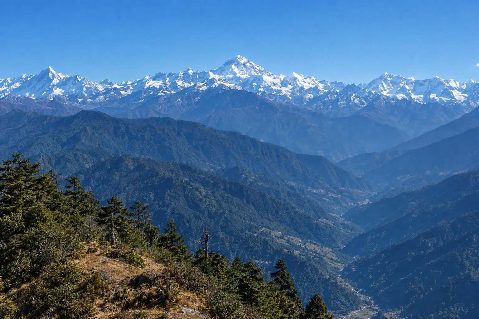
    The climax of the trek. From Chhokang Paro the trail climbs north to Mu Gompa (3,700m), the highest monastery in the Tsum Valley, over 8-10 km in 4-5 hours of steady ascent. The trail passes the last Tsum settlements — small clusters of stone houses with enormous prayer flag poles in the central courtyards — before entering the high grazing grounds below the monastery. The Ganesh and Sringi Himal peaks come into full view from the upper approach, their scale increasing with every metre of altitude gained.

    See Mu Gompa on the map
  8. Day 8

    Explore Mu Gompa, Dephyudonma Glacier

    • 3,700 m
    • Teahouse
    • Breakfast, Lunch, Dinner

    A full day at Mu Gompa for exploration, acclimatisation, and cultural immersion. The morning puja at the monastery begins before dawn — the low resonance of horns and the percussion of drums carrying across the valley in the dark. Attending this ceremony, seated quietly at the edge of the prayer hall, is the most intimate access to Tibetan Buddhist monastic life available on any moderate Himalayan trek.

    See Mu Gompa on the map
  9. Day 9

    Trek to Chhokang Paro

    • 3,010 m
    • Down690 m from day 8
    • Teahouse
    • Breakfast, Lunch, Dinner

    The descent from Mu Gompa to Chhokang Paro reverses the Day 7 trail over 8-10 km in 3-4 hours of downhill walking. The descent from 3,700m loses 690 metres gradually on a clear trail, and the increasing warmth and thicker air are noticeable with every 100 metres of descent. The afternoon perspective on the valley — looking south from the high grazing grounds back toward the settled cultural zone — gives a satisfying sense of the valley's shape and scale that was invisible from within it.

  10. Day 10

    Trek to Lokpa

    • 2,240 m
    • Down770 m from day 9
    • Teahouse
    • Breakfast, Lunch, Dinner

    The trail from Chhokang Paro retraces the approach south through Nile and down the Siyar Khola to Lokpa (2,240m), covering 12-14 km in 5-6 hours with significant descent. The valley that took four days to ascend is now being exited in two — the familiar rhythm of this phase of long treks, where the ground covered feels both shorter and more saturated with meaning on the return. The mani walls at village entrances, the monastery bells, the smoke from kitchen fires — all carry the specific weight of things observed and understood, rather than merely encountered for the first time.

    See Lokpa on the map
  11. Day 11

    Trek to Machhakhola, Drive to Kathmandu

    • 1,400 m
    • Down840 m from day 10
    • Hotel
    • Breakfast, Lunch

    A final trekking day descends from Lokpa through the Budhi Gandaki gorge to Machhakhola (900m) — 12-14 km in 4-5 hours of mostly downhill walking on the familiar gorge trail. The suspension bridges, cliff traverses, and river crossings of the approach are reversed in the morning light, arriving in Machhakhola by midday for a final trail lunch before the vehicle transfer.

  12. Day 12

    Departure

    • 1,400 m
    • Breakfast

    A final breakfast in Kathmandu before a private transfer to Tribhuvan International Airport. The 30-45 minute drive from Thamel allows time for a last cup of coffee and a chance to process the considerable impressions of the past twelve days. The Tsum Valley is one of a small number of places in the Himalayan world where the phrase 'unchanged for centuries' retains genuine meaning rather than being a marketing shorthand. Returning home with that knowledge — and the passport stamp from the Restricted Area checkpoint — is its own reward.

Want a different pace?

A local guide can add a rest day, shorten a stage, or swap where you sleep. We reply within 24 hours.

Ask a guide on WhatsApp

What's Included

Best Time to Trek Tsum Valley

Month by month

Main seasons: Mar to May and Sep to Nov

Tap a month to add it to your plan.

Spring

April-May brings green valley floors and clear mountain mornings. Tibetan Buddhist festivals may coincide. The Budhi Gandaki gorge approach is lush.

Autumn

October-November offers the clearest Ganesh and Sringi Himal views from Mu Gompa. Dry conditions make the gorge trail comfortable.

From
$1,099/ person

Before you book

Is the Tsum Valley Trek right for you?

Straight answers from this trek's own plan. Tap Ask about this on anything you are unsure of, and we send it all to a local guide in one message.

Who this trek suits

Nepal's best-preserved Tibetan Buddhist valley for culturally motivated trekkers. Tsum Valley was closed to foreigners until 2008 and retains an authenticity rare in Nepal. The restricted area permit limits visitor numbers, ensuring a genuine cultural encounter. Moderate altitude makes it accessible.

Can I walk it?

Level 2 of 4: Moderate.

5-7 hours walking per day

  • Some steep sections, moderate altitude
  • Basic fitness and some hiking experience recommended

Moderate fitness required. Daily walking is 5-7 hours with gradual altitude gain. Maximum 3,700m is manageable for most trekkers. The Budhi Gandaki gorge sections involve some narrow, exposed trail sections that require confidence on steep terrain.

How high does it go?

Highest point 3,700 meters. 4 of 12 days end above 2,500 meters.

Days above 2,500 m
4 of 12
Rest days to adjust
1

Above 2,500 m altitude sickness is possible for anyone, fit or not. Walk slowly, drink plenty and tell your guide how you feel. Our guides are trained Wilderness First Responders.

Where will I sleep?

  • 10teahouse nights
  • 1hotel night

Teahouses are simple family-run lodges: a twin room, a shared dining room and home-cooked meals. Rooms get more basic the higher you go.

Teahouses by altitude

Who will I walk with?

Up to 12 trekkers per group

  • Guides trained as Wilderness First Responders
  • Guiding in 5 languages: English, German, French, Spanish, Nepali
  • Nepal Tourism Board Licensed, trekking since 2010
Meet the team

What if my plans change?

  1. You bookNo deposit
  2. 30 days beforeFree to cancel until here
  3. DepartureGuaranteed to run

You do not pay a deposit to hold your dates. Cancel for free up to 30 days before you start, and our departures are guaranteed, so a confirmed date runs.

What do other trekkers say?

4.9out of 5, from 1,200+ reviews
“The team customized the itinerary so everyone could enjoy at their own pace.”
Markus Weber, Langtang Valley, 2025
Read more reviews

Still unsure? Ask a guide who has walked it.

Tap Ask about this on any answer above to add it to your message.

A real person in our Thamel office replies within 24 hours. Asking costs nothing.

The route

Where the route goes

Every stop on a satellite map, numbered in order. The line follows the trail as mapped on OpenStreetMap. Tap a stop on the map or in the list for its elevation and where you sleep, or switch to the topo map for contour lines. Pick 3D to see the valleys and passes in relief, and fly along the trail.

5 stopsWalk the route stop by stop

Height along the trail: 5 stops over 75.5 km of the route as drawn on the map, from Soti Khola at 700 meters to Mu Gompa at 3,700 meters.

Ground height along the OpenStreetMap trail, from the Copernicus DEM GLO-90 (© DLR e.V. 2010-2014 and © Airbus Defence and Space GmbH 2014-2018, provided under COPERNICUS by the European Union and ESA). Stop heights are our own.

  • Trail, from OpenStreetMap
  • Start
  • Finish
  • Overnight stop

5 stops, in order

Frequently asked questions

Similar treks nearby

Other routes in the Langtang region.

  • Langtang Valley Trek

    7 daysModerate

    Highest point 3,800 m

    Best: Spring, Autumn, Winter

    from$649

  • Gosainkunda Lake Trek

    8 daysModerate

    Highest point 4,380 m

    Best: Spring, Autumn

    from$599

  • Helambu Trek

    6 daysEasy

    Highest point 3,650 m

    Best: Spring, Autumn, Winter

    from$450

Compare0/3
Add a trek
Add a trek
Add a trek