Skip to content
+977-9861293812
WhatsApp
Trek and Tour Nepal
Langtang Region · Nepal

Ganesh Himal Trek

4.7from 42 reviews
Days
12
Highest point
4,400 m
Level
Challenging
Best months
Mar to May and Sep to Nov

Overview

Two hours north of Kathmandu by road, the Ganesh Himal massif rises to 7,422 metres — yet fewer than a hundred foreign trekkers per year pass beneath its flanks. The Ganesh Himal Trek is Nepal's most compelling off-the-beaten-path adventure at this price point: twelve days through some of the country's least-visited Tamang villages, over a high pass that delivers views from Dhaulagiri to Everest, and through the Ruby Valley — a glacial basin named for the semi-precious stones found in its rivers. The route from Trisuli Bazaar climbs gradually through the lower Tamang hills before ascending to the pass country above 3,000 metres. The three camping nights on the approach to Pangsang Pass are a deliberate and essential part of the experience — there are no teahouses at these altitudes, and the tent camp in a yak pasture under a sky undimmed by any electric light is a reminder of what trekking felt like before the teahouse network expanded through Nepal's major corridors. A professional cook and full kitchen equipment are provided. Crossing Pangsang Pass (4,400m) is the physical and psychological centrepiece of the route: a steep 600-metre ascent over loose moraine to a narrow col where the Ganesh summits rise almost directly overhead. The descent into Tipling on the far side drops through terraced fields where the sudden appearance of trekkers causes brief astonishment among villagers — a gauge of how rarely this ground is walked. This is trekking for experienced adventurers who understand that remoteness and discomfort are precisely the point.

Want more detail on this route?

Read our full route guide with trail conditions, permits, and planning tips.

Route Guide

Highlights

Cross Pangsang Pass (4,400m) with close-up views of the Ganesh Himal range
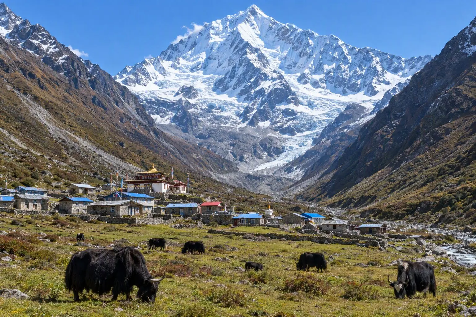
Trek through some of Nepal's least-visited Tamang villages
Experience the Ruby Valley — named for the semi-precious stones found in its rivers
Witness traditional rural life unchanged by tourism
Mixed teahouse and camping — a true adventure experience

Itinerary

12 days
Highest stop
3,800 m
Day 5
Biggest climb
+1,480 m
Day 2
Over 2,500 m
4 days
of 12

Day 1 of 12 · Drive to Trisuli Bazaar, Trek to Betrawati

620 m

2,500 m · altitude zone
  1. Day 1

    Drive to Trisuli Bazaar, Trek to Betrawati

    • 620 m
    • Teahouse
    • Breakfast, Lunch, Dinner

    A 3-4 hour drive northwest from Kathmandu on the Trisuli Highway brings you to Trisuli Bazaar (475m), a junction town on the Trisuli River where the road to Dhunche and the Langtang region continues north. From Trisuli the trail begins on foot, following the river south for 3-4 km before turning west to climb to Betrawati (620m) — a larger market town with a grid of streets, government offices, and several adequate teahouses. The day's trekking is only 2-3 hours, designed as a gentle start after the drive.

  2. Day 2

    Trek to Grang

    • 2,100 m
    • Up1,480 m from day 1
    • Teahouse
    • Breakfast, Lunch, Dinner
    • Biggest climb

    The trail from Betrawati climbs steadily northwest through terraced farmland and mixed forest, gaining approximately 1,480 metres over 12-14 km to reach the Tamang village of Grang (2,100m) — a demanding day of 6-7 hours that makes up for yesterday's short stage. The lower sections pass through Nagadi village and cross several tributaries of the Trisuli system, with the forest thickening progressively as altitude increases. The subtropical vegetation of the river zone gives way to oak and rhododendron by 1,500 metres.

  3. Day 3

    Trek to Rupchet

    • 2,800 m
    • Up700 m from day 2
    • Teahouse
    • Breakfast, Lunch, Dinner

    The trail from Grang continues northwest along the main ridge system, climbing through dense rhododendron forest to Rupchet (2,800m) over 10-12 km in 5-6 hours. The forest on this section is among the finest in the western Langtang region — massive tree rhododendrons whose trunks are wrapped in moss and lichen, and whose canopy in April creates a cathedral of blossoms overhead. The trail passes no significant settlements between Grang and Rupchet, making this a day of genuine wilderness walking with only birdsong and the wind in the canopy for company.

    See Rupchet on the map
  4. Day 4

    Trek to Singla Bhanjyang

    • 3,250 m
    • Up450 m from day 3
    • Camping
    • Breakfast, Lunch, Dinner

    The first camping day. From Rupchet the trail climbs above the treeline onto open alpine pasture, ascending to Singla Bhanjyang (3,250m) over 8-10 km in 5-6 hours. The landscape changes dramatically as the rhododendron forest gives way to dwarf juniper, alpine grass, and bare rock faces. The views from the broad ridgeline at Singla are the first unobstructed panoramas of the trek: Ganesh Himal I-IV appear directly to the north, their glaciers and rock walls catching the afternoon light in tones of blue, gold, and grey.

  5. Day 5

    Trek to Pangsang Pass Base

    • 3,800 m
    • Up550 m from day 4
    • Camping
    • Breakfast, Lunch, Dinner
    • Highest stop

    From Singla Bhanjyang the trail continues north along the upper ridge system toward the Pangsang Pass base camp (3,800m), covering 8-10 km over 5-6 hours of high-altitude walking on the open mountain. The route stays above the treeline throughout, crossing boulder fields and seasonal snowmelt streams between the main ridges. The Ganesh peaks grow steadily larger to the north — by afternoon they fill a significant portion of the sky, their scale becoming genuinely impressive as the approach continues.

  6. Day 6

    Cross Pangsang Pass (4,400m), Camp at Chalish

    • 3,450 m
    • Down350 m from day 5
    • Camping
    • Breakfast, Lunch, Dinner

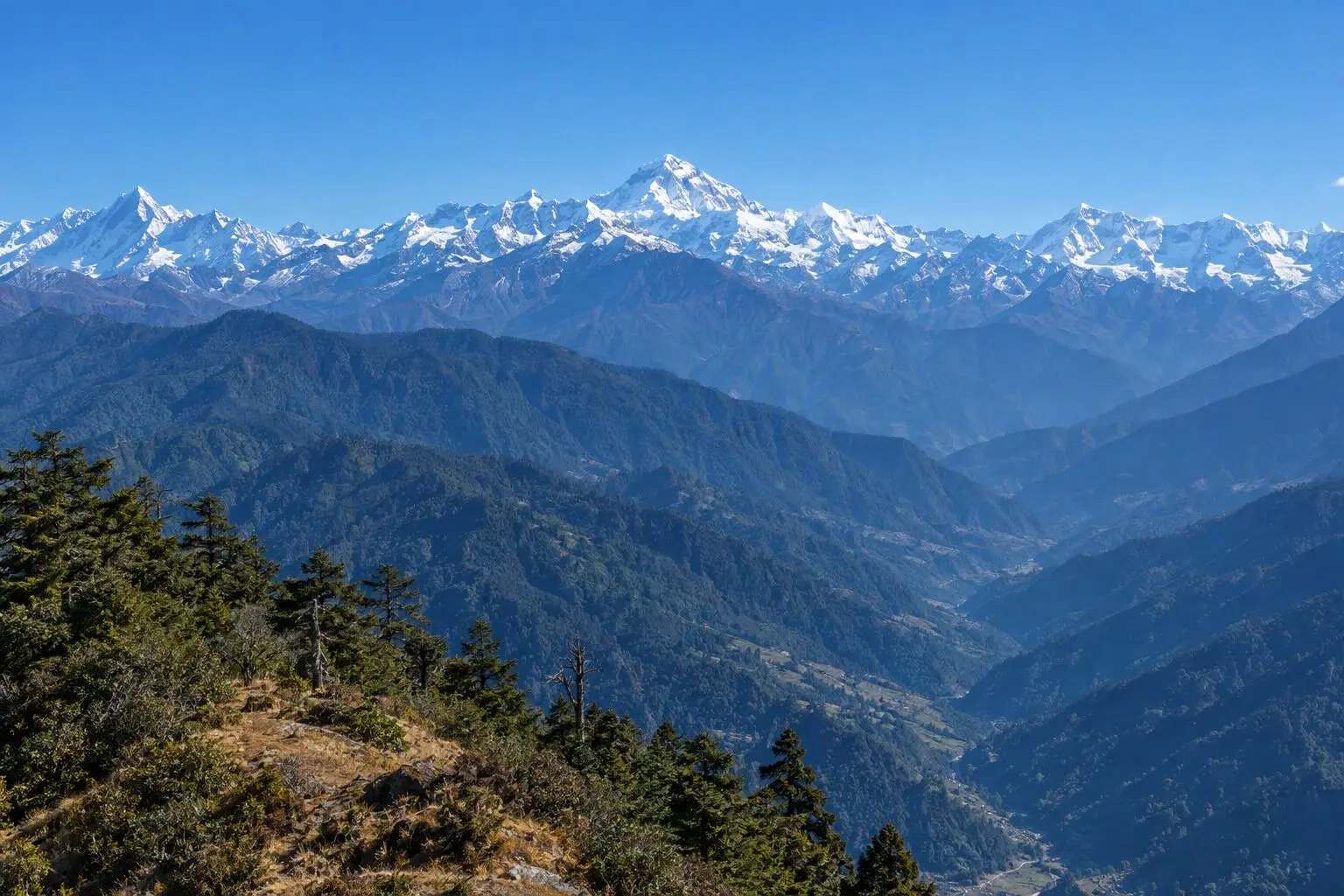
    A 4am start in the darkness. Headlamps on, the trail climbs steeply from camp to Pangsang Pass (4,400m) over approximately 600 metres of ascent on loose moraine and rock — 2-3 hours of hard work at altitude. The pre-dawn cold is significant and thermals, fleece, and wind layer are all required. The reward comes at the col: the Ganesh Himal summits rise almost directly overhead from the pass, their ice faces catching the first light in shades of rose and orange that gradually intensify to white as the sun climbs. On a clear morning, the view extends west to Manaslu and east along the Langtang chain.

  7. Day 7

    Trek to Tipling

    • 2,100 m
    • Down1,350 m from day 6
    • Teahouse
    • Breakfast, Lunch, Dinner

    A long descent from Chalish to Tipling (2,100m), dropping approximately 1,350 metres over 12-14 km through pasture country and increasingly dense forest over 5-6 hours. The trail passes through the edge of the Ruby Valley proper — the wide glacial basin around Somdang where semi-precious stone deposits give the valley its name. The route does not visit Somdang today (that ground is covered on the Ruby Valley trek, a separate itinerary) but the views across the basin from the descent trail are extensive.

    See Tipling on the map
  8. Day 8

    Explore Tipling, Rest Day

    • 2,100 m
    • Teahouse
    • Breakfast, Lunch, Dinner
    • Acclimatization

    A rest and exploration day in Tipling — a deliberate pause in the itinerary for the body to recover from the Pangsang Pass crossing and the long descent. Tipling receives perhaps a dozen foreign trekking groups per year, which means the children's open curiosity about visitors remains entirely unaffected by exposure, and village elders speak about their lives with the ease of people who are not accustomed to performing for tourists.

    See Tipling on the map
  9. Day 9

    Trek to Borang

    • 2,400 m
    • Up300 m from day 8
    • Teahouse
    • Breakfast, Lunch, Dinner

    From Tipling the trail descends gradually northwest along the valley floor, following the Ankhu Khola river downstream to Borang (2,400m) over 10-12 km in 4-5 hours. The trail passes through forested sections alternating with open terraced farmland, crossing the river on wooden bridges at two points. The Ankhu Khola is fast and clear at this altitude — the sound of its rush accompanies the entire walk. This is a relatively gentle day by the standards of the previous week, with modest elevation changes and a well-defined trail.

  10. Day 10

    Trek to Lapagaon

    • 1,450 m
    • Down950 m from day 9
    • Teahouse
    • Breakfast, Lunch, Dinner

    The final full trekking day follows the Ankhu Khola valley downstream from Borang to Lapagaon (1,450m) — a long, gradually descending 14-16 km stage taking 5-6 hours. The vegetation changes completely as altitude drops: the high-altitude forests of oak and rhododendron give way to subtropical scrub and eventually to the banana and mango orchards of the lower valley. The trail crosses the river several times on suspension bridges and passes through Tiru village, where a simple teahouse provides the last mid-trail lunch stop of the trek.

    See Lapagaon on the map
  11. Day 11

    Drive to Kathmandu

    • 1,400 m
    • Down50 m from day 10
    • Hotel
    • Breakfast, Lunch

    The drive from Lapagaon to Kathmandu follows the lower valley road to the Trisuli Highway and then south to the capital — approximately 5-6 hours depending on road conditions. The road from Lapagaon to the highway is rough in sections but entirely passable by 4WD. The Trisuli Highway section is paved and straightforward, bringing you into Kathmandu's northern suburbs by late afternoon. Hotel in Thamel or tourist district with hot shower, comfortable bed, and dinner at your preferred restaurant. A 12-day adventure through one of Nepal's least-visited regions deserves a proper celebration.

  12. Day 12

    Departure

    • 1,400 m
    • Breakfast

    A final breakfast in Kathmandu before a private transfer to Tribhuvan International Airport. The 30-45 minute drive is straightforward in the early morning. If your flight is later in the day, the Pashupatinath Temple complex on the Bagmati River is ten minutes from the airport — one of Nepal's most significant Hindu pilgrimage sites and a fitting end to a trek that passed through some of the most traditional religious communities in the country.

Want a different pace?

A local guide can add a rest day, shorten a stage, or swap where you sleep. We reply within 24 hours.

Ask a guide on WhatsApp

What's Included

Best Time to Trek Ganesh Himal

Month by month

Main seasons: Mar to May and Sep to Nov

Tap a month to add it to your plan.

Spring

April-May offers the best Pangsang Pass conditions. Rhododendron forests on the approach are in bloom. Leeches can be present in lower sections during late May.

Autumn

October-November delivers clear Ganesh Himal views and dry trail conditions. The pass is reliably clear of snow.

From
$949/ person

Before you book

Is the Ganesh Himal Trek right for you?

Straight answers from this trek's own plan. Tap Ask about this on anything you are unsure of, and we send it all to a local guide in one message.

Who this trek suits

For experienced trekkers seeking genuine off-the-beaten-path adventure. Ganesh Himal sees fewer than 100 trekkers per year. The route combines high-pass crossing with deep cultural immersion in villages where you may be the first foreigner in weeks. Not for comfort seekers.

Can I walk it?

Level 3 of 4: Challenging.

6-8 hours walking per day

  • High passes, steep terrain, significant altitude
  • Prior multi-day trekking and good fitness required

Hard trek requiring strong fitness. The Pangsang Pass day involves a steep 600m ascent over loose terrain at altitude. Mixed accommodation means some camping nights on uneven ground. Prior multi-day trekking experience is strongly recommended.

How high does it go?

Highest point 4,400 meters. 4 of 12 days end above 2,500 meters.

Days above 2,500 m
4 of 12
Rest days to adjust
1

Above 2,500 m altitude sickness is possible for anyone, fit or not. Walk slowly, drink plenty and tell your guide how you feel. Our guides are trained Wilderness First Responders.

Where will I sleep?

  • 7teahouse nights
  • 3tent nights
  • 1hotel night

Teahouses are simple family-run lodges: a twin room, a shared dining room and home-cooked meals. Rooms get more basic the higher you go.

Teahouses by altitude

Who will I walk with?

Up to 12 trekkers per group

  • Guides trained as Wilderness First Responders
  • Guiding in 5 languages: English, German, French, Spanish, Nepali
  • Nepal Tourism Board Licensed, trekking since 2010
Meet the team

What if my plans change?

  1. You bookNo deposit
  2. 30 days beforeFree to cancel until here
  3. DepartureGuaranteed to run

You do not pay a deposit to hold your dates. Cancel for free up to 30 days before you start, and our departures are guaranteed, so a confirmed date runs.

What do other trekkers say?

4.9out of 5, from 1,200+ reviews
“The team customized the itinerary so everyone could enjoy at their own pace.”
Markus Weber, Langtang Valley, 2025
Read more reviews

Still unsure? Ask a guide who has walked it.

Tap Ask about this on any answer above to add it to your message.

A real person in our Thamel office replies within 24 hours. Asking costs nothing.

The route

Where the route goes

Every stop on a satellite map, numbered in order, with the peaks around them. The line follows the trail as mapped on OpenStreetMap, and runs straight where no trail is mapped. Tap a stop on the map or in the list for its elevation and where you sleep, or switch to the topo map for contour lines. Pick 3D to see the valleys and passes in relief, and fly along the trail.

5 stopsWalk the route stop by stop

Height along the trail: 5 stops over 49.2 km of the route as drawn on the map, from Dhunche at 1,960 meters to Lapagaon at 1,450 meters.

Ground height along the OpenStreetMap trail, from the Copernicus DEM GLO-90 (© DLR e.V. 2010-2014 and © Airbus Defence and Space GmbH 2014-2018, provided under COPERNICUS by the European Union and ESA). Stop heights are our own. Dashed: no mapped trail, a straight line between the stops.

  • Trail, from OpenStreetMap
  • Straight line where the trail is not mapped
  • Start
  • Finish
  • Overnight stop
  • Stop on the way
  • Mountain peak

5 stops, in order

Frequently asked questions

Similar treks nearby

Other routes in the Langtang region.

  • Langtang Valley Trek

    7 daysModerate

    Highest point 3,800 m

    Best: Spring, Autumn, Winter

    from$649

  • Gosainkunda Lake Trek

    8 daysModerate

    Highest point 4,380 m

    Best: Spring, Autumn

    from$599

  • Helambu Trek

    6 daysEasy

    Highest point 3,650 m

    Best: Spring, Autumn, Winter

    from$450

Compare0/3
Add a trek
Add a trek
Add a trek