Skip to content
+977-9861293812
WhatsApp
Trek and Tour Nepal
Annapurna Region · Nepal

Nar Phu Valley Trek

4.9from 41 reviews
Days
14
Highest point
5,243 m
Level
Challenging
Best months
Mar to May and Sep to Nov

Overview

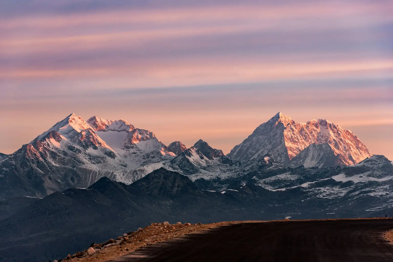
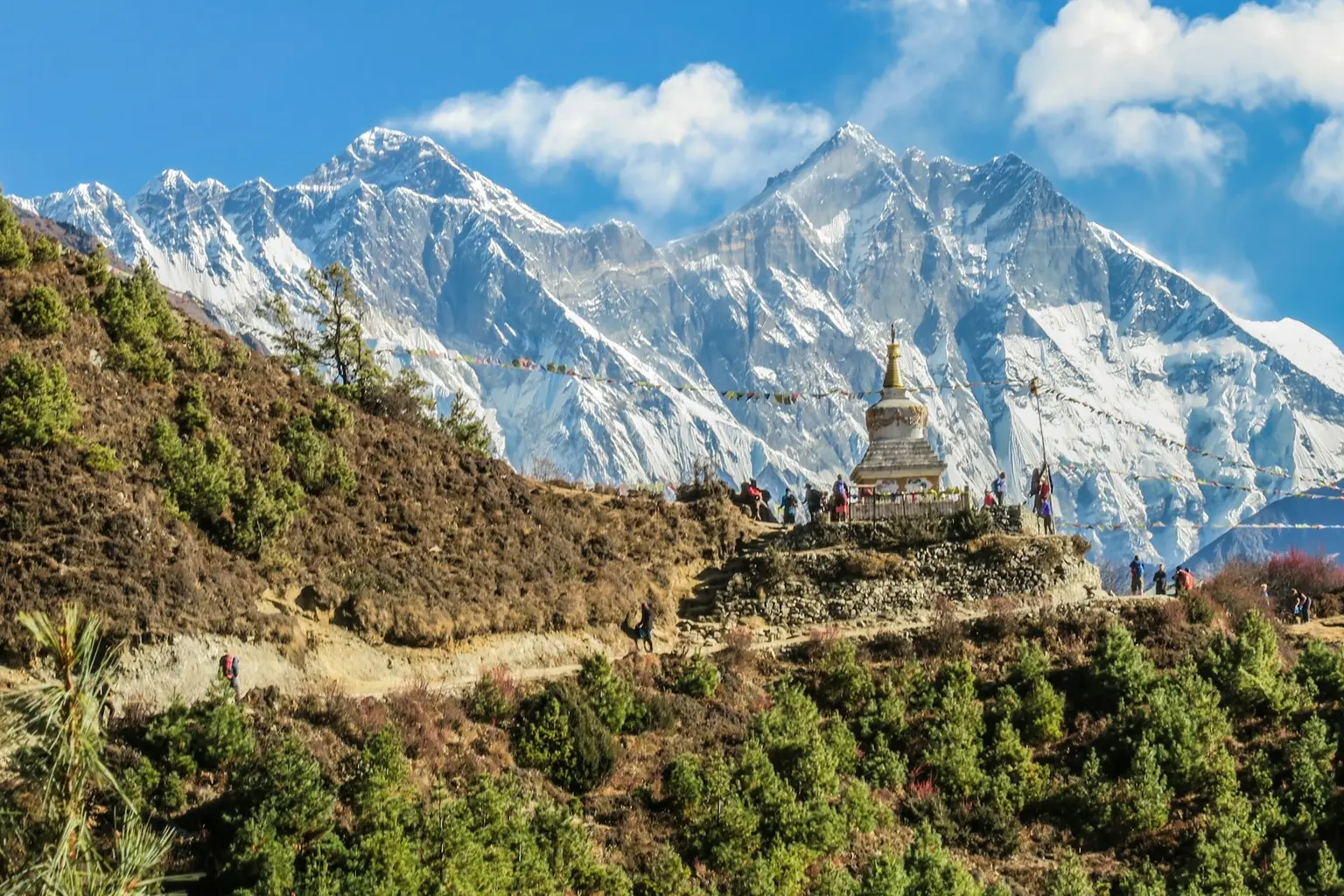
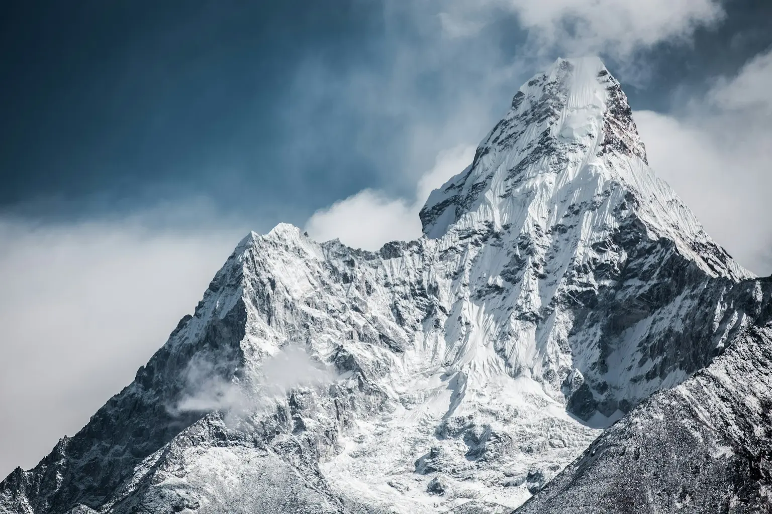
If you have dreamed of finding a place where time has truly stopped, the Nar Phu Valley is that place. Fewer than 500 trekkers per year enter this restricted permit zone — a hidden canyon accessed through a dramatic gorge off the Annapurna Circuit at Koto, leading to two of the most extraordinary settlements in the Himalaya. Phu village, an ancient Tibetan trading post at 4,080m, sits beneath the ice-draped face of Himlung Himal, its flat-roofed stone houses and centuries-old monastery unchanged for generations. Nar, a medieval village clinging to a steep hillside, guards 500-year-old Buddhist murals of breathtaking artistry. Between these time-capsule villages and the outside world stands the Kang La Pass at 5,243m, a serious high-altitude crossing that delivers panoramic views of Annapurna II, Gangapurna, and the Tilicho massif. This 14-day expedition suits experienced trekkers who crave genuine remoteness and cultural depth over comfort. The restricted area permit and mandatory licensed guide ensure the valley remains pristine and uncrowded. Spring and autumn are the only viable seasons, with autumn offering the most stable weather for the Kang La crossing. No other trek in Nepal combines this level of cultural immersion, wilderness isolation, and high-altitude challenge.

Want more detail on this route?

Read our full route guide with trail conditions, permits, and planning tips.

Route Guide

Highlights

Enter the restricted Nar Phu Valley seen by fewer than 500 trekkers per year
Cross the dramatic Kang La Pass at 5,243m with panoramic Annapurna views
Explore Phu village, an ancient Tibetan trading post beneath Himlung Himal
View 500-year-old Buddhist murals in Nar's medieval monastery
Trek through a spectacular entrance gorge with sheer 500m canyon walls
Experience Tibetan Buddhist culture preserved in near-total isolation

Itinerary

14 days
Highest stop
4,800 m
Day 8
Biggest climb
+960 m
Day 3
Over 2,500 m
10 days
of 14

Day 1 of 14 · Arrival in Kathmandu

1,400 m

2,500 m · altitude zone
  1. Day 1

    Arrival in Kathmandu

    • 1,400 m
    • Hotel
    • Dinner

    Arrive at Tribhuvan International Airport in Kathmandu (1,400m) where our representative meets you and transfers you to your hotel in Thamel. The afternoon is dedicated to trek briefing and permit verification — the Nar Phu restricted area permit requires passport copies, photos, and police check documentation. Your guide walks you through the 14-day itinerary and reviews the specialized gear requirements for this high-altitude restricted zone trek.

  2. Day 2

    Drive to Koto (Nar Phu Gate)

    • 2,600 m
    • Up1,200 m from day 1
    • Teahouse
    • Breakfast, Lunch, Dinner

    Depart Kathmandu at dawn for the long 8-10 hour drive to Koto (2,600m), following the Prithvi Highway west to Dumre, then turning north on the Besisahar road into the Marsyangdi Valley. The final section follows the Annapurna Circuit jeep road through Besisahar, Ngadi, and Bahundanda before reaching Koto — the police checkpoint and gateway to the restricted Nar Phu Valley.

    See Koto on the map
  3. Day 3

    Trek to Meta

    • 3,560 m
    • Up960 m from day 2
    • Teahouse
    • Breakfast, Lunch, Dinner
    • Biggest climb

    Enter the Nar Phu Valley through its dramatic entrance gorge, trekking approximately 14 km over 6-7 hours from Koto (2,600m) to Meta (3,560m), ascending 960m through one of the most spectacular canyon sections in the Himalaya. The trail crosses the Nar Khola on a wooden bridge just beyond Koto and immediately plunges into a narrow canyon where sheer rock walls rise 500 metres on either side, sometimes narrowing to barely wider than the trail itself.

    See Meta on the map
  4. Day 4

    Trek to Phu Village

    • 4,080 m
    • Up520 m from day 3
    • Teahouse
    • Breakfast, Lunch, Dinner

    Trek approximately 12 km over 6-7 hours from Meta (3,560m) to Phu village (4,080m), ascending 520m through an increasingly arid and wind-scoured landscape. The trail follows the Phu Khola upstream through a wide valley flanked by towering limestone cliffs. You pass through Kyang — a ruined settlement — and several ancient chortens before the trail climbs to the broad plateau where Phu village sits beneath the imposing Himlung Himal (7,126m).

  5. Day 5

    Exploration Day in Phu

    • 4,080 m
    • Teahouse
    • Breakfast, Lunch, Dinner

    A full rest and exploration day in Phu village (4,080m) for acclimatization and cultural immersion. The recommended acclimatization hike ascends to the ruins of the old Phu fortress above the village at approximately 4,500m, a 2-3 hour round trip that provides spectacular views of Himlung Himal and the surrounding peaks. The remainder of the day is spent exploring the village, visiting the monastery, and interacting with the villagers.

  6. Day 6

    Trek to Nar Village

    • 4,110 m
    • Up30 m from day 5
    • Teahouse
    • Breakfast, Lunch, Dinner

    Trek from Phu (4,080m) back down the valley and across the high pastures to Nar village (4,110m), covering approximately 10 km over 5-6 hours. The route backtracks to the junction near Kyang before branching east on a trail that climbs over a minor pass and traverses high grazing meadows to reach Nar, perched on a hillside above the Nar Khola.

  7. Day 7

    Exploration Day in Nar

    • 4,110 m
    • Teahouse
    • Breakfast, Lunch, Dinner

    A second acclimatization and exploration day, this time based in Nar village (4,110m). The recommended hike climbs to Nar Phedi (4,400m) on the slopes above the village, following an ancient yak herder's trail through alpine scrub and boulder fields. The round trip takes 3-4 hours and provides critical altitude exposure before the Kang La Pass crossing in two days.

  8. Day 8

    Trek to Kang La Base Camp

    • 4,800 m
    • Up690 m from day 7
    • Teahouse
    • Breakfast, Lunch, Dinner
    • Highest stop

    Depart Nar village and trek approximately 8 km over 5-6 hours to Kang La Base Camp (4,800m), ascending 690m through barren high-altitude terrain. The trail follows the Nar Khola upstream before turning south into a glacial side valley. The landscape is stark and treeless — loose rock, glacial moraine, and sparse brown grass scattered across a windswept plateau beneath the imposing walls guarding Kang La Pass.

  9. Day 9

    Cross Kang La Pass (5,243m), Descend to Ngawal

    • 3,657 m
    • Down1,143 m from day 8
    • Teahouse
    • Breakfast, Lunch, Dinner

    The defining day of the Nar Phu trek. Depart base camp at 4:00 AM by headlamp, ascending 443m over approximately 3 km to reach Kang La Pass (5,243m) in 3-4 hours. The descent from the pass drops steeply through moraine and alpine meadows for approximately 14 km over 4-5 hours to Ngawal (3,657m) in the Manang Valley. Total walking time: 8-10 hours.

  10. Day 10

    Trek to Manang

    • 3,540 m
    • Down117 m from day 9
    • Teahouse
    • Breakfast, Lunch, Dinner

    A gentle and scenic trek of approximately 8 km over 3-4 hours from Ngawal (3,657m) to Manang (3,540m), losing a modest 117m of elevation along the broad Manang Valley. The trail passes through open fields, ancient Buddhist monuments, and small villages before reaching Manang, the largest settlement in the upper Marsyangdi Valley and the cultural hub of the Manang District.

    See Manang on the map
  11. Day 11

    Trek to Chame, Drive toward Besisahar

    • 2,670 m
    • Down870 m from day 10
    • Teahouse
    • Breakfast, Lunch, Dinner

    Descend from Manang (3,540m) through the Marsyangdi Valley, trekking approximately 12 km over 4-5 hours to Chame (2,670m) via Upper Pisang, Bratang, and the apple orchards of the mid-valley. From Chame, board a local jeep for the bumpy 3-4 hour drive along the valley road toward Besisahar, covering the lower circuit trail sections by vehicle. Total elevation loss: 870m on foot.

  12. Day 12

    Drive to Kathmandu

    • 1,400 m
    • Down1,270 m from day 11
    • Hotel
    • Breakfast, Dinner

    Full-day drive from the Marsyangdi Valley to Kathmandu (1,400m), covering approximately 180 km over 7-8 hours along the Annapurna Circuit road and Prithvi Highway. The route follows the Marsyangdi River downstream to Dumre junction, then joins the main east-west highway along the Trisuli River through Mugling and Kurintar before climbing over the final ridge into the Kathmandu Valley.

  13. Day 13

    Free Day in Kathmandu

    • 1,400 m
    • Hotel
    • Breakfast

    A full rest and exploration day in Kathmandu (1,400m) to recover from the trek and immerse yourself in the cultural wealth of the Kathmandu Valley. Recommended visits include Boudhanath Stupa — the largest Buddhist stupa in Nepal, surrounded by Tibetan monasteries — and Pashupatinath Temple, the most sacred Hindu site in the country, where cremation ceremonies take place on the ghats of the Bagmati River.

  14. Day 14

    Departure

    • 1,400 m
    • Breakfast

    Transfer from your hotel to Tribhuvan International Airport for your international departure. The drive takes approximately 30-45 minutes depending on Kathmandu's notoriously unpredictable traffic, so allow at least 3 hours before your scheduled departure. Your guide or company representative accompanies you to the terminal and assists with check-in.

Want a different pace?

A local guide can add a rest day, shorten a stage, or swap where you sleep. We reply within 24 hours.

Ask a guide on WhatsApp

What's Included

Best Time to Trek Nar Phu Valley

Month by month

Main seasons: Mar to May and Sep to Nov

Tap a month to add it to your plan.

Spring

Snow melts from the lower trails by late March, and Nar and Phu villages come alive after winter. Fewer permit holders than autumn means even more solitude in this restricted area.

Autumn

The most stable weather window for the Kang La Pass (5,243m) crossing — clear skies, minimal wind, and daytime temperatures that keep the high-altitude camping manageable.

From
$1,349/ person

Before you book

Is the Nar Phu Valley Trek right for you?

Straight answers from this trek's own plan. Tap Ask about this on anything you are unsure of, and we send it all to a local guide in one message.

Who this trek suits

Reserved for experienced trekkers craving genuine remoteness and Tibetan cultural immersion. Autumn offers the most stable weather for the Kang La Pass crossing at 5,243m, spring brings fewer trekkers to Phu and Nar villages, and the restricted permit ensures you share the trail with fewer than 500 visitors per year.

Can I walk it?

Level 3 of 4: Challenging.

6-8 hours walking per day

  • High passes, steep terrain, significant altitude
  • Prior multi-day trekking and good fitness required

The Kang La Pass (5,243m) requires strong fitness and altitude tolerance. You should have completed at least one multi-day trek above 4,000m before attempting this route. The remote setting means rescue options are limited.

How high does it go?

Highest point 5,243 meters. 10 of 14 days end above 2,500 meters.

Days above 2,500 m
10 of 14
Rest days to adjust
2

Above 2,500 m altitude sickness is possible for anyone, fit or not. Walk slowly, drink plenty and tell your guide how you feel. Our guides are trained Wilderness First Responders.

Where will I sleep?

  • 10teahouse nights
  • 3hotel nights

Teahouses are simple family-run lodges: a twin room, a shared dining room and home-cooked meals. Rooms get more basic the higher you go.

Teahouses by altitude

Who will I walk with?

Up to 12 trekkers per group

  • Guides trained as Wilderness First Responders
  • Guiding in 5 languages: English, German, French, Spanish, Nepali
  • Nepal Tourism Board Licensed, trekking since 2010
Meet the team

What if my plans change?

  1. You bookNo deposit
  2. 30 days beforeFree to cancel until here
  3. DepartureGuaranteed to run

You do not pay a deposit to hold your dates. Cancel for free up to 30 days before you start, and our departures are guaranteed, so a confirmed date runs.

What do other trekkers say?

4.9out of 5, from 1,200+ reviews
“As a solo female traveler, I felt completely safe the entire time.”
Emma Richardson, Annapurna Circuit, 2024
Read more reviews

Still unsure? Ask a guide who has walked it.

Tap Ask about this on any answer above to add it to your message.

A real person in our Thamel office replies within 24 hours. Asking costs nothing.

The route

Where the route goes

Every stop on a satellite map, numbered in order, with the peaks around them. The line follows the trail as mapped on OpenStreetMap, and runs straight where no trail is mapped. Tap a stop on the map or in the list for its elevation and where you sleep, or switch to the topo map for contour lines. Pick 3D to see the valleys and passes in relief, and fly along the trail.

5 stopsWalk the route stop by stop

Height along the trail: 5 stops over 70.0 km of the route as drawn on the map, from Koto at 2,600 meters to Manang at 3,537 meters.

Ground height along the OpenStreetMap trail, from the Copernicus DEM GLO-90 (© DLR e.V. 2010-2014 and © Airbus Defence and Space GmbH 2014-2018, provided under COPERNICUS by the European Union and ESA). Stop heights are our own. Dashed: no mapped trail, a straight line between the stops.

  • Trail, from OpenStreetMap
  • Straight line where the trail is not mapped
  • Start
  • Finish
  • Overnight stop
  • Mountain peak

5 stops, in order

Frequently asked questions

Similar treks nearby

Other routes in the Annapurna region.

  • Annapurna Circuit Trek

    16 daysChallenging

    Highest point 5,416 m

    Best: Spring, Autumn

    from$1,099

  • Annapurna Base Camp Trek

    11 daysModerate

    Highest point 4,130 m

    Best: Spring, Autumn

    from$949

  • Mardi Himal Trek

    7 daysModerate

    Highest point 4,500 m

    Best: Spring, Autumn

    from$749

Compare0/3
Add a trek
Add a trek
Add a trek