Skip to content
+977-9861293812
WhatsApp
Trek and Tour Nepal
Langtang Region · Nepal

Ruby Valley Trek

4.6from 38 reviews
Days
10
Highest point
3,842 m
Level
Moderate
Best months
Mar to May and Sep to Nov

Overview

The Ruby Valley lies in the shadow of the Ganesh Himal massif — a wide, glacier-carved basin at around 3,200 metres where the rivers run over beds of semi-precious stone and the forests of oak, rhododendron, and blue pine have rarely been touched by tourist footfall. Named for the rubies historically extracted from the Trisuli and Ankhu Khola river systems, the valley is now accessible only to the curious and unhurried trekker willing to leave the main corridor behind. This ten-day route follows the approach up through Tamang hill villages from Betrawati, climbing through progressively wilder terrain to reach the Ruby Valley's centrepiece at Somdang (3,270m) — a semi-abandoned mining settlement surrounded by extraordinary mountain scenery. A day viewpoint walk from Somdang pushes to 3,842m for the closest unobstructed view of the Ganesh range available without crossing a technical pass. The scale of these peaks — Ganesh I at 7,422m rising almost directly above — is impressive in a way that requires physical proximity to properly understand. The Ruby Valley trek achieves a balance that the more demanding Ganesh Himal Circuit does not: access to the same remote valley country and cultural richness without the strenuous Pangsang Pass crossing. One camping night is required at Chalish, on the approach above the treeline — a small adventure within a manageable adventure. Below that, the route stays on teahouse terrain through Tamang villages where your arrival is still sufficiently novel to draw a genuine welcome. This is trekking in a region Nepal has barely discovered.

Want more detail on this route?

Read our full route guide with trail conditions, permits, and planning tips.

Route Guide

Highlights

Explore the Ruby Valley — named for semi-precious stones found in its rivers
Close-up views of the Ganesh Himal range from Somdang viewpoint
Trek through pristine forests of oak, rhododendron, and blue pine
Visit remote Tamang villages where tourism is a novelty
Discover the semi-abandoned mining village of Somdang

Itinerary

10 days
Highest stop
3,842 m
Day 6
Biggest climb
+1,480 m
Day 2
Over 2,500 m
4 days
of 10

Day 1 of 10 · Drive to Betrawati

620 m

2,500 m · altitude zone
  1. Day 1

    Drive to Betrawati

    • 620 m
    • Teahouse
    • Breakfast, Lunch, Dinner

    A 3-4 hour drive northwest from Kathmandu on the Trisuli Highway brings you to Betrawati (620m), a market town on the Trisuli River system that serves as the trailhead for the Ruby Valley route. The road is paved throughout and the journey comfortable, passing through the Nuwakot district with its terraced rice paddies and Tamang villages visible on the hillsides above the valley floor. Betrawati itself is a busy local market with several teahouses catering to the occasional trekking group.

  2. Day 2

    Trek to Grang

    • 2,100 m
    • Up1,480 m from day 1
    • Teahouse
    • Breakfast, Lunch, Dinner
    • Biggest climb

    The trail from Betrawati climbs steeply northwest through terraced farmland and forest to reach Grang (2,100m), gaining approximately 1,480 metres over 12-14 km in 6-7 hours. This is the hardest single day of ascent on the Ruby Valley trek, and it should be approached at a deliberate pace with regular water breaks and snack stops. The lower trail passes through Nagadi and several smaller hamlets before entering the oak and rhododendron forest belt between 1,500m and 2,000m.

  3. Day 3

    Trek to Rupchet

    • 2,800 m
    • Up700 m from day 2
    • Teahouse
    • Breakfast, Lunch, Dinner

    From Grang the trail continues northwest along the ridge system, climbing through dense rhododendron and oak forest to Rupchet (2,800m) over 10-12 km in 5-6 hours. The forest on this section is exceptional — ancient tree rhododendrons draped in moss and lichen create a living tunnel over the trail, and in spring (April) the blossom transforms the canopy into a cathedral of red, pink, and white. Red pandas are occasionally spotted in this forest, particularly in the early morning hours when mist still clings to the ridges.

  4. Day 4

    Trek to Chalish

    • 3,450 m
    • Up650 m from day 3
    • Camping
    • Breakfast, Lunch, Dinner

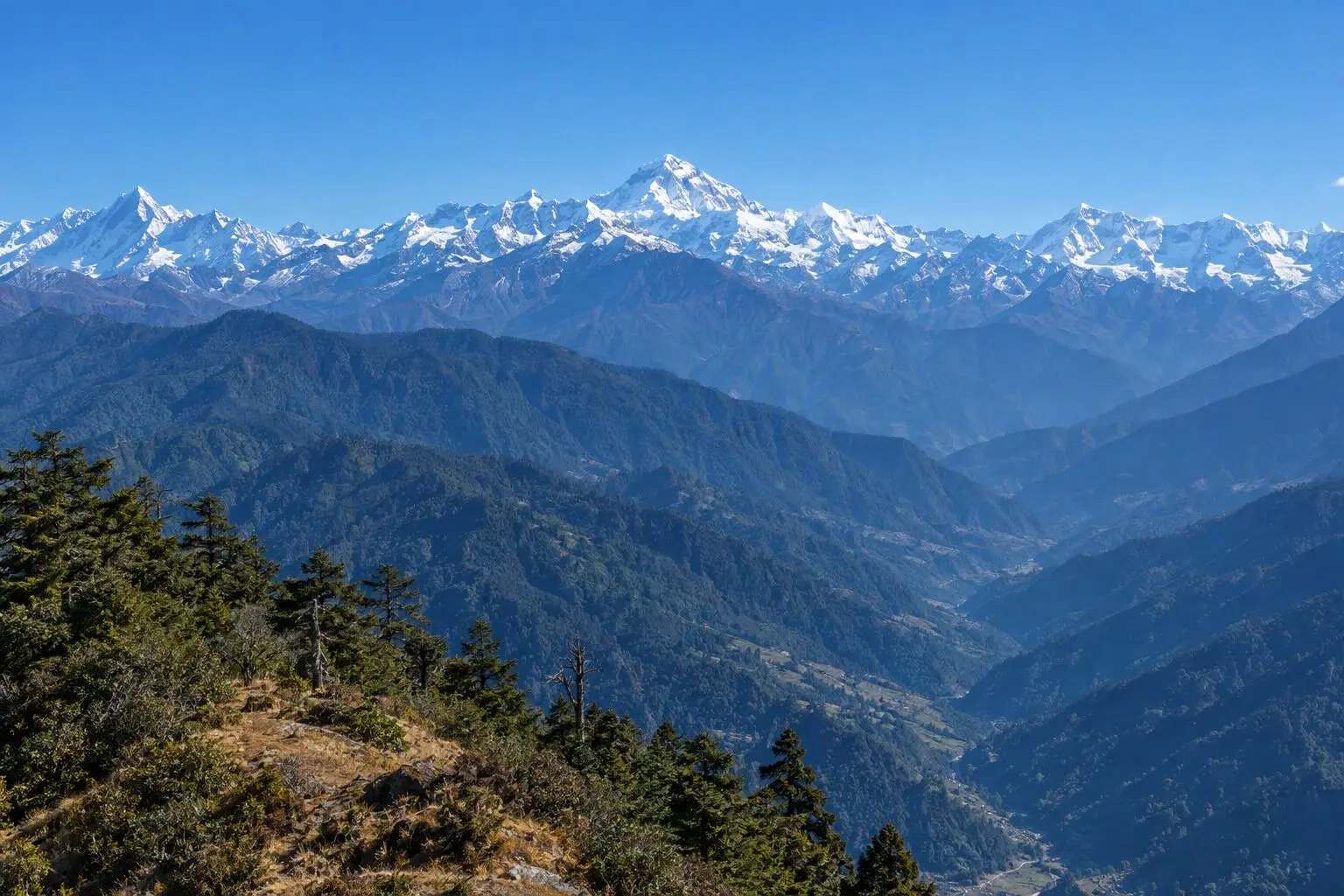
    The camping day. From Rupchet the trail climbs above the treeline into open alpine pasture, ascending to Chalish (3,450m) over 8-10 km in 5-6 hours. The landscape changes completely above the rhododendron belt — dwarf juniper and alpine grasses give way to bare rock and boulder fields, and the view to the north opens suddenly and dramatically with the full span of the Ganesh Himal appearing above the ridge. Ganesh I (7,422m), Ganesh II, III, and IV stretch across the horizon in a chain of ice and rock that is simply stunning at this proximity.

  5. Day 5

    Trek to Somdang

    • 3,270 m
    • Down180 m from day 4
    • Teahouse
    • Breakfast, Lunch, Dinner

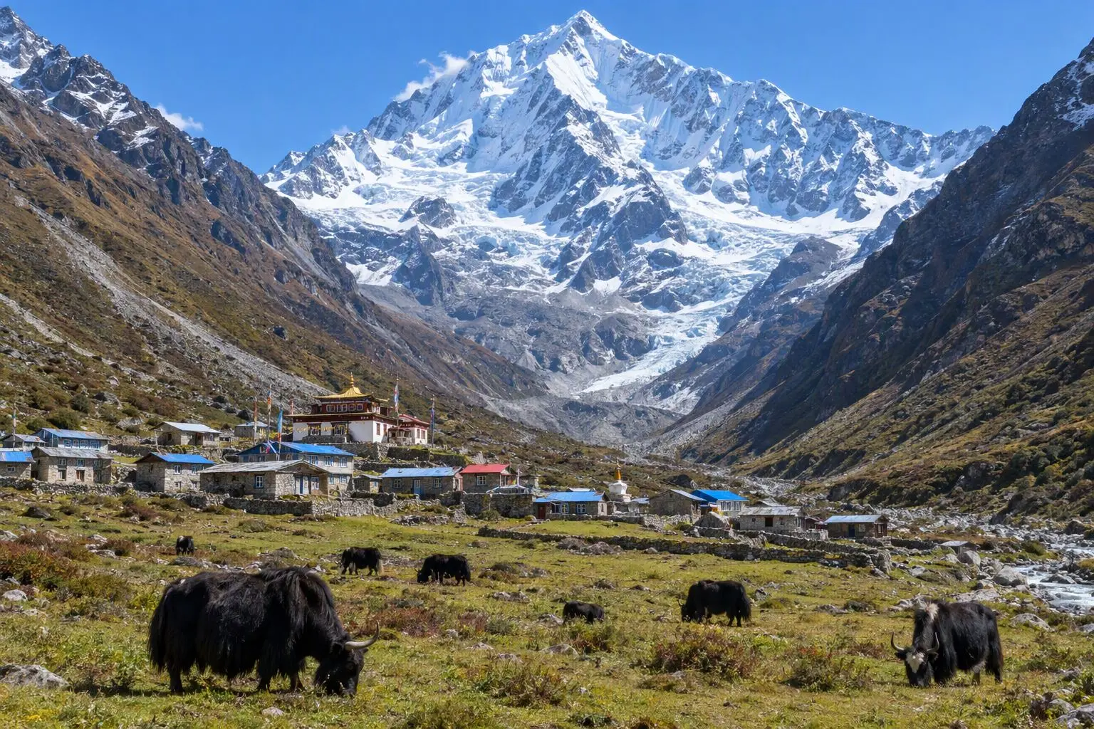
    From Chalish the trail descends slightly before traversing northwest into the Ruby Valley proper, reaching Somdang (3,270m) over 8-10 km in 4-5 hours. The Ruby Valley reveals itself gradually as you approach from the east: a broad glacial basin with a flat floor threaded by braided streams, surrounded by forested ridges, and dominated by the Ganesh peaks rising above the northern horizon. The valley has the specific quality of high-altitude glacial basins — spacious, slightly austere, and profoundly quiet.

    See Somdang on the map
  6. Day 6

    Explore Somdang, Ganesh Himal Views

    • 3,842 m
    • Up572 m from day 5
    • Teahouse
    • Breakfast, Lunch, Dinner
    • Highest stop

    An acclimatisation and exploration day based in Somdang, with a morning walk to the 3,842m viewpoint above the valley floor. The climb from the village gains approximately 570 metres over 3-4 km on a clear trail through boulder country to a high knoll with unobstructed views of the entire Ganesh massif. Ganesh I (7,422m) is directly to the north at this point, its South Ridge descending in a series of enormous buttresses to the valley floor. Himalchuli appears to the northwest and Langtang Lirung to the east. On clear mornings, the silence at this viewpoint is absolute.

    See Somdang on the map
  7. Day 7

    Trek to Tipling

    • 2,100 m
    • Down1,742 m from day 6
    • Teahouse
    • Breakfast, Lunch, Dinner

    From Somdang the trail descends east toward Tipling (2,100m), losing over 1,100 metres in descent over 10-12 km — a 5-6 hour day that moves from the open alpine basin of the Ruby Valley back into forested terrain and eventually into the cultivated terraces of the lower Ankhu Khola valley. The descent is steep in sections, particularly above the treeline, and trekking poles significantly reduce the impact on knees over the rocky upper trail.

    See Tipling on the map
  8. Day 8

    Trek to Lapagaon

    • 1,450 m
    • Down650 m from day 7
    • Teahouse
    • Breakfast, Lunch, Dinner

    A straightforward final trekking day from Tipling down the Ankhu Khola valley to Lapagaon (1,450m) — 12-14 km over 5-6 hours of gradually descending trail following the river downstream. The vegetation becomes increasingly subtropical as altitude drops: the forest of oak and rhododendron gives way to scrub and eventually to the banana groves and terraced mustard fields of the lower valley. The trail crosses the river several times on suspension bridges, each crossing a pause to watch the clear, cold water rushing south toward the Trisuli.

  9. Day 9

    Drive to Kathmandu

    • 1,400 m
    • Down50 m from day 8
    • Hotel
    • Breakfast, Lunch

    The drive from Lapagaon to Kathmandu follows the valley road to the Trisuli Highway and south to the capital — approximately 5-6 hours in a private 4WD. The first section of road from Lapagaon is rough in places, requiring slow, careful driving over rocky sections, but improves significantly once the Trisuli Highway is reached. Kathmandu arrives in the late afternoon, heralded by the characteristic fog, traffic, and energy of the Kathmandu Valley. Hotel in Thamel, hot shower, and a celebratory dinner mark the end of ten days in one of Nepal's least-visited corners.

  10. Day 10

    Departure

    • 1,400 m
    • Breakfast

    A final breakfast before a private vehicle transfer to Tribhuvan International Airport. The 30-45 minute drive is straightforward in the early morning. If your flight is later in the day, the nearby Pashupatinath Temple on the Bagmati River offers a compelling final morning — one of South Asia's great Hindu pilgrimage sites and a remarkable counterpoint to the Buddhist cultural immersion of the Tamang villages that defined the past ten days.

Want a different pace?

A local guide can add a rest day, shorten a stage, or swap where you sleep. We reply within 24 hours.

Ask a guide on WhatsApp

What's Included

Best Time to Trek Ruby Valley

Month by month

Main seasons: Mar to May and Sep to Nov

Tap a month to add it to your plan.

Spring

April-May delivers excellent conditions. Forest sections are in bloom. Moderate temperatures at altitude.

Autumn

October-November offers clear Ganesh Himal panoramas and dry trails. The valley's golden autumn colours add warmth to photography.

From
$799/ person

Before you book

Is the Ruby Valley Trek right for you?

Straight answers from this trek's own plan. Tap Ask about this on anything you are unsure of, and we send it all to a local guide in one message.

Who this trek suits

A quieter alternative to the Ganesh Himal Circuit for trekkers wanting Ruby Valley access without the strenuous Pangsang Pass. The route reaches 3,842m — challenging enough to feel like an achievement but below the serious altitude sickness threshold. Perfect for those seeking solitude.

Can I walk it?

Level 2 of 4: Moderate.

5-7 hours walking per day

  • Some steep sections, moderate altitude
  • Basic fitness and some hiking experience recommended

Moderate fitness needed. Lower and less demanding than the Ganesh Himal Circuit. Daily walking is 5-7 hours. One camping night required. Prior trekking experience recommended but not essential.

How high does it go?

Highest point 3,842 meters. 4 of 10 days end above 2,500 meters.

Days above 2,500 m
4 of 10
Rest days to adjust
0

Above 2,500 m altitude sickness is possible for anyone, fit or not. Walk slowly, drink plenty and tell your guide how you feel. Our guides are trained Wilderness First Responders. This plan has no separate rest day; ask us if you want one added.

Where will I sleep?

  • 7teahouse nights
  • 1tent night
  • 1hotel night

Teahouses are simple family-run lodges: a twin room, a shared dining room and home-cooked meals. Rooms get more basic the higher you go.

Teahouses by altitude

Who will I walk with?

Up to 12 trekkers per group

  • Guides trained as Wilderness First Responders
  • Guiding in 5 languages: English, German, French, Spanish, Nepali
  • Nepal Tourism Board Licensed, trekking since 2010
Meet the team

What if my plans change?

  1. You bookNo deposit
  2. 30 days beforeFree to cancel until here
  3. DepartureGuaranteed to run

You do not pay a deposit to hold your dates. Cancel for free up to 30 days before you start, and our departures are guaranteed, so a confirmed date runs.

What do other trekkers say?

4.9out of 5, from 1,200+ reviews
“The team customized the itinerary so everyone could enjoy at their own pace.”
Markus Weber, Langtang Valley, 2025
Read more reviews

Still unsure? Ask a guide who has walked it.

Tap Ask about this on any answer above to add it to your message.

A real person in our Thamel office replies within 24 hours. Asking costs nothing.

The route

Where the route goes

Every stop on a satellite map, numbered in order. The line follows the trail as mapped on OpenStreetMap. Tap a stop on the map or in the list for its elevation and where you sleep, or switch to the topo map for contour lines. Pick 3D to see the valleys and passes in relief, and fly along the trail.

5 stopsWalk the route stop by stop

Height along the trail: 5 stops over 40.4 km of the route as drawn on the map, from Syabrubesi at 1,503 meters to Tipling at 1,800 meters.

Ground height along the OpenStreetMap trail, from the Copernicus DEM GLO-90 (© DLR e.V. 2010-2014 and © Airbus Defence and Space GmbH 2014-2018, provided under COPERNICUS by the European Union and ESA). Stop heights are our own.

  • Trail, from OpenStreetMap
  • Start
  • Finish
  • Overnight stop
  • Stop on the way

5 stops, in order

Frequently asked questions

Similar treks nearby

Other routes in the Langtang region.

  • Langtang Valley Trek

    7 daysModerate

    Highest point 3,800 m

    Best: Spring, Autumn, Winter

    from$649

  • Gosainkunda Lake Trek

    8 daysModerate

    Highest point 4,380 m

    Best: Spring, Autumn

    from$599

  • Helambu Trek

    6 daysEasy

    Highest point 3,650 m

    Best: Spring, Autumn, Winter

    from$450

Compare0/3
Add a trek
Add a trek
Add a trek