


The Khumbu region — encompassing Sagarmatha National Park and its buffer zones — is among the world's most closely studied high-altitude ecosystems. It is also among the most visited, with over 50,000 foreign trekkers passing through annually. The tension between these two realities — a globally significant ecosystem under intense tourism pressure — defines conservation efforts here.
Understanding what you are walking through transforms the trekking experience. The rocky moraines, the birch and rhododendron forests, the glacial lakes and high alpine meadows are not merely scenic backdrops. They are a functioning ecosystem that extends from 2,845m at the park entrance near Monjo to 8,849m at the summit of Everest — the world's greatest single vertical wilderness zone.
Sagarmatha National Park: Foundation Facts
1976
1979
1,148 km²
275 km²
2,845m (Monjo)
8,849m (Mt. Everest)
19, including Khumbu (longest)
50,000–60,000 foreign visitors
NPR 3,000 (~$22 USD)
Sagarmatha Pollution Control Committee (SPCC)
Sagarmatha is Nepal's most visited national park by a significant margin. The park protects not only the approaches to the world's highest peaks but also the communities — the Sherpa people — whose culture, religious sites, and mountain knowledge are as much a part of the park's heritage as its glaciers and wildlife.
The UNESCO designation was awarded in 1979, five years after the park's founding, recognising the extraordinary combination of natural and cultural significance.
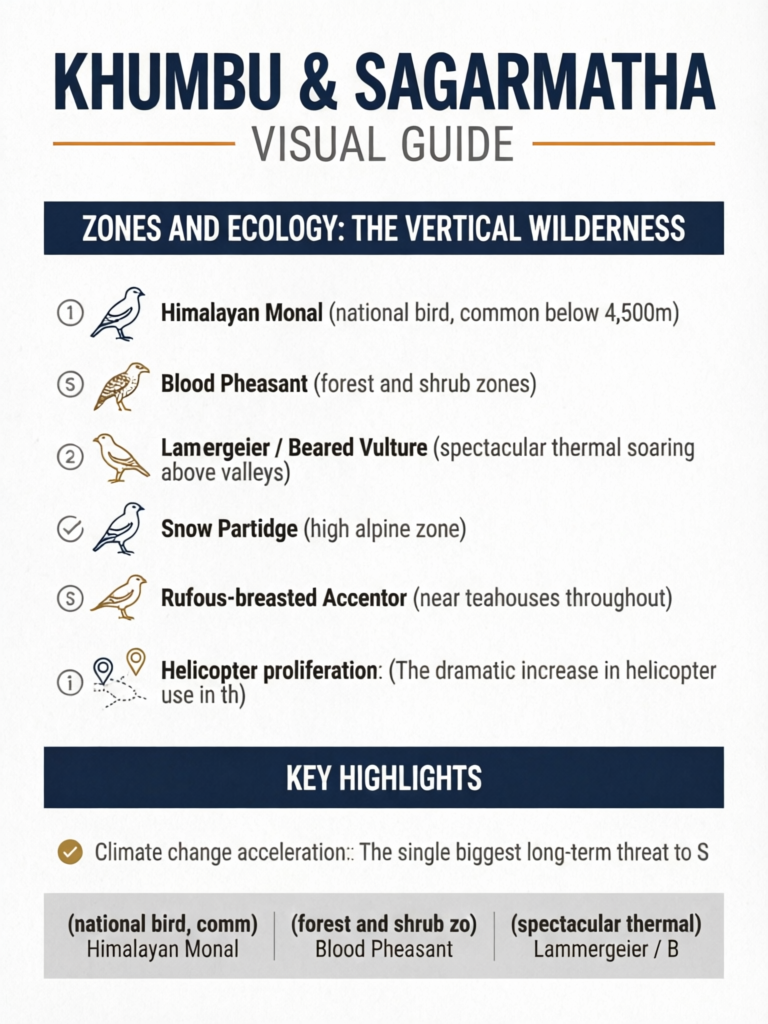
Zones and Ecology: The Vertical Wilderness
The park's 6,000-metre elevation range creates dramatically different ecological communities within its boundaries.
Subalpine Forest Zone (2,845m–3,500m)
The lower reaches of the park, traversed on the approach through Namche Bazaar, support the only closed-canopy forest in the park. Species include:
Trees: Silver fir (Abies spectabilis), Himalayan birch (Betula utilis), and several rhododendron species, including the iconic Rhododendron arboreum whose red blooms colour the spring trails.
Understory: Dwarf bamboo, rose hip, and various medicinal herbs including varieties used in traditional Sherpa medicine.
Wildlife concentration: This zone supports the highest density of wildlife in the park, including the critically important community of Himalayan tahr, musk deer, and snow leopard that depend on the forests for shelter and forage.
The forest zone suffered severe depletion before the park was established. Historical demand for firewood from mountaineering expeditions and early tourism stripped hillsides that have only partially recovered. The park now enforces strict regulations on wood burning.
Alpine Meadow Zone (3,500m–4,500m)
Above the treeline, the landscape transitions to high-altitude meadows and shrublands. The dominant vegetation includes various juniper species (Juniperus recurva), dwarf willows, and high-altitude grasses.
These meadows were traditionally used for summer yak grazing (called "yarsas" or summer pastures). The seasonal movement of yak herds remains an integral part of Sherpa pastoral culture, though the grazing pressure on park meadows is managed within the park's management plans.
Bird life is exceptional in this zone — the Himalayan monal (Lophophorus impejanus), Nepal's national bird, is most frequently spotted in rhododendron and alpine scrub between 3,000–4,500m. The brilliant iridescent plumage of the male monal makes it one of Nepal's most spectacular bird sightings.
High Alpine Zone (4,500m–5,500m)
Characterised by cushion plants, mosses, and sparse grasses adapted to freeze-thaw cycles. The yakfields around Dingboche (4,410m) represent the upper limit of meaningful vegetation cover. Above this, life is increasingly sparse.
Notable plant: Saussurea gossypiphora — the Himalayan edelweiss equivalent — grows in the highest elevations, reaching up to 5,600m, making it one of the world's highest flowering plants. Look for the white woolly heads on rocky slopes above Lobuche.
Nival Zone (Above 5,500m)
Above 5,500m, permanent ice, snow, and bare rock dominate. Microbial communities exist on glacial surfaces, and occasional high-altitude birds (including bar-headed geese migrating over Everest) pass through. Otherwise, this is a mineral landscape supporting virtually no plant life.
The Khumbu Glacier: Nepal's Living Ice Laboratory
The Khumbu Glacier is Nepal's longest glacier at approximately 17 km, and one of the most scientifically monitored glaciers in the world. It flows from the Western Cwm of Everest at around 7,600m down to its terminus near Lobuche at approximately 4,900m.
The Khumbu Icefall
The dramatic Khumbu Icefall — the broken, chaotic ice cliff that all Everest climbers must navigate — results from the glacier's rapid descent over a steep bedrock step between 5,400m and 6,200m. The icefall moves at a rate of approximately 1–1.5 metres per day, making it one of the fastest-moving sections of any Himalayan glacier.
Every spring, the professional icefall doctors of the Icefall Doctors' Association install ropes and ladders across the crevasses for the expedition season. The icefall has claimed the lives of more climbers than any other section of the Everest route.
Glacier Lake Formation: The GLOF Risk
Glacial lake outburst floods (GLOFs) are a growing hazard in the Khumbu. As the glacier retreats and meltwater accumulates, moraine-dammed lakes form. The sudden failure of these dams can release catastrophic floods downstream.
Imja Tsho Lake (also called Imja Lake), near Dingboche at approximately 5,010m, is the Khumbu's best-documented glacial lake hazard. It has grown from a tiny pond in the 1960s to a lake over 2 km long. In 2016, a GLOF mitigation project lowered the lake level by draining controlled volumes. Scientists from ICIMOD (International Centre for Integrated Mountain Development) continue to monitor Imja and 20 other glacial lakes in the Khumbu watershed.
Glacier Retreat Data
Scientific monitoring shows the Khumbu Glacier has retreated significantly since the 1950s:
- The terminus has retreated approximately 5 km since the 1950s
- Thinning rates of 1–2m per year have been measured
- Surface area loss of approximately 13% over the last 50 years
What this means for trekkers: the moraine landscape you traverse between Dingboche and Lobuche looks dramatically different from photographs taken in the 1970s and 1980s. Glacial ponds appear, trails change, and the relationship between the hiking path and the ice surface shifts over years.
Wildlife: What Lives in Sagarmatha
Snow Leopard (Panthera uncia)
The park is home to an estimated 3–5 snow leopards. You will almost certainly not see one — the snow leopard is among the most elusive large mammals on Earth. But presence tracking using camera traps has confirmed a small, stable population in the upper reaches of the park.
Signs of snow leopard activity — scrape marks on rocks, prey remains, and pugmarks in snow — can be found by trained guides in the high alpine zone. If your guide points out potential snow leopard signs, treat it as a significant finding.
Himalayan Tahr (Hemitragus jemlahicus)
The most commonly sighted large mammal in Sagarmatha, the Himalayan tahr is a stocky wild goat with striking curved horns and thick reddish-brown coats. Males carry impressive manes. You are likely to see groups on rocky hillsides throughout the park — particularly around Namche Bazaar, Khumjung, and the hillsides between Tengboche and Dingboche. See the complete Himalayan wildlife guide.
Musk Deer (Moschus chrysogaster)
The shy and solitary musk deer inhabits the forest zone, most commonly seen at dawn and dusk. The males possess the musk gland that gives the species its name — historically among the most valuable wildlife products in Nepal, driving heavy poaching pressure before protection.
Red Panda (Ailurus fulgens)
The red panda exists in small numbers in the lower forest zones of the park — primarily in the rhododendron and bamboo forests below 3,500m. Sightings are rare but genuine. Alert guides occasionally spot them during early morning or evening walks in the Namche area.
Birds
Bird diversity in Sagarmatha includes:
- Himalayan Monal (national bird, common below 4,500m)
- Blood Pheasant (forest and shrub zones)
- Yellow-billed Chough (abundant at altitude — the birds you see near Gorak Shep and EBC)
- Lammergeier / Bearded Vulture (spectacular thermal soaring above valleys)
- Snow Partridge (high alpine zone)
- Rufous-breasted Accentor (near teahouses throughout)
Conservation Achievements and Ongoing Challenges
Achievements
Forest regeneration: The strict prohibition on cutting trees within the park, enforced since the late 1970s, has produced measurable forest recovery on hillsides that were stripped before 1976. The reforestation around Tengboche, Namche, and Phortse is real and visible.
Wildlife population stability: Despite heavy trekking pressure, Himalayan tahr and musk deer populations have stabilised within the park. Poaching has been significantly reduced through ranger patrols and community awareness programmes.
Waste management infrastructure: The Sagarmatha Pollution Control Committee (SPCC) operates waste management facilities in Namche Bazaar and at key trail sites. The collection of non-biodegradable waste from the Everest Base Camp area has dramatically improved over the past decade. The SPCC has removed over 70 tonnes of waste from the mountain and surrounding areas since its inception.
Biodegradable waste composting: Several lodges in Namche and Tengboche now operate compost toilets and use compost for vegetable gardens — a virtuous cycle that reduces both waste and the food miles associated with supplies brought from Kathmandu.
Challenges
Wastewater management: The concentration of thousands of trekkers and hundreds of lodges in a limited number of villages (particularly Namche and Gorak Shep) creates significant wastewater pressure on streams and groundwater. Properly sealed septic systems are not universal.
Helicopter proliferation: The dramatic increase in helicopter use in the Khumbu — for resupply, tourism flights, and evacuation — creates noise pollution that researchers have linked to reduced wildlife activity in affected areas. The number of helicopter movements over the park has grown from a few hundred per year in the 1990s to thousands today.
Fuel wood use despite restrictions: Some lodges still use wood fuel despite regulations, particularly in winter. Enforcement remains inconsistent in remote settlements.
Climate change acceleration: The single biggest long-term threat to Sagarmatha's ecology is climate change. Glacier retreat, warming temperatures, and shifting precipitation patterns are already measurably altering vegetation zones and wildlife behaviour.
Trekker Responsibilities
Every trekker visiting Sagarmatha National Park has a direct impact on this ecosystem. The choices you make determine whether you are part of the solution or part of the problem.
Carry out all non-biodegradable waste. Do not leave batteries, film packaging, plastic wrappers, or any non-biodegradable item on the trail. Use the designated waste collection bins in Namche and Pheriche.
Use only solar-heated or gas-heated showers. Lodges that heat water with firewood are consuming the park's most pressured resource. Choose lodges using alternative energy where possible.
Hire local guides and porters. The economic argument for porters and guides is also an environmental one — a trekking industry that supports local employment creates incentives to protect the ecosystem that drives that income.
Stay on marked trails. Shortcutting switchbacks causes erosion that, on steep Himalayan terrain, can initiate landslides. The stone-paved sections of trail are maintained by community trail committees funded partly by your park entry fee.
Respect sacred sites. Monasteries, mani walls, and chortens are integral to the Sherpa cultural heritage that UNESCO recognised alongside the natural values. Walk clockwise around mani walls and chortens. Ask before photographing religious ceremonies.
Related Resources
How Can Trekkers Reduce Their Environmental Impact in the Khumbu?
Carry a reusable water bottle and use water purification instead of buying plastic bottles. Pack out all waste including used batteries. Stay on marked trails to prevent erosion. Support the Sagarmatha Pollution Control Committee by paying the garbage deposit and respecting waste management systems at teahouses. Choose agencies that practice Leave No Trace principles.
Frequently Asked Questions
How much is the Sagarmatha National Park entry fee?
The entry fee for foreign nationals is NPR 3,000 (approximately $22 USD) as of 2026. This is separate from the Khumbu Pasang Lhamu Rural Municipality fee.
What wildlife can I see in the Khumbu region?
Himalayan tahr, musk deer, Himalayan monal, Tibetan snowcock, and bearded vulture (lammergeier) are the most commonly sighted species. Snow leopard presence is confirmed but sightings are extremely rare on standard trekking routes.
Is the Khumbu Glacier retreating?
Yes. ICIMOD research shows the Khumbu Glacier has retreated significantly over recent decades, with measurable surface lowering and expansion of glacial lakes. This is visible to trekkers as exposed moraine and growing lake systems along the EBC route.
What conservation challenges does the Khumbu face?
Waste management from 50,000+ annual trekkers, deforestation for firewood, climate-driven glacier retreat, and maintaining traditional Sherpa land management practices against commercial pressures are the primary conservation challenges.
How is the Khumbu different from the Annapurna Conservation Area?
Sagarmatha National Park uses a strict national park model with government management. The Annapurna Conservation Area uses a community-based conservation model managed by NTNC-ACAP. Both are effective but structurally different.