

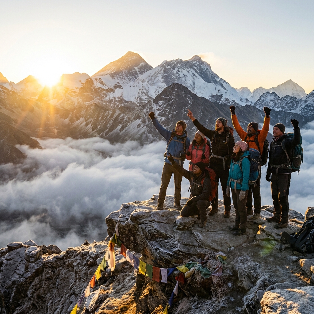
Nepal's high mountain passes are the punctuation marks of the trekking experience — the moments when you stop, look back at where you've come from and forward at where you're going, and feel the full weight of what the Himalaya represents. They are also, depending on conditions, some of the most dangerous terrain that non-mountaineers will ever traverse.
This guide covers Nepal's major trekking passes above 5,000 metres: their objective difficulty, the hazards specific to each, what gear is required, and the seasonal windows that determine whether crossing is safe or suicidal.
Grading System Used
This guide uses a modified trekking pass grading scale:
Grade 1 — Trail Pass: Well-marked path, no technical terrain, altitude is the primary challenge. Examples: Thorong La.
Grade 2 — Moderate Technical: Some rocky scrambling, possible snow slopes, crampons may be needed in shoulder seasons. Examples: Larkya La, Renjo La.
Grade 3 — Challenging Technical: Rocky scrambling plus glacier travel or steep snow. Crampons essential, ice axe useful. Examples: Cho La, Kongma La.
Grade 4 — Alpine: Glacier navigation with crevasse risk, steep technical climbing. Mountaineering skills required. Examples: Tashi Lapcha (Rolwaling).
The Major Passes: Complete Overview
Thorong La — Annapurna Circuit (5,416m)
Grade: 1 (altitude challenge) to Grade 2 (in snow conditions) Route: Thorong High Camp (4,950m) → Thorong La → Muktinath (3,710m) Ascent from High Camp: 466m Time: 3–4 hours ascent, 2–3 hours descent to Muktinath Crampons: Not required in most conditions; useful after fresh snowfall Best season: October–May; most reliable October–November and March–April Closure frequency: Moderate — several days per season
Thorong La is Nepal's most-crossed high pass, used by tens of thousands of Annapurna Circuit trekkers annually. Despite its altitude, it is technically the most straightforward of Nepal's famous passes — essentially a well-marked trail that becomes a snow walk after fresh precipitation.
The challenge is altitude, not technical terrain. The pass sits at 5,416m, making it higher than anything most trekkers have previously experienced. The combination of altitude, early morning cold (-15 to -20°C), and the long descent to Muktinath (1,616m below the pass) makes this a hard day despite the low technical grade.
Key hazards:
- Altitude sickness — do not attempt with any AMS symptoms
- Early morning cold and wind
- Fresh snow obscuring the trail
- Altitude-related decision-making impairment (going too fast, ignoring warning signs)
Recommended preparation: Acclimatization days in Manang are critical. The HRA Manang clinic holds altitude lectures that address Thorong La preparation directly.
Cho La — Three Passes Trek (5,420m)
Grade: 3 (challenging technical — glacier travel) Route: Dzongla (4,830m) → Cho La → Dragnag (4,700m) Ascent: 590m from Dzongla Time: 7–9 hours total crossing Crampons: Essential October–May Ice axe: Recommended for experienced users Best season: October–November, April–May Closure frequency: High — frequently closed after storms
Cho La is the technical heart of the Three Passes Trek and the most demanding of the Khumbu's classic passes. The glacier crossing distinguishes it from all other standard trekking passes — this is genuine glaciated terrain with active crevasse risk.
Gear required: 10-point minimum crampons (12-point preferred), trekking poles with snow baskets, full down jacket, windproof shell, insulated gloves with backup pair, headlamp (4–5 AM start), Category 4 sunglasses.
Key hazards:
- Glacier crevasses (hidden under fresh snow)
- Steep rocky descent to Dragnag
- Weather changes — afternoon clouds build quickly
- Route-finding on glacier after fresh snow
The detailed Cho La Pass guide provides complete route descriptions for both crossing directions.
Kongma La — Three Passes Trek (5,535m)
Grade: 3 (challenging — highest of the three standard passes) Route: Chukhung (4,730m) → Kongma La → Lobuche (4,940m) Ascent from Chukhung: 805m Time: 8–10 hours total crossing Crampons: Essential in most conditions Best season: October–November, April–May Closure frequency: Moderate-high
Kongma La is the highest of the Everest region's three standard passes and, in conditions after snowfall, the most demanding. Unlike Cho La, there is no glacier, but the steep rocky approaches on both sides and the sustained altitude make this an exhausting crossing.
Ascent from Chukhung: The east side involves 805m of gain through rocky terrain, often with ice patches. Fixed ropes assist the steepest section but check their condition — fixed ropes on trekking passes in Nepal are not maintained to mountaineering standards.
Descent to Lobuche: The western descent involves steep moraines. Navigationally complex in poor visibility. The trail traverses the edge of the Khumbu Glacier's moraine before dropping to Lobuche.
Why Kongma La is often underestimated: Most trekkers on the Three Passes circuit have crossed Cho La before they reach Kongma La. Having completed Cho La, they approach Kongma La with less caution. But Kongma La is higher, gains more elevation, and has fewer established fixed-point references for route-finding. Do not underestimate it.
Renjo La — Three Passes Trek (5,360m)
Grade: 2 (moderate technical) Route: Lungden (4,380m) → Renjo La → Gokyo (4,750m) or reverse Ascent from Lungden: 980m Time: 7–9 hours including approach Crampons: Useful but not always required Best season: October–November, April–May Closure frequency: Moderate — occasionally closed in early season snowfall
Renjo La is regarded as the most scenic of the three Everest region passes and — at Grade 2 — the least technically demanding. There is no glacier crossing. The pass involves sustained rocky ascent and a moderate descent through moraine and snowfields.
The view from Renjo La encompasses one of Nepal's great panoramas: the Gokyo Lakes glittering below, Everest and Cho Oyu rising behind them, and the enormous white sweep of Ngozumpa Glacier to the south.
Approach from Lungden: The Lungden approach involves significant elevation gain through boulder fields. The final push to the pass involves steeper terrain requiring hands-on scrambling in places. The view on arrival at the pass makes the effort immediately worthwhile.
Larkya La — Manaslu Circuit (5,160m)
Grade: 2 (moderate — lower than Everest passes but significant commitment) Route: Dharamsala/High Camp (4,460m) → Larkya La → Bimthang (3,590m) Ascent: 700m from high camp Time: 8–10 hours from high camp to Bimthang Crampons: Recommended; essential in icy conditions Best season: October–November, March–May Closure frequency: Moderate
Larkya La is the defining challenge of the Manaslu Circuit and one of the most dramatically positioned passes in Nepal. From the pass at 5,160m, the descent runs through moraine, glaciated terrain, and rhododendron forest to Bimthang — a journey through all of the circuit's ecological zones compressed into a single day.
The length of the day is the primary challenge. At 8–10 hours from high camp to Bimthang, this is one of the longest single-day passes in Nepal's standard circuit. Starting before dawn (3:30–4:00 AM) is essential.
The crossing in detail: The ascent from Dharamsala is through loose scree and rocky moraine. The final push to the pass involves a snow or ice slope of variable steepness depending on season. Crampons and trekking poles are standard equipment. The descent from the pass begins steeply through snow and rocks before easing into the glaciated valley above Bimthang.
Route-finding: The trail is generally well-marked with cairns but can be obscured after fresh snow. Local guides have substantially better route knowledge than GPS tracks in these conditions.
Ganja La — Langtang Region (5,122m)
Grade: 3 (challenging — glacier approach and snow slopes) Route: Kyanjin Gompa (3,870m) → Ganja La → Helambu Time: 2 days — camp high, cross next day Crampons: Essential Guide required: Strongly recommended Best season: October–November, May
Less well-known than the Khumbu passes, Ganja La connects Langtang Valley to the Helambu region over a technically demanding crossing. The approach involves camping at approximately 4,900m, and the cross-over involves exposed steep snow slopes that require crampon confidence.
This pass is not for those without prior high-altitude experience. The consequences of a slip on the steep snow sections are significant. However, it provides one of the most dramatic cross-region connections in Nepal's north — the drop from Tibetan-influenced Langtang to the Hindu-dominated Helambu within a single crossing.
General Preparation for Any High Pass
Physical Preparation
Begin training at least 3 months before your trek with an emphasis on:
- Cardiovascular endurance (extended hiking with pack weight)
- Quadricep strength for steep descents (eccentric single-leg squats — see the knee protection guide)
- Step-up and step-down training (stairs work well)
- Carrying a loaded pack on all training hikes
Acclimatization Requirements
For any pass above 5,000m, a minimum acclimatization protocol:
- At least 2 nights at 4,000m+
- At least 1 night at 4,500m+ (where possible — some itineraries don't allow this)
- No AMS symptoms for 48 hours before attempting
- Previous ascent to near the pass altitude on a day hike if possible
Universal Gear List
For any Grade 2+ pass:
- Crampons (10–12 point)
- Trekking poles with snow baskets
- Headlamp and backup (early starts required)
- Full down insulation layer
- Windproof shell (jacket and pants for Grade 3+)
- Insulated gloves + liner gloves
- Balaclava or warm hat
- Category 4 sunglasses
- 1 litre of water (or more) in an insulated carrier
- Emergency shelter (ultralight bivy)
For Grade 3+ passes:
- Ice axe (if you know how to use it)
- Rope (guided groups may provide)
- Gaiters
When to Turn Back: Universal Decision Criteria
For any high pass crossing, establish turn-back criteria before you start:
- Visibility drops below 100m
- Any group member develops AMS symptoms during ascent
- Wind becomes strong enough to affect balance
- You cannot identify the route ahead
- You cannot reach the pass by a predetermined time (typically 11 AM–12 PM)
- Equipment failure (crampon failure, etc.)
The key principle: conditions will be the same or better tomorrow if you wait. A pass that is dangerous today is usually crossable in 24–48 hours. No itinerary is worth forcing a dangerous crossing.