Skip to content
+977-9861293812
WhatsApp
Trek and Tour Nepal
Everest Region · Nepal

Everest Three Passes Trek

4.9from 89 reviews
Days
19
Highest point
5,545 m
Level
Strenuous
Best months
Mar to May and Sep to Nov

Overview

Fewer than 3,000 trekkers a year attempt what the Everest Three Passes Trek demands: crossing three consecutive passes above 5,300 metres while combining the two most iconic destinations in the Khumbu — Everest Base Camp and the Gokyo Lakes — into a single, relentless, 19-day traverse. The circuit moves clockwise through the heart of Sagarmatha National Park, linking the Imja Valley, the Khumbu Glacier, and the Gokyo Valley through the three highest passes in the Everest region: Kongma La (5,535m), Cho La (5,420m), and Renjo La (5,340m). It is the definitive Everest experience, and it is not for the faint-hearted. Each pass is a world of its own. Kongma La involves a steep scramble above the Chukhung glacier, rewarding the effort with a bird's-eye view over the entire Khumbu Glacier. Cho La is the most technical — its western slope carries a short but legitimate section of fixed ropes and potentially icy terrain that requires basic crampon skills and a cool head at 5,420 metres. Renjo La completes the circuit with a crossing above the Gokyo lake system that reveals a panorama of such scale — Everest, Cho Oyu, and the turquoise lakes below — that most trekkers stop dead in their tracks. Between the passes, the route delivers everything the Khumbu has to offer: the bustle of Namche Bazaar, prayer ceremonies at Tengboche Monastery, the stark memorial cairns at Thukla Pass, sunrise from Kala Patthar, the colourful tent city of Everest Base Camp in climbing season, and the mirror-still waters of Gokyo's sacred lakes. This is Nepal's most comprehensive mountain trek — a complete circuit of the Khumbu in a format that leaves nothing unexplored.

Want more detail on this route?

Read our full route guide with trail conditions, permits, and planning tips.

Route Guide

Highlights

Cross three legendary passes: Kongma La (5,535m), Cho La (5,420m), Renjo La (5,340m)
Summit both Kala Patthar and Gokyo Ri for the two best panoramic viewpoints in the Khumbu
Visit Everest Base Camp and explore the turquoise Gokyo Lakes in a single trek
Traverse the full breadth of the Khumbu region from east to west
Experience the technical thrill of fixed-rope sections on Cho La's icy slopes

Itinerary

19 days
Highest stop
5,140 m
Day 10
Biggest climb
+830 m
Day 3
Over 2,500 m
16 days
of 19

Day 1 of 19 · Arrival in Kathmandu

1,400 m

2,500 m · altitude zone
  1. Day 1

    Arrival in Kathmandu

    • 1,400 m
    • Hotel
    • Dinner

    The Everest Three Passes Trek begins in Kathmandu, the teeming capital of Nepal at 1,400 metres, where ancient Hindu temples and Buddhist stupas crowd alongside trekking outfitters and rooftop restaurants. A company representative meets you at Tribhuvan International Airport and transfers you by private vehicle to your hotel in Thamel — 30 minutes through traffic that operates by its own chaotic logic. After settling in, your trek leader conducts a thorough pre-trek briefing covering the 19-day circuit, the three pass crossings, gear requirements, and emergency protocols.

  2. Day 2

    Fly to Lukla, Trek to Phakding

    • 2,610 m
    • Up1,210 m from day 1
    • Teahouse
    • Breakfast, Lunch, Dinner

    A 5:00 AM transfer to the domestic terminal begins the Three Passes adventure in earnest. The 35-minute flight to Tenzing-Hillary Airport at Lukla (2,840m) is one of the world's most celebrated mountain approaches — the aircraft drops sharply between valley walls before landing on an uphill runway perched above a 600-metre drop. The adrenaline of the arrival matches the ambition of the trek ahead.

    See Lukla on the map
  3. Day 3

    Trek to Namche Bazaar

    • 3,440 m
    • Up830 m from day 2
    • Teahouse
    • Breakfast, Lunch, Dinner
    • Biggest climb

    The 11-kilometre ascent to Namche Bazaar (3,440m) defines the opening week of the Three Passes trek, gaining 830 metres over 5 to 6 hours through dense forest and across the legendary Hillary Suspension Bridge. The Monjo checkpoint registers your Sagarmatha National Park permit before the switchback climb through blue pine and rhododendron rises steeply to the Namche ridge. The first view of Everest from the famous trail-side viewpoint — the dark pyramid floating above the Lhotse-Nuptse wall — arrives with the same electric impact on every visit.

  4. Day 4

    Acclimatisation in Namche Bazaar

    • 3,440 m
    • Teahouse
    • Breakfast, Lunch, Dinner
    • Acclimatization

    The acclimatisation rest day in Namche is an investment in the entire 19-day circuit. The recommended climb-high, sleep-low hike ascends to the Everest View Hotel ridge at 3,880 metres — a 440-metre gain over 3 hours that exposes your body to higher altitude while you sleep again at 3,440 metres. The panorama from the ridge includes Everest, Lhotse, Ama Dablam, Thamserku, and the full amphitheatre of Namche below, an orientation view for the circuit you are about to complete.

  5. Day 5

    Trek to Tengboche

    • 3,860 m
    • Up420 m from day 4
    • Teahouse
    • Breakfast, Lunch, Dinner

    From Namche, the trail descends steeply toward the Dudh Koshi confluence at Phungi Thanga before climbing 600 metres through dense rhododendron and magnolia forest to the Tengboche ridge at 3,860 metres — a 10-kilometre, 5-hour day that showcases the classic Khumbu landscape. This section follows the main EBC highway, the most heavily trafficked trail in the Himalaya, and the contrast between the Three Passes' eventual remoteness and this busy corridor is striking.

    See Tengboche on the map
  6. Day 6

    Trek to Dingboche

    • 4,410 m
    • Up550 m from day 5
    • Teahouse
    • Breakfast, Lunch, Dinner

    The 12-kilometre walk from Tengboche to Dingboche (4,410m) crosses the Imja Khola on a steel bridge at Pangboche — home to the oldest monastery in the Khumbu, built in the 17th century around a rock said to bear Milarepa's handprint — before climbing steadily 550 metres up the broad Imja Valley into the alpine zone. The trail leaves the tree line permanently behind above Pangboche, entering a landscape of stone-walled yak pastures, dwarf alpine scrub, and wind-carved ridges.

    See Dingboche on the map
  7. Day 7

    Acclimatisation in Dingboche

    • 4,410 m
    • Teahouse
    • Breakfast, Lunch, Dinner
    • Acclimatization

    The second acclimatisation day is strategically placed at Dingboche before the Three Passes circuit's most demanding section begins. The standard morning hike climbs 670 metres to Nangkartshang Peak (5,083m), a 4 to 5-hour round trip up steep alpine terrain. The summit delivers a 360-degree panorama that includes Makalu (8,485m, the world's fifth highest peak) to the southeast, the enormous Lhotse south face, Island Peak's snow pyramid, and the sweeping Chukhung valley stretching east toward the Amphu Lapcha pass — a useful preview of the terrain your route will traverse over the next five days.

    See Dingboche on the map
  8. Day 8

    Trek to Chukhung

    • 4,730 m
    • Up320 m from day 7
    • Teahouse
    • Breakfast, Lunch, Dinner

    The 8-kilometre walk from Dingboche to Chukhung (4,730m) follows the flat, boulder-strewn Imja Valley floor for 3 to 4 hours, gaining 320 metres through one of the most dramatic alpine landscapes in the Himalaya. The trail runs directly below the Lhotse-Nuptse wall — a 3-kilometre vertical cliff of ice and rock that rises 4,000 metres from the valley floor to Lhotse's 8,516-metre summit. The scale is genuinely incomprehensible from below.

  9. Day 9

    Cross Kongma La (5,535m), Trek to Lobuche

    • 4,910 m
    • Up180 m from day 8
    • Teahouse
    • Breakfast, Lunch, Dinner

    Today is one of the most demanding days of the entire Three Passes circuit. The trail from Chukhung climbs sharply 800 metres to the summit of Kongma La (5,535m), then descends 625 metres to Lobuche (4,910m), for a total walking time of 7 to 8 hours. The ascent begins in darkness with headlamps illuminating a steep path of loose scree and rocky scrambles above the Chukhung Glacier. The altitude at 5,000 metres requires deliberate, slow breathing — every trekker develops their own rhythm, typically 3 to 4 steps per breath.

    See Lobuche on the map
  10. Day 10

    Trek to Gorakshep and Everest Base Camp

    • 5,140 m
    • Up230 m from day 9
    • Teahouse
    • Breakfast, Lunch, Dinner
    • Highest stop

    The day begins with a 5-kilometre walk across rocky moraine from Lobuche to Gorak Shep (5,140m), the highest settlement on the route at 3 hours. After dropping packs at the teahouse, the full group continues another 5 kilometres across glacial rubble and boulders to Everest Base Camp (5,364m), a 2 to 3-hour walk each way. The total day involves 7 to 8 hours of walking at the most extreme altitude of the trek.

  11. Day 11

    Summit Kala Patthar, Trek to Dzongla

    • 4,830 m
    • Down310 m from day 10
    • Teahouse
    • Breakfast, Lunch, Dinner

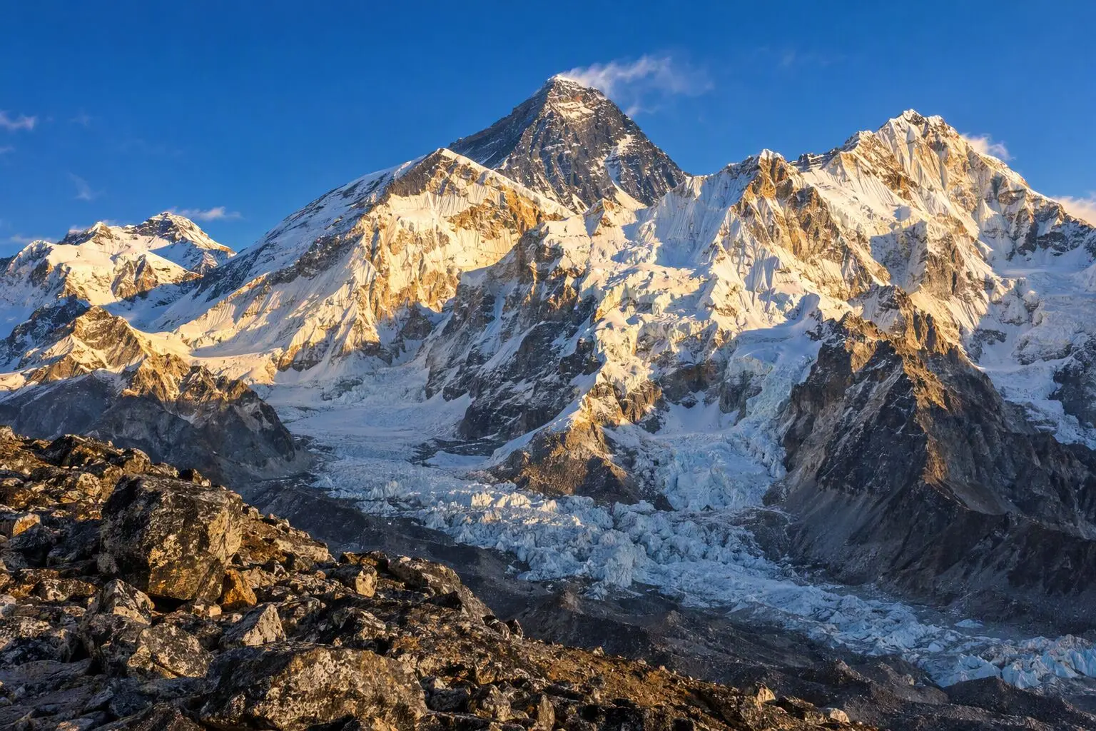
    A 4:00 AM alarm launches the highest point of the entire 19-day circuit. The 405-metre climb from Gorak Shep to Kala Patthar's summit (5,545m) takes approximately 2 hours up a steep rocky ridge in pre-dawn darkness, temperatures plummeting to -15°C or below. The panorama at the summit is the most celebrated in the Himalaya: Everest's full summit pyramid illuminated in gold by the rising sun, flanked by Lhotse, Nuptse, Changtse, and Pumori. Cho Oyu gleams to the west. For trekkers completing the Three Passes circuit, this summit carries particular weight — it is the highest point of a route that has already tested them at Kongma La and has two more passes to come.

  12. Day 12

    Cross Cho La (5,420m), Trek to Thagnag

    • 4,700 m
    • Down130 m from day 11
    • Teahouse
    • Breakfast, Lunch, Dinner

    Cho La is the most technically demanding section of the Three Passes circuit and deserves complete respect. The trail from Dzongla climbs through a narrow rocky valley to the base of the pass, where the gradient steepens sharply onto a boulder field above a permanent snowfield. The final approach to the pass summit at 5,420 metres involves a 30 to 45-minute section of fixed ropes on potentially icy, exposed terrain — crampons are fitted here, and your guide leads the sequence with careful attention to each trekker's footing. The total ascent from Dzongla takes 4 to 5 hours.

    See Cho La on the map
  13. Day 13

    Trek to Gokyo Village

    • 4,700 m
    • Teahouse
    • Breakfast, Lunch, Dinner

    The 6-kilometre walk from Thagnag to Gokyo (4,700m) over 3 to 4 hours transitions the Three Passes route from the stark Khumbu Glacier terrain to the extraordinary beauty of the Gokyo lake system. The trail follows the western edge of the Ngozumpa Glacier's lateral moraine northward, with the glacier's 36-kilometre extent spread to the right — an almost incomprehensible river of crevassed ice, glacial ponds, and rock debris stretching to the Tibetan border.

    See Gokyo on the map
  14. Day 14

    Summit Gokyo Ri, Explore the Lakes

    • 4,700 m
    • Teahouse
    • Breakfast, Lunch, Dinner

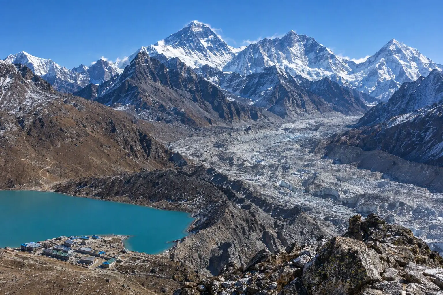
    The second summit day of the Three Passes circuit ascends Gokyo Ri (5,357m) — a 657-metre climb from the village that takes 2 to 3 hours in the pre-dawn darkness. For trekkers who have already stood on Kala Patthar, Gokyo Ri offers a genuinely different experience: where Kala Patthar looks directly at Everest from close range, Gokyo Ri provides a wider-angle panorama that includes four 8,000-metre peaks — Everest, Lhotse, Makalu, and Cho Oyu — simultaneously. The Ngozumpa Glacier spreads below in its full scale, and the turquoise lake system sparkles in the early light far below. Many trekkers rate this view as the finest of the entire Three Passes circuit.

    See Gokyo on the map
  15. Day 15

    Cross Renjo La (5,340m), Trek to Marlung

    • 4,210 m
    • Down490 m from day 14
    • Teahouse
    • Breakfast, Lunch, Dinner

    Renjo La, the third and final pass, is the most rewarding of the three crossings for pure visual drama. The trail climbs steeply northwest from Gokyo village, ascending 640 metres to the pass summit at 5,340 metres over 3 to 4 hours. The approach passes above the fifth Gokyo lake, Ngozumpa Tsho, its surface visible far below as a blue-green gem set in the moraine. The final climb to the pass is a sustained ascent of rocky switchbacks and shale slopes with Renjo La's prayer-flag col gradually approaching.

    See Renjo La on the map
  16. Day 16

    Trek to Namche Bazaar

    • 3,440 m
    • Down770 m from day 15
    • Teahouse
    • Breakfast, Lunch, Dinner

    The 18-kilometre descent from Marlung to Namche Bazaar (3,440m) drops 770 metres over 6 to 7 hours, following the Bhote Koshi valley south and east before rejoining the main Khumbu trail above Namche. The route passes through the village of Thame (3,800m), a traditional Sherpa community of whitewashed stone houses and an important gompa that sits at the mouth of the Bhote Koshi valley leading toward the Nangpa La — the high-altitude trade pass to Tibet. Thame is the home village of many of the Khumbu's most celebrated climbers, including Apa Sherpa, who summited Everest a record 21 times.

  17. Day 17

    Trek to Lukla

    • 2,840 m
    • Down600 m from day 16
    • Teahouse
    • Breakfast, Lunch, Dinner

    The final trekking day descends 19 kilometres from Namche to Lukla (2,840m) over 6 to 7 hours, retracing the original approach through Phakding and the lower Dudh Koshi valley. The trail is familiar now, and there is a characteristically bittersweet quality to walking it for the last time. Fresh-faced trekkers heading uphill carry the anticipation and uncertainty that filled you 16 days ago — you carry something different now: the quiet confidence of three passes crossed and two summits stood upon.

    See Lukla on the map
  18. Day 18

    Fly to Kathmandu

    • 1,400 m
    • Down1,440 m from day 17
    • Hotel
    • Breakfast, Dinner

    The morning flight from Lukla back to Kathmandu reverses the dramatic 35-minute mountain approach of Day 2. Lukla's weather-dependent operations mean early-morning departures between 6:30 and 9:00 AM are standard, but delays of hours or a full day are possible when conditions deteriorate. Your guide monitors weather, communicates with the airline, and briefs the group on options — patience and humour are the appropriate responses to Lukla's unpredictable weather window.

  19. Day 19

    Departure

    • 1,400 m
    • Breakfast

    The Everest Three Passes Trek concludes with a private transfer to Tribhuvan International Airport, 30 to 45 minutes from Thamel depending on traffic. Collect trek completion certificates if not already distributed, and allow sufficient buffer time for Kathmandu's notoriously unpredictable airport traffic, particularly in peak trekking season. The hotel can store luggage for late-departing travellers.

Want a different pace?

A local guide can add a rest day, shorten a stage, or swap where you sleep. We reply within 24 hours.

Ask a guide on WhatsApp

What's Included

Best Time to Trek Everest Three Passes

Month by month

Main seasons: Mar to May and Sep to Nov

Tap a month to add it to your plan.

Spring

April-May offers stable pass crossings once winter snow clears. Cho La can retain snow patches requiring basic crampons. Warmer temperatures at lower elevations make the long days more comfortable.

Autumn

October-November delivers the most reliable pass conditions and the clearest visibility. All three passes are typically snow-free. The busiest season but the safest for high-pass crossings.

From
$1,799/ person

Before you book

Is the Everest Three Passes Trek right for you?

Straight answers from this trek's own plan. Tap Ask about this on anything you are unsure of, and we send it all to a local guide in one message.

Who this trek suits

Designed for experienced high-altitude trekkers who want the definitive Everest experience. This is the most comprehensive Khumbu trek — combining EBC, Gokyo, and three passes above 5,300m into a single 19-day traverse. Requires prior high-altitude experience and strong fitness.

Can I walk it?

Level 4 of 4: Strenuous.

7-10 hours walking per day

  • Technical terrain, very high altitude, remote areas
  • Extensive trekking experience and excellent fitness essential

This is Nepal's most demanding teahouse trek. Three consecutive passes above 5,300m require exceptional cardiovascular fitness and comfort at extreme altitude. Prior experience above 5,000m is strongly recommended. Cho La involves a short section of fixed ropes and potentially icy terrain — basic crampon skills are needed.

How high does it go?

Highest point 5,545 meters. 16 of 19 days end above 2,500 meters.

Days above 2,500 m
16 of 19
Rest days to adjust
2

Above 2,500 m altitude sickness is possible for anyone, fit or not. Walk slowly, drink plenty and tell your guide how you feel. Our guides are trained Wilderness First Responders.

Where will I sleep?

  • 16teahouse nights
  • 2hotel nights

Teahouses are simple family-run lodges: a twin room, a shared dining room and home-cooked meals. Rooms get more basic the higher you go.

Teahouses by altitude

Who will I walk with?

Up to 12 trekkers per group

  • Guides trained as Wilderness First Responders
  • Guiding in 5 languages: English, German, French, Spanish, Nepali
  • Nepal Tourism Board Licensed, trekking since 2010
Meet the team

What if my plans change?

  1. You bookNo deposit
  2. 30 days beforeFree to cancel until here
  3. DepartureGuaranteed to run

You do not pay a deposit to hold your dates. Cancel for free up to 30 days before you start, and our departures are guaranteed, so a confirmed date runs.

What do other trekkers say?

4.9out of 5, from 1,200+ reviews
“From the first email to standing at Base Camp, everything was handled perfectly.”
James & Lisa, Melbourne, Australia
Read more reviews

Still unsure? Ask a guide who has walked it.

Tap Ask about this on any answer above to add it to your message.

A real person in our Thamel office replies within 24 hours. Asking costs nothing.

The route

Where the route goes

Every stop on a satellite map, numbered in order, with the peaks around them. The line follows the trail as mapped on OpenStreetMap. Tap a stop on the map or in the list for its elevation and where you sleep, or switch to the topo map for contour lines. Pick 3D to see the valleys and passes in relief, and fly along the trail.

12 stopsWalk the route stop by stop

Height along the trail: 12 stops over 105 km of the route as drawn on the map, from Lukla at 2,860 meters to Thame at 3,820 meters.

Ground height along the OpenStreetMap trail, from the Copernicus DEM GLO-90 (© DLR e.V. 2010-2014 and © Airbus Defence and Space GmbH 2014-2018, provided under COPERNICUS by the European Union and ESA). Stop heights are our own.

  • Trail, from OpenStreetMap
  • Start
  • Finish
  • Overnight stop
  • Stop on the way
  • Mountain peak

12 stops, in order

Frequently asked questions

Similar treks nearby

Other routes in the Everest region.

Compare0/3
Add a trek
Add a trek
Add a trek