Skip to content
+977-9861293812
WhatsApp
Trek and Tour Nepal
Kanchenjunga Region · Nepal

Kanchenjunga Base Camp Trek

4.9from 31 reviews
Days
22
Highest point
5,143 m
Level
Challenging
Best months
Mar to May and Sep to Nov

Overview

Kanchenjunga Base Camp is Nepal's ultimate expedition trek — a 22-day wilderness journey to the foot of the world's third-highest peak through a region that receives fewer than 300 trekkers per year. The route traces the far eastern edge of Nepal, threading through dense rhododendron forests teeming with red panda and rare bird species before climbing into the raw, glaciated upper valleys beneath Kanchenjunga's 8,586-metre bulk. What sets this trek apart from every other 8,000-metre base camp route is the dual approach: this is the only circuit that reaches both the North Base Camp (Pangpema at 5,143m) and the South Base Camp (Yalung at 4,610m), connected by a crossing of the Mirgin La pass at 4,500 metres. The north approach follows the Ghunsa Khola through ever-thinning vegetation to the stark moraine camps below the Yalung Glacier, while the south side descends through the lush Simbuwa valley to the forested amphitheatre below Kanchenjunga's towering south face. The entire trek is camping-only — there are no teahouse chains in the Kanchenjunga region, and all food, tents, and equipment are carried by a dedicated porter and kitchen team. This expedition-style format creates a profound sense of self-sufficiency and isolation. Evenings in camp are defined by the silence of the mountains, the cook's fire, and skies unpolluted by any artificial light for hundreds of kilometres. Culturally, the route passes through the ancestral territory of the Limbu and Rai peoples in the lower valleys, transitioning to Sherpa and Tibetan communities in the upper reaches around Ghunsa. A Restricted Area Permit and mandatory licensed guide are required — logistical details we handle entirely.

Want more detail on this route?

Read our full route guide with trail conditions, permits, and planning tips.

Route Guide

Highlights

Reach the base of Kanchenjunga (8,586m), the world's third-highest peak
Visit both North and South Base Camps on the same trek — a rare dual approach
Cross Mirgin La (4,500m) connecting the two valleys
Trek through pristine forests teeming with rare wildlife: red panda, snow leopard territory
Experience the Limbu and Rai cultures of far-eastern Nepal
Genuine expedition-style camping in Nepal's most remote trekking region

Itinerary

22 days
Highest stop
4,780 m
Day 10
Biggest climb
+865 m
Day 6
Over 2,500 m
14 days
of 22

Day 1 of 22 · Fly to Bhadrapur, Drive to Taplejung

1,820 m

2,500 m · altitude zone
  1. Day 1

    Fly to Bhadrapur, Drive to Taplejung

    • 1,820 m
    • Hotel
    • Breakfast, Lunch, Dinner

    Your Kanchenjunga expedition begins with an early morning domestic flight from Kathmandu to Bhadrapur, the gateway city of far-eastern Nepal situated in the Jhapa district at 60 metres elevation. The 45-minute flight crosses the length of Nepal's middle hills, and on clear mornings the entire eastern Himalayan wall — from Makalu to Kanchenjunga — is visible through the right-side windows.

    See Taplejung on the map
  2. Day 2

    Trek to Chirwa

    • 1,270 m
    • Down550 m from day 1
    • Camping
    • Breakfast, Lunch, Dinner

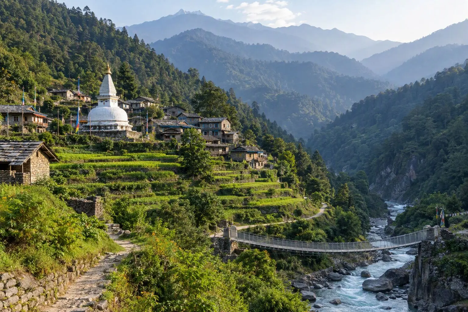
    The trek begins in earnest from Taplejung, descending steeply into the Tamor River valley through terraced farmland and small Limbu villages. The Limbu people of eastern Nepal have inhabited these valleys for centuries and their distinctive stone-and-timber houses, decorated with carved woodwork and adorned with dried maize and chilli strings, create a vivid first impression of the cultural landscape you'll move through over the coming days.

    See Chirwa on the map
  3. Day 3

    Trek to Sekathum

    • 1,660 m
    • Up390 m from day 2
    • Camping
    • Breakfast, Lunch, Dinner

    From Chirwa the trail continues up the Tamor valley, gradually ascending through a mosaic of cultivated land and old-growth forest. The river gorge tightens as you move upstream, and the trail alternates between wide, easy riverside sections and short, steep scrambles over rocky outcrops where the gorge walls squeeze close. Several suspension bridges cross tributaries, and at each one the views up side valleys reveal forested ridges and the occasional thread of waterfall descending from the hidden heights above.

  4. Day 4

    Trek to Amjilosa

    • 2,510 m
    • Up850 m from day 3
    • Camping
    • Breakfast, Lunch, Dinner

    The Ghunsa Khola valley becomes increasingly dramatic as you ascend from Sekathum. The trail climbs steadily through dense subtropical forest — tree ferns, rhododendron in the understorey, and giant oaks draped with moss and lichen creating a cathedral-like atmosphere above the trail. The river below roars through a series of rapids and gorges, white water visible in glimpses through the trees. This is classic lower Kanchenjunga terrain: lush, wild, and almost completely free of other trekking groups.

  5. Day 5

    Trek to Gyabla

    • 2,730 m
    • Up220 m from day 4
    • Camping
    • Breakfast, Lunch, Dinner

    A moderate day of steady climbing carries you from Amjilosa at 2,510 metres to Gyabla at 2,730 metres through increasingly temperate forest. The rhododendrons, which in spring are in full explosive bloom — vivid red, pink, and white against the grey stone of the valley walls — are the defining vegetation of this elevation band, and the route becomes a tunnel of colour that stops trekkers repeatedly for photographs. In autumn the same trees display rich russet and amber foliage against a backdrop of clear blue sky.

  6. Day 6

    Trek to Ghunsa

    • 3,595 m
    • Up865 m from day 5
    • Camping
    • Breakfast, Lunch, Dinner
    • Biggest climb

    The approach to Ghunsa is one of the most anticipated days of the trek, as the landscape makes its final dramatic transition from forested hill country to open alpine valley. The trail climbs from Gyabla through thinning treeline, crossing a high ridge section where the forest gives way to open hillside and, for the first time, the upper reaches of the Kanchenjunga massif become visible ahead — a wall of ice and rock filling the entire northern horizon.

    See Ghunsa on the map
  7. Day 7

    Acclimatization Day in Ghunsa

    • 3,595 m
    • Camping
    • Breakfast, Lunch, Dinner
    • Acclimatization

    A mandatory rest day at 3,595 metres allows the body to begin its altitude adjustment before the serious high-altitude gains ahead. The acclimatization protocol here follows the standard principle: hike high during the day, sleep low at night. The recommended excursion climbs to approximately 4,200 metres on the ridge above Ghunsa, gaining 600 metres on a well-worn trail used by yak herders heading to summer pastures, and returning to camp for the night.

    See Ghunsa on the map
  8. Day 8

    Trek to Kambachen

    • 4,050 m
    • Up455 m from day 7
    • Camping
    • Breakfast, Lunch, Dinner

    Departing Ghunsa, the trail immediately enters the high alpine zone above the treeline. The Ghunsa Khola valley above the village is a wide, boulder-strewn glacial corridor flanked by sheer rock walls and hanging glaciers that periodically calve with a thunderous crack audible for kilometres. The path is cairned across the moraine, and the altitude gain from 3,595 to 4,050 metres is gradual enough to be managed comfortably with the previous day's acclimatization.

    See Kambachen on the map
  9. Day 9

    Acclimatization Day in Kambachen

    • 4,050 m
    • Camping
    • Breakfast, Lunch, Dinner
    • Acclimatization

    A second acclimatization day — this time at 4,050 metres — consolidates the body's adjustment before the push to Lhonak at 4,780 metres. The prescribed hike climbs toward the lateral moraine of the Kanchenjunga Glacier, gaining 400-500 metres above camp on a clear route across the glacial debris field. From the moraine crest the glacier itself is visible below: a slow river of dirty ice, crevassed and serrated, extending several kilometres to the north beneath the hanging glaciers of the main peak.

    See Kambachen on the map
  10. Day 10

    Trek to Lhonak

    • 4,780 m
    • Up730 m from day 9
    • Camping
    • Breakfast, Lunch, Dinner
    • Highest stop

    The advance from Kambachen to Lhonak represents the trek's most sustained altitude gain on a single day — a 730-metre climb across open moraine and glacial debris to the high camp at 4,780 metres. The landscape at this elevation is entirely barren: no vegetation, no soil, only the angular grey and brown boulders of the glacial moraine, occasional patches of grey ice, and the relentless wind that scours the upper valley even on clear days. This is the zone above life, and its stark beauty is confronting and magnificent in equal measure.

    See Lhonak on the map
  11. Day 11

    Kanchenjunga North Base Camp (5,143m) Excursion

    • 4,780 m
    • Camping
    • Breakfast, Lunch, Dinner

    The summit day of the northbound approach — the excursion to Pangpema, Kanchenjunga's North Base Camp at 5,143 metres. The trail leaves Lhonak following the lateral moraine of the Kanchenjunga Glacier, climbing steadily across a landscape of extraordinary desolation: nothing grows, nothing moves except the wind and the occasional calving of a hanging glacier on the peaks above. The route from camp to Pangpema takes two to three hours of steady walking, gaining 363 metres over approximately four kilometres of moraine terrain.

  12. Day 12

    Trek to Ghunsa

    • 3,595 m
    • Down1,185 m from day 11
    • Camping
    • Breakfast, Lunch, Dinner

    A long descent day retraces the route from Lhonak back to Ghunsa — a 1,185-metre descent across the full length of the upper valley. The body, having spent three nights above 4,000 metres and completed a major high-altitude excursion, responds to the descent with an unmistakeable flood of ease and energy. The thinning air of the high moraine gives way progressively to warmer temperatures, and by the time the treeline is reached below Kambachen the contrast with the barren upper valley is striking.

    See Ghunsa on the map
  13. Day 13

    Trek to Sele Le

    • 4,290 m
    • Up695 m from day 12
    • Camping
    • Breakfast, Lunch, Dinner

    Today's route departs the Ghunsa Khola valley entirely, leaving the familiar trail to begin the cross-mountain section linking the North Base Camp valley to the South Base Camp valley. The trail climbs steeply out of Ghunsa on the east side of the valley, gaining altitude rapidly through a series of switchbacks on open hillside above the treeline. The views back down the Ghunsa Khola valley — the entire route walked over the past eight days visible in one panoramic sweep — are exceptional in clear weather.

  14. Day 14

    Cross Mirgin La (4,500m), Trek to Tseram

    • 3,870 m
    • Down420 m from day 13
    • Camping
    • Breakfast, Lunch, Dinner

    The Mirgin La crossing at 4,500 metres is the linchpin of the Kanchenjunga circuit — the high pass that connects the northern and southern approaches and transforms what would otherwise be two separate out-and-back treks into a genuine mountain circuit. An early departure from Sele Le takes advantage of the calm morning air before the pass winds develop. The ascent to the pass from the camp at 4,290 metres is a 210-metre gain over approximately two kilometres of rocky trail, straightforward in good conditions but potentially hazardous with fresh snow or ice.

  15. Day 15

    Trek to Ramche

    • 4,360 m
    • Up490 m from day 14
    • Camping
    • Breakfast, Lunch, Dinner

    The approach to Kanchenjunga's South Base Camp begins in earnest from Tseram. The trail follows the Simbuwa Khola upstream through the Yalung Glacier's lateral moraine — a boulder field that requires careful navigation on a trail marked by cairns and the boot-worn grooves of decades of expedition traffic. The Yalung Glacier to the left is a dramatic presence: a two-kilometre-wide river of dirty grey ice flowing slowly between walls of compressed moraine, creaking and settling with sounds that carry across the valley on quiet mornings.

  16. Day 16

    Kanchenjunga South Base Camp (4,610m) Excursion

    • 4,360 m
    • Camping
    • Breakfast, Lunch, Dinner

    The excursion to Oktang — Kanchenjunga's South Base Camp at 4,610 metres — is a two-to-three-hour climb from Ramche across the Yalung Glacier's lateral moraine and snow-covered upper basin. The trail gains 250 metres from camp, initially on a well-marked path across the moraine and then across a snow field that varies in condition from firm névé in early season to soft afternoon snow that requires careful step placement. Gaiters are essential, and ice axe use is possible in icy conditions — the guide assesses conditions before departure.

  17. Day 17

    Trek to Tortong

    • 2,995 m
    • Down1,365 m from day 16
    • Camping
    • Breakfast, Lunch, Dinner

    The long descent from the South Base Camp area begins in earnest today — a significant drop of 1,365 metres from Ramche at 4,360 metres to Tortong at 2,995 metres. The trail leaves the stark moraine environment rapidly as altitude is lost, and the re-entry into the forested world below feels like travelling backwards through time. Within two hours of departure, the first dwarf rhododendrons appear; by midday, full-sized rhododendron trees line the trail; by the time you reach Tortong, the forest is dense enough to provide shade and shelter from the afternoon sun.

  18. Day 18

    Trek to Yamphudin

    • 2,080 m
    • Down915 m from day 17
    • Camping
    • Breakfast, Lunch, Dinner

    The descent continues through the lower Simbua valley on a trail that now passes through true mid-altitude forest: mixed oak, maple, and rhododendron with a dense understorey of ferns and mosses. The route from Tortong to Yamphudin loses a further 915 metres over approximately fourteen kilometres, following the Simbua Khola downstream through a series of side-valley confluences. Several communities of Limbu and Sherpa families maintain small farms at the confluences, and the trail passes through their cultivated land on wooden bridges and stone-paved paths.

  19. Day 19

    Trek to Mamankhe

    • 1,780 m
    • Down300 m from day 18
    • Camping
    • Breakfast, Lunch, Dinner

    A relatively short walking day from Yamphudin to Mamankhe covers around twelve kilometres with a modest descent to 1,780 metres. The trail follows the Simbua Khola valley downstream, initially through forested hillside and then into a wider, more cultivated valley section where rice paddies and millet fields cover every flat terrace. The Limbu people farm these terraces with traditional techniques — wooden ploughs pulled by water buffalo, hand-harvesting with curved sickles, and hand-threshing on stone floors — and the pastoral scene provides a vivid contrast with the glacial world of the previous week.

  20. Day 20

    Trek to Taplejung

    • 1,820 m
    • Up40 m from day 19
    • Hotel
    • Breakfast, Lunch, Dinner

    The final day of trekking brings the group back to Taplejung at 1,820 metres — a route that descends from Mamankhe to the Tamor River before climbing briefly back to the district headquarters. The day's walking covers approximately sixteen kilometres over five to six hours, passing through a final sequence of Limbu villages and farmland before emerging onto the rough road that connects Taplejung to the lowlands.

    See Taplejung on the map
  21. Day 21

    Fly to Kathmandu via Bhadrapur

    • 1,400 m
    • Down420 m from day 20
    • Hotel
    • Breakfast

    The final travel day from Taplejung begins with an early morning drive back to Bhadrapur for the domestic flight to Kathmandu. The drive retraces the route of Day 1 through the tea gardens of Ilam district — green and ordered after the wild mountain terrain of the past three weeks — and descends to the flat Terai plains and Bhadrapur airport. The morning light on the foothills and the glimpse of Kanchenjunga on the northern horizon from the plains is a final reminder of where you have been.

  22. Day 22

    Departure

    • 1,400 m
    • Breakfast

    The Kanchenjunga Base Camp expedition concludes with a transfer to Tribhuvan International Airport for your international departure. Depending on flight timing, a final morning in Kathmandu may allow a visit to Boudhanath Stupa — the great white dome and its gilded spire surrounded by circling monks and pilgrims — which has a particular resonance after three weeks in the Tibetan-Buddhist valleys of the Kanchenjunga region.

Want a different pace?

A local guide can add a rest day, shorten a stage, or swap where you sleep. We reply within 24 hours.

Ask a guide on WhatsApp

What's Included

Best Time to Trek Kanchenjunga Base Camp

Month by month

Main seasons: Mar to May and Sep to Nov

Tap a month to add it to your plan.

Spring

April-May offers the most stable weather and the best snow conditions for the Mirgin La crossing. Rhododendron forests in the lower valleys are spectacular. The approach is warm and lush.

Autumn

October-November delivers clear Kanchenjunga views but the Mirgin La can have early snow. Slightly shorter days mean longer camping evenings. Peak season for serious trekkers.

From
$2,499/ person

Before you book

Is the Kanchenjunga Base Camp Trek right for you?

Straight answers from this trek's own plan. Tap Ask about this on anything you are unsure of, and we send it all to a local guide in one message.

Who this trek suits

Nepal's ultimate expedition trek for those who've done EBC and want the next frontier. Kanchenjunga sees fewer than 300 trekkers per year. The dual base camp approach and Mirgin La crossing make this the most comprehensive circuit of any 8,000m peak. Requires 3 weeks and expedition fitness.

Can I walk it?

Level 3 of 4: Challenging.

6-8 hours walking per day

  • High passes, steep terrain, significant altitude
  • Prior multi-day trekking and good fitness required

Expedition-level fitness required. 22 days of continuous walking at altitudes up to 5,143m with full camping. The Mirgin La crossing is strenuous. No technical climbing required but you must be comfortable walking 6-8 hours daily at altitude for 3 weeks. Prior 5,000m+ experience is essential.

How high does it go?

Highest point 5,143 meters. 14 of 22 days end above 2,500 meters.

Days above 2,500 m
14 of 22
Rest days to adjust
2

Above 2,500 m altitude sickness is possible for anyone, fit or not. Walk slowly, drink plenty and tell your guide how you feel. Our guides are trained Wilderness First Responders.

Where will I sleep?

  • 18tent nights
  • 3hotel nights

Most nights on this route are in tents, because there are few or no lodges on the way.

Who will I walk with?

Up to 12 trekkers per group

  • Guides trained as Wilderness First Responders
  • Guiding in 5 languages: English, German, French, Spanish, Nepali
  • Nepal Tourism Board Licensed, trekking since 2010
Meet the team

What if my plans change?

  1. You bookNo deposit
  2. 30 days beforeFree to cancel until here
  3. DepartureGuaranteed to run

You do not pay a deposit to hold your dates. Cancel for free up to 30 days before you start, and our departures are guaranteed, so a confirmed date runs.

What do other trekkers say?

4.9out of 5, from 1,200+ reviews
“Twenty-two days of pure wilderness. The guides knew every trail and every village chief by name.”
Riku Tanaka, Kanchenjunga Circuit, 2025
Read more reviews

Still unsure? Ask a guide who has walked it.

Tap Ask about this on any answer above to add it to your message.

A real person in our Thamel office replies within 24 hours. Asking costs nothing.

The route

Where the route goes

Every stop on a satellite map, numbered in order, with the peaks around them. The line follows the trail as mapped on OpenStreetMap. Tap a stop on the map or in the list for its elevation and where you sleep, or switch to the topo map for contour lines. Pick 3D to see the valleys and passes in relief, and fly along the trail.

6 stopsWalk the route stop by stop

Height along the trail: 6 stops over 81.8 km of the route as drawn on the map, from Taplejung at 1,820 meters to Pangpema (North BC) at 5,143 meters.

Ground height along the OpenStreetMap trail, from the Copernicus DEM GLO-90 (© DLR e.V. 2010-2014 and © Airbus Defence and Space GmbH 2014-2018, provided under COPERNICUS by the European Union and ESA). Stop heights are our own.

  • Trail, from OpenStreetMap
  • Start
  • Finish
  • Overnight stop
  • Mountain peak

6 stops, in order

Frequently asked questions

Similar treks

Other challenging treks in Nepal.

  • Everest Base Camp Trek

    14 daysChallenging

    Highest point 5,545 m

    Best: Spring, Autumn

    from$1,349

  • Gokyo Lakes Trek

    13 daysChallenging

    Highest point 5,357 m

    Best: Spring, Autumn

    from$949

  • Jiri to Everest Base Camp Trek

    20 daysChallenging

    Highest point 5,545 m

    Best: Spring, Autumn

    from$1,199

Compare0/3
Add a trek
Add a trek
Add a trek