

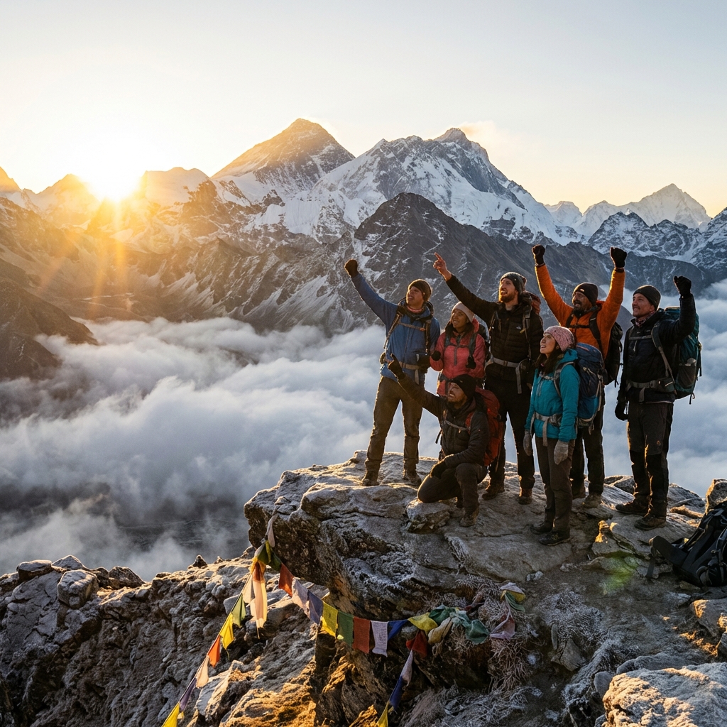
The Great Himalayan Trail (GHT) is Nepal's defining long-distance trek — a 1,700-kilometre journey from the far west at Humla, near the Tibetan border, east to Taplejung in the Kanchenjunga region. It crosses every major Himalayan watershed, passes through seven of Nepal's eight highest mountain zones, and connects communities that most trekkers will never see in a lifetime of Himalayan travel.
Completing the full GHT is one of the most demanding wilderness challenges on Earth. The route passes over 160 mountain passes, many above 5,000 metres, traverses more than 20 distinct ethnic and cultural zones, and requires resupply logistics worthy of an expedition. At its highest, the trail crests 6,146 metres at Kagmara La in the Dolpo region. At its lowest, it winds through subtropical river valleys at barely 1,000 metres.
This guide covers everything you need to understand the GHT: the high route versus low route, the 10 regional sections, permit requirements, realistic logistics, difficulty ratings, and the seasonal windows that make the difference between a successful traverse and a forced retreat.
Quick Facts: The Great Himalayan Trail
1,700 km (high route) / 1,400 km (low route)
80-150 days for full traverse
6,146m (Kagmara La, Dolpo)
5,416m (Thorong La, Annapurna)
10 regional sections
East to West or West to East
Oct–Nov (autumn), Apr–May (spring)
7–12 permits depending on route
Strongly recommended — logistics critical
Fewer than 100 (full traverse)
High Route vs Low Route: Understanding the Two Trails
The GHT is not a single trail but a framework with two parallel alignments that converge and diverge across Nepal's length.
The High Route
The high route is what most people imagine when they hear "Great Himalayan Trail." It follows the main Himalayan spine, crossing passes above 5,000 metres and traversing terrain that is remote, demanding, and often genuinely technical. The high route:
- Passes over 160 high mountain passes across Nepal's full length
- Reaches maximum elevation at Kagmara La (6,146m) in Dolpo
- Requires mountaineering skills in several sections (glacier travel, fixed lines)
- Passes through restricted areas requiring special permits
- Has minimal teahouse support in western sections — camping mandatory
- Is only accessible during tight seasonal windows, typically October–November and April–May
- Takes 100–150 days for the full traverse
This is genuinely one of the world's most challenging walks. The central section through Dolpo, in particular, crosses passes that see fewer than a dozen trekking parties per year and requires complete self-sufficiency between resupply points that may be 10 days apart.
The Low Route
The low route is a more practical alternative that still constitutes a remarkable achievement. Following slightly lower passes and incorporating established trekking routes where they align with the GHT corridor, the low route:
- Can be completed in 80–100 days
- Uses established teahouse networks through most major regions
- Includes sections of the Annapurna Circuit, Manaslu Circuit, and Everest three passes routes
- Still crosses challenging passes but generally below 5,500 metres
- Is feasible for experienced trekkers without technical mountaineering skills
- Remains remote and demanding in western sections
Most trekkers who complete the full GHT do so on the low route, with high-route variations inserted where logistics allow and fitness and acclimatization permit.
Section-by-Section Choices
Very few trekkers commit to either pure high or pure low route for the entire traverse. The practical approach is to follow the high route where conditions and logistics are manageable, and drop to the low route for supply runs, weather windows, or in sections where the high route requires technical skills beyond your ability. This adaptive approach is how most successful GHT traverses are completed.
The 10 Sections: Overview of Each Leg
The GHT is officially divided into 10 sections. Each section typically takes 10–20 days and can be trekked independently as a standalone adventure.
Section 1: Kanchenjunga (Far East)
Distance: ~180 km | Duration: 14–18 days | Max Altitude: 5,140m (Mirgin La)
The eastern terminus begins at Taplejung and traverses the Kanchenjunga region, Nepal's most remote major trekking area. The route passes beneath Kanchenjunga (8,586m) — the world's third-highest mountain — visiting both the north and south base camps. This section features stunning rhododendron forests, traditional Limbu villages, and a genuine wilderness feel. The Kanchenjunga Base Camp trek covers the core of this section and provides an excellent standalone experience.
Section 2: Makalu–Barun
Distance: ~160 km | Duration: 12–16 days | Max Altitude: 4,850m (Tutu La)
Passing through the Makalu–Barun National Park — a UNESCO World Heritage Site and one of the world's most biodiverse regions — this section is characterised by dramatic vertical relief. The route drops to subtropical valleys before climbing back through temperate and alpine zones, crossing passes into the Arun River drainage. The Makalu Base Camp trek is the centrepiece of this section.
Section 3: Everest–Khumbu
Distance: ~150 km | Duration: 12–18 days | Max Altitude: 5,535m (Kongma La)
The most famous and well-serviced section, the Khumbu leg follows the Three Passes Trek alignment through the heart of the Everest region. High-route variations cross Kongma La, Cho La, and Renjo La in sequence. The excellent teahouse network makes this the easiest section logistically, though the altitude makes it among the most physically demanding. Everest Base Camp is accessible as a side trip.
Section 4: Rolwaling
Distance: ~130 km | Duration: 10–14 days | Max Altitude: 5,755m (Tashi Lapcha Pass)
The Rolwaling Valley section is one of the most technically demanding on the entire GHT. The Tashi Lapcha Pass (5,755m) involves genuine glacier travel and requires mountaineering equipment. The valley itself is a hidden gem — remote, culturally intact, and strikingly beautiful. This section is most commonly combined with Section 3 (Khumbu).
Section 5: Langtang–Gosaikunda
Distance: ~140 km | Duration: 12–15 days | Max Altitude: 5,122m (Tserko Ri)
Passing through Langtang National Park and the sacred Gosaikunda Lakes, this section is characterised by recovering forest after the 2015 earthquake. The Langtang–Gosaikunda loop links to the Tamang Heritage Trail and offers superb cultural immersion with Tamang and Tibetan communities.
Section 6: Manaslu–Tsum
Distance: ~160 km | Duration: 14–18 days | Max Altitude: 5,160m (Larkya La)
Encircling the world's eighth-highest mountain, this section combines the Manaslu Circuit with the hidden Tsum Valley — a restricted area with ancient Tibetan Buddhist communities. Larkya La (5,160m) is the section's high point. This is widely regarded as one of the finest sections of the entire GHT for cultural depth and scenic variety.
Section 7: Annapurna
Distance: ~170 km | Duration: 14–20 days | Max Altitude: 5,416m (Thorong La)
The longest and most diverse section traverses the full Annapurna Circuit alignment with high-route variations above the standard trail. Thorong La (5,416m) is the defining pass. The section passes through the rain-shadow Mustang borderlands, lush sub-tropical forests, and the high-altitude desert of Manang. The GHT high route variant in this section crosses rarely visited passes above the circuit.
Section 8: Dhaulagiri–Dolpo (East)
Distance: ~170 km | Duration: 15–20 days | Max Altitude: 5,860m (Jungben La)
Crossing between the Dhaulagiri massif and the eastern edge of Dolpo, this section is remote and seriously challenging. The Dolpo region requires a restricted area permit and lies beyond easy evacuation range. Camping is mandatory for much of this section, and route-finding requires experience and comprehensive maps.
Section 9: Dolpo–Humla (West)
Distance: ~200 km | Duration: 18–25 days | Max Altitude: 6,146m (Kagmara La)
The most extreme section of the GHT and its highest point. This western Dolpo to Humla traverse crosses the legendary Kagmara La at 6,146 metres — the highest point on the entire trail. Communities here are among Nepal's most isolated, with some villages receiving fewer than 10 foreign visitors per year. The restricted area permit costs apply throughout.
Section 10: Humla–Simikot (Far West)
Distance: ~120 km | Duration: 10–14 days | Max Altitude: 4,620m (Nara La)
The western terminus ends in Humla, Nepal's most remote district. This section offers extraordinary cultural immersion with communities that retain pre-Buddhist Bon traditions alongside Tibetan Buddhism. The route connects to Simikot, the regional hub with the nearest airstrip.
Permits: What You Need
The GHT requires more permits than any other trek in Nepal. The exact combination depends on which sections you travel and whether you take the high or low route.
Universal Permits
TIMS Card (Trekkers' Information Management System): Required for the full route. Available from TAAN offices in Kathmandu (NPR 2,000 for independent trekkers, NPR 1,000 through agencies).
National Park Entry Permits: Multiple national parks are crossed including Sagarmatha, Langtang, Makalu–Barun, Rara, and Api Nampa. Costs range from NPR 1,500 to NPR 3,000 per park per entry.
Restricted Area Permits
Several sections cross restricted areas requiring additional permits obtainable only through registered agencies:
| Restricted Area | Cost | Group Requirement |
|---|---|---|
| Upper Dolpo | USD 50 per day (no minimum) | Min. 2 trekkers + agency |
| Lower Dolpo | $50 per week (peak) | Min. 2 trekkers + agency |
| Manaslu Corridor | $100 per week (peak) | no minimum group size (solo trekkers allowed with licensed guide since 2023) + agency |
| Upper Mustang | USD 50 per day (no minimum) | Min. 2 trekkers + agency |
| Tsum Valley | $35 per week | Min. 2 trekkers + agency |
| Nar–Phu Valley | $90 per week (peak) | Min. 2 trekkers + agency |
| Kanchenjunga | $20 per week | Min. 2 trekkers + agency |
Permit Budgeting for the Full Traverse
A full GHT traverse through high-route restricted areas can cost $2,000–3,500 USD in permits alone, separate from guiding, food, and accommodation. For the low route avoiding most restricted areas, budget $300–600 for permits. Always check current rates with the Nepal Department of Immigration before departure, as costs change regularly.
Agency and Guide Requirements
All restricted area sections require a registered trekking agency and a licensed guide. For the full traverse, working with a specialist agency experienced in multi-section GHT logistics is essential. Key agencies with GHT expertise include those based in Kathmandu that specialise in remote trekking rather than standard routes.
Logistics: The Critical Challenge
Logistics are the defining challenge of any GHT traverse. Unlike established routes where tea houses handle meals and accommodation, large sections of the GHT require complete self-sufficiency.
Resupply Points
The main resupply points for a full traverse (west to east or east to west) include:
East to West: Taplejung → Lukla → Jiri → Syabrubesi → Dharapani → Jomsom → Dunai → Juphal → Simikot
Each resupply requires either flying in supplies via charter flight (expensive but reliable) or carrying sufficient food between resupply points. In Dolpo and Humla, 10–12 day carries are sometimes necessary.
Porter and Guide Logistics
A full GHT traverse typically requires:
- 1–2 licensed guides (mandatory for restricted sections)
- 2–4 porters for high-route camping sections
- Replacement porters at major junctions as terrain or altitude exceeds individual contracts
Porters are generally hired for single sections and replaced at junction towns. Building relationships with a core guide team for the full duration is valuable for route knowledge and logistics coordination.
Camping vs Teahouses
| Section | Teahouse Availability | Camping Needed |
|---|---|---|
| Kanchenjunga | Limited | 50% of nights |
| Makalu–Barun | Limited | 60% of nights |
| Khumbu | Excellent | Optional |
| Rolwaling | Very limited | 80% of nights |
| Langtang | Good | 20% of nights |
| Manaslu–Tsum | Moderate | 30% of nights |
| Annapurna | Excellent | Optional |
| Dolpo–West | None | 100% camping |
| Humla | Very basic | 70% of nights |
Emergency Evacuation
Emergency evacuation from remote western sections can take days even with helicopter support, as weather windows for flights are limited. Satellite communication devices are essential — see our satellite communication guide for recommendations. Travel insurance with helicopter evacuation coverage of at least $20,000 is the absolute minimum.
Difficulty and Physical Requirements
The GHT is not a single difficulty rating — it spans from challenging (Khumbu section using standard routes) to extreme (Dolpo high route). For the full traverse:
Physical requirements:
- Proven ability to trek 8–10 hours per day for extended periods
- Comfort with camping in all weather conditions
- Experience at altitudes above 5,000m
- Basic glacier travel skills for Rolwaling and high Dolpo sections
- Mental resilience for 80–150 consecutive days
Technical skills required:
- Crampon use on glaciers and steep snow
- Route-finding with map and compass
- Basic crevasse hazard awareness
- Camp management in extreme cold
Most successful GHT trekkers have completed multiple Himalayan treks before attempting the full traverse. The Khumbu and Annapurna sections alone are poor preparation — training on remote sections like Dolpo, Makalu–Barun, or Kanchenjunga first gives a more realistic sense of GHT conditions.
Best Seasons
The GHT passes through climate zones ranging from subtropical to arctic, creating complex seasonal planning.
Autumn (October–November): The best overall window. Post-monsoon clarity provides exceptional visibility, high passes are snow-free, and teahouses throughout are fully staffed. Eastern sections (Kanchenjunga, Makalu) are best in October. Western sections (Dolpo, Humla) become snowbound by November.
Spring (April–May): A viable but more challenging window. Western sections are accessible as winter snow melts, rhododendrons bloom in lower elevations (spectacular in Kanchenjunga and Makalu). High passes can hold dangerous snow into May. Storm frequency is higher than autumn.
Winter (December–March): High passes are closed. Possible in far-eastern lower sections only.
Monsoon (June–September): Not recommended. Passes are covered in new snow, rivers are dangerous, leeches infest lower trails, and landslides are common. Some trekkers attempt eastern sections in September as the monsoon breaks.
Related Resources
The GHT in Perspective
The Great Himalayan Trail is not a trail in the conventional sense. It is a geographic corridor — a declared concept made real by the people who walk it, piece by piece, year after year. Some approach it section by section over many years, returning to pick up where they left off. Others commit to the full traverse as the defining adventure of their lives.
Nepal's government, with support from the United Nations Development Programme, has worked to develop and mark the GHT as a tourism product, but the infrastructure remains patchy and in many sections essentially non-existent. That is, simultaneously, its greatest challenge and its greatest gift.
For trekkers prepared for genuine uncertainty, the GHT offers what no other established trail in the world can match: the full breadth of the Himalayan experience, from the jungles of the Arun River to the ice deserts of high Dolpo, connected by the logic of mountain geography and the endurance of human legs.